Wednesday, June 16, 2021

New England Welcomes You

One hundred forty five miles west of Menoken, where we stayed Monday night, lies the town of Medora, North Dakota. This little burg, population 115, give or take, has a couple of interesting things to see. The town was founded by French nobleman Marquis de Mores and named after his wife. The Marquis wanted to ship beef to eastern markets via the railroad that was built through here in 1883. The venture failed, but the Marquis was a friend of a member of a wealthy eastern businessman named Theodore Roosevelt, who visited on April 7, 1903. A roaring crowd, apparently everyone who lived in the "Badlands" turned out to shake the hand of the then President of the United States. 

Our first stop in Medora was at the Red Trail Campground, where we were welcomed with a site change. We had been scheduled for a site with only water and electricity, but someone didn't show up and we moved into a full hook-up site. It's going to be a challenge getting the motorhome out of the park with the narrow roads and large trees, but it will happen! The wind was blowing more than 35 mph. Not good.

After set-up, we headed a few blocks west to one of the main attractions of the area, the National Park Visitors Center for Theodore Roosevelt National Park, South Unit.


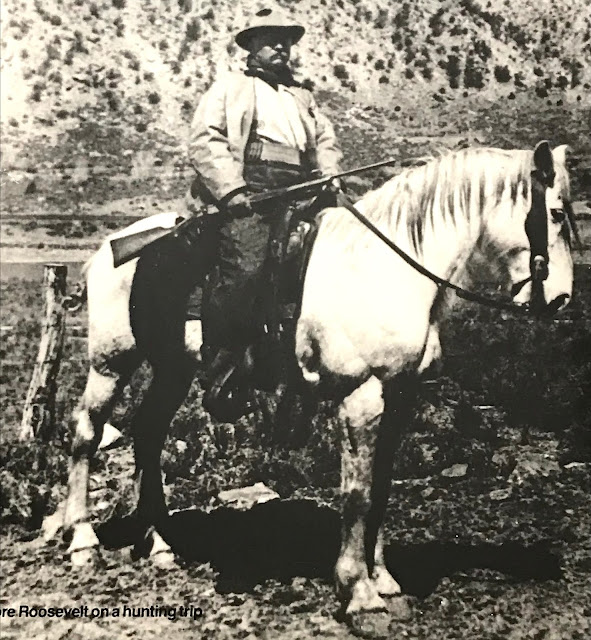
In the Visitors Center, we checked out a small museum about TR and his relationship with Medora and North Dakota. TR found this area to be a wonderful change from political life in New York. Hunting trips and investments in cattle and ranches introduced Teddy to the area. 

TR's love of the west revolved primarily around hunting and horseback riding. Two of his Winchester 50-95 rifles are on display.


His triple barrel Baker rifle is also there, with two 12 gauge shotgun barrels mounted over a 45-70 rifle barrel!


TR on a hunting trip


When his wife and mother both died on Valentines Day, 1884, TR abandoned politics (he was in the New York legislature) and struck out for the Dakota Territories to recover from his grief. When a blizzard in 1885 wiped out his prized herd of cattle, he returned to the east and again took up politics. After a stint in the Spanish-American War, and governor of New York, he was selected as William McKinley's vice-president, moving into the White House when McKinley died at the beginning of his second term.

President Roosevelt never forgot his love of the west, and is known for protecting thousands of acres of public land for the enjoyment of "The People." However, his family life wasn't so successful. His daughter Alice was a scandal in Washington society, and was banned from attending society affairs after she once remarked that Calvin Coolidge looked as though he had been weaned on a pickle.

Today, the 16th, We decided to visit TRNP, the North Unit. This little known and rarely visited area was Theodore Roosevelt's favorite, and is very near the site of his Elkhorn Ranch. Unfortunately, the ranch buildings do not exist anymore due to having been constructed of soft Cottonwood logs. On the way north from Medora, we happened upon an historical marker at a cross on a hill. Ukrainian immigrants came to North Dakota to develop a farming empire undreamed of. The Ukrainian Pioneer Memorial Cross is dedicated to these hardy men and women.


It's about 75 miles from Medora to the entrance to the North Unit, through thousands of acres of farm and ranch lang.


Entering the North Unit, we started the 14 mile trip through some of the most beautiful areas of the state.


And, saw our first bison of the day!


The wind continued today, even harder than yesterday. Donna enjoyed the view, but not so much the wind!


And, to make our day complete, we met a bison herd up close and personal.


The North Unit, and Theodore Roosevelt's focus, is bisected by the Little Missouri River. There is only about a gallon of water in the river, but the stream bed shows evidence of much more water activity!


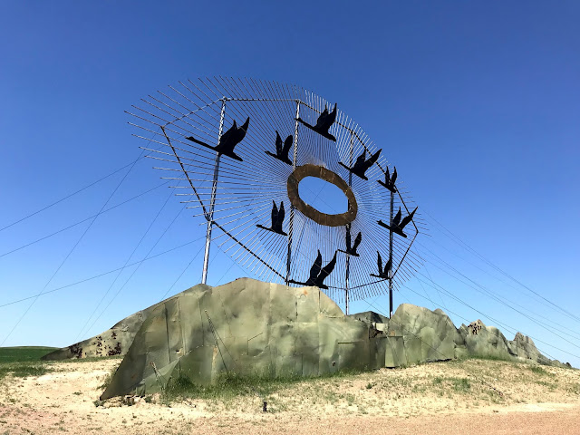
After traveling on US85 north, known as the CanAm Highway, we turned around and slid down the same road to the intersection of ND200, where we turned east toward the oil town of Killdeer just to take a different road, and then south on ND22 toward Dickinson, the largest city in the area. A few miles east of Dickinson, we bailed off Interstate 94 onto CR 100 1/2 Ave SW toward Regent. Known as the Enchanted Highway, there are several sculptures along the road.

The first is Geese in Flight. The gravel road is lined with metal geese, and the huge artifact is awesome!


Deer Crossing:


Grasshoppers in a Field:


Teddy Rides Again:


The Tin Family:


Pheasants on the Prairie:


A Fishermans Dream:


Along about here, we began to see a pattern. At each work of art, a small sign was placed in the corner advertising The Castle, where "You'll be Treated like a King." At the last stop, in the front of The Castle, a several year old motel with plywood cutouts of castle walls and a knight facing a dragon, complete with earth moving equipment as backup, we saw the light! Come to the town of Regent and stay and eat and leave your money...


And again, taking a different road home, we passed through the hamlet of New England, where we were welcomed.


Tomorrow, we hope to tour the South Unit of TRNP. Hope so, the wind has stopped!


Monday, June 14, 2021

Nice Place Ya Got Here, Kristi!

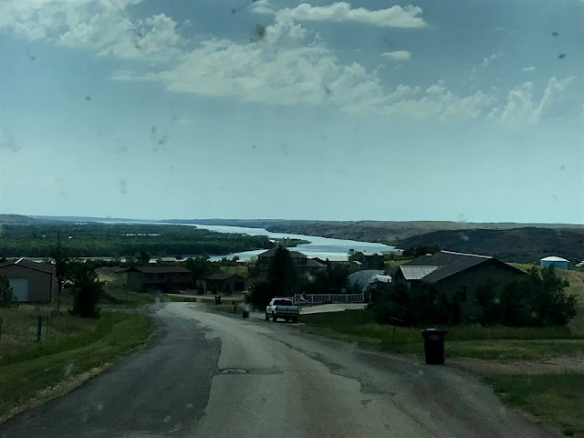
 We were sad to leave Pierre this morning, particularly when we caught this sight of the Missouri River from the top of the hill just outside River View RV Park.


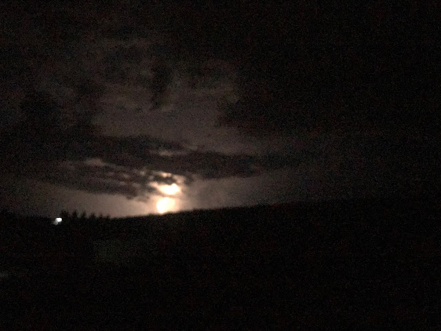
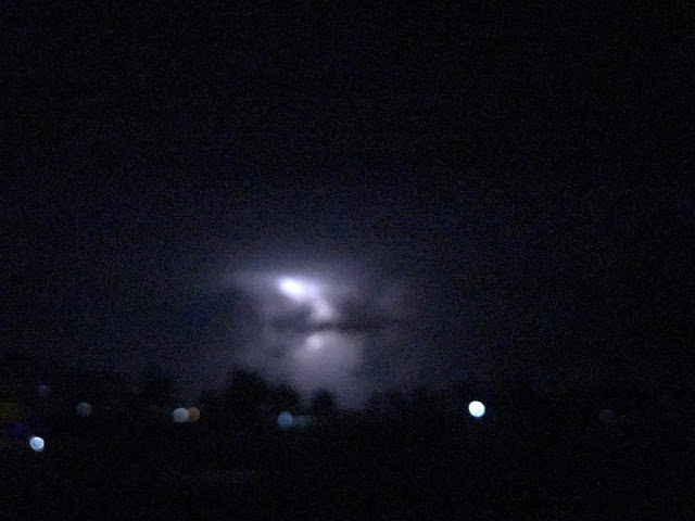
But the real show was took place about midnight last night, when a fair-thee-well midwest t-storm passed by.


You'll have to forgive my little phone camera! It was overwhelmed!

Leaving Pierre on US83, we turned north, paralleling Lake Oahe that we saw yesterday. The lake is 231 miles long, extending to Bismarck, North Dakota. This is the northernmost of the four Missouri River lakes, and the largest. It is the fourth-largest reservoir in the United States!

Sorry, Got a little carried away, there. It's such a super lake for so many outdoor water activities.

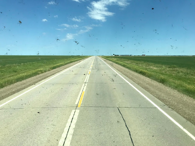
The highway took us through the middle of South Dakota farm and ranch land. There are a handful of little communities scattered along the way, but for the most part, the terrain is flat and green. As I look at this photo, I realize why I was having such a hard time seeing today! I gotta clean the bugs off!


After a couple of hours of driving, we pulled off the road in Mound City, South Dakota. Population 61.
Sasha and I walked the length of Main Street. A block and a half. Three times. The only buildings that were open were the MC Bar and an agricultural mechanics shop. In the following photo, the dark building on the right has a small concrete step in front of the door that was inscribed "1940" when the concrete was still wet! I suspect that the buildings have been abandoned for some time.


It never hurts to have a prop holding up the building facade!

 
We soon got to the North Dakota/South Dakota state line. Still flat. Still green. Passed through Strasburg, ND, the birthplace of Lawrence Welk. Sorry, couldn’t stop to see the homestead….

We enjoyed our time in South Dakota. Without exception, the people we met were friendly and helpful, and the sights and sounds of the state, quite simply, made us feel comfortable. If the winters were a bit less exciting, we might consider.....


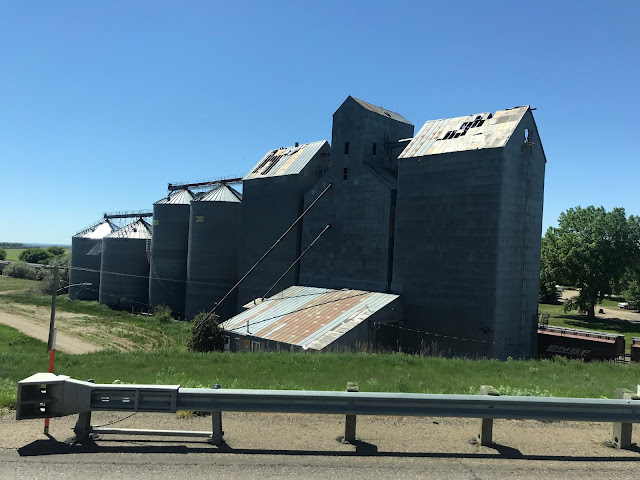
Just south of Interstate 94, we spotted this abandoned grain elevator.


While we saw many abandoned farmhouses and barns on our travels today, it seems unusual to see the very building that farmers use to ship their corn, beans, or wheat to market not being used. There are hundreds of elevators in the plains. Many of them are the main employer and livelihood of small towns. Wonder what happened to this one...

Eleven miles west after the intersection with Interstate 94, we pulled off into A Prairie Breeze RV Park.


We've stayed here in the past, and it has an air of semi-permanence to it. Most of the "residents" are working in the area, either on pipelines, communications, or highway projects. I'll bet the place is empty in December! While we seem to be the only "transients", we have been welcomed by other residents. The checkin process is strictly on the honor system, with a kiosk at the entrance. Envelopes and directions are posted there, and a metal post serves as a cash register! Thirty five bucks a night, cash, is among the least expensive fees we've paid this year, and that includes 50 amp power, utilities, and wifi!

So after a short 205 mile day, we're settled in for the night. Tomorrow gets us to a destination that we've wanted to visit for years. Stay tuned!


Sunday, June 13, 2021

Daytrip in Pierre

 We thought that the capitol city of South Dakota would be boring, being only some 15,000 residents, second only to Montpelier, Vermont, and only planned a lazy day at the State House. Were we ever wrong!

We were greeted with a growing thunderstorm when we got up this morning. The leading edge of the storm had an interesting configuration.

Donna said it looked like Casper, The Friendly Ghost, but I thought it resembled a turtle.

The rv park sits on a bluff overlooking the Missouri River, so we could see for miles. The storm gathered to the north about 20 miles according to the weather channel.


The leading edge of the clouds formed an awesome pattern over the river.


We decided to take a loop drive around the city and to points north. On highway 1804, just north of Pierre, we happened upon one of the landing sites of Charles Lindbergh when he was making a nationwide tour after his famous flight to Paris.


Driving north along the east bank of the Missouri River, we couldn't help but try to imagine how this area must have looked when Lewis and Clark traveled through here in 1804-1806. 


The T-storm was still gathering to the north and we approached Oahe Dam and Lake Oahe.


We returned to Ft Pierre via a riverfront road. There are a number of  very nice homes along the west bank of the Missouri north of Ft Pierre, but there are still some turkeys in the neighborhood!


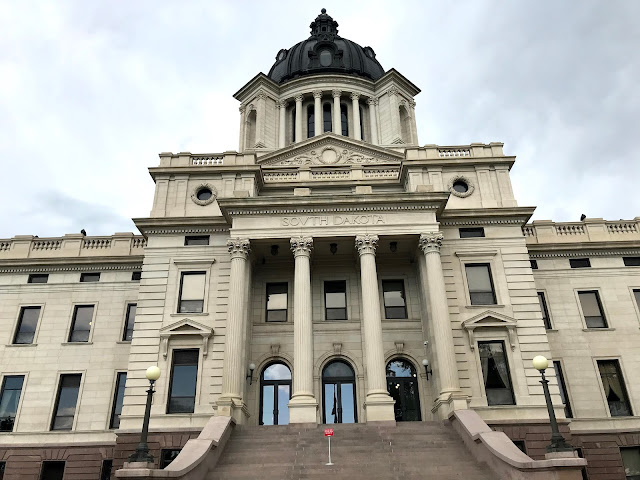
After a short pit stop back at the motorhome, we went on to our second stop for the day: The South Dakota Capitol Building.


The Grand Staircase on the second floor, under the rotunda, is where the formal events start. This is where governors have their formal portraits done, and inauguration ceremonies occur. Note the terrazzo floor. More on that.


The floors throughout the building are done in terrazzo tile. Some 66 Italian masons labored on the floor and each was given a single blue tile to place wherever they wanted. Only 55 blue tiles have been discovered. We found one, but didn't have time to scour the floors in the four story building for more!
There are a whole bunch of heart-shaped tiles scattered throughout the building, used as markers to indicate were repairs to the floor have been made. We didn't find a single one of those!


The "Barrel Vault" above the Grand Staircase is constructed of Victorian leaded stained glass while the cross members are painted solid oak.

From a bronze plaque placed in the floor on the second floor at the foot of the Grand Staircase, the rotunda  top is 96 meet up. Another 65 feet above that gets you to the ball atop the exterior dome.


Symbolism is everywhere in the Capitol. Below the stained glass of the dome are 16 alcoves in which the art represents the "Tree of Life". Beneath the alcoves are horizontal rectangular openings which feature a pasque, the state flower of South Dakota, surrounded by acanthus leaves which symbolize wisdom. The bottom ring is adorned with entwined bands of ribbon representing the "Ring of Eternity."

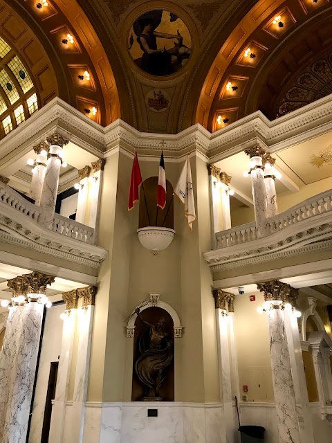
In each corner of the rotunda are the Seals of Sovereignty for the four governments that have claimed ownership of South Dakota: France, Spain, South Dakota, and the United States of America.


Below each seal, niches hold flags appropriate to that era, and a bronze figure below represents either "Wisdom," "Vision," "Courage," or "Integrity.'

From the fourth floor, a unique look at the upper rotunda and vault.


Also from the fourth floor, we were able to check out the House of Representatives.


And the Senate chamber.


The west side of the Capitol Building is the formal entrance, but is closed to the public, with entry granted through a security checkpoint on the north side.


The Capitol Complex has it's own lake, Capitol Lake. On the shore is a memorial to those who served and fallen in our nations conflicts.

In this larger than life-size sculpture, all branches of service are represented, saluting the flags of the United States and South Dakota.
 

Combat wounded are honored at this marble monument.


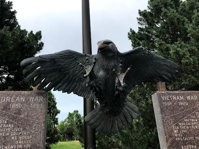
Vietnam War veterans are honored.


And a Screaming Eagle.


One of many ducks that inhabit Capitol Lake seemed to take a liking to the flower bed at the edge of the parking lot!


The Governors Mansion is on the south side of the lake, in a gated compound. While serving as the Governors residence, it is also used for formal receptions and events.


We should have booked more time in Pierre! History plays a huge part in this area, with Lewis and Clark and their meeting at the junction of the Missouri River and the Bad River in downtown Pierre with Black Buffalo, who feasted the visitors with roast dog, potatoes, and pemmican, to the Oahe dam and powerhouse that creates 826 thousand kilowatts at full capacity, there is much to see and understand. 

Unfortunately, we must move on, so perhaps a return trip is in the schedule....