Wednesday, August 24, 2016

Chickamauga and Chattanooga

Nessie went into the hospital today, so we were left with a dog, a car, and a desire for breakfast! A quick stop at the nearest Waffle House took care of the last item, and a look online resulted in  something to do.

About 9 miles south of Chattanooga, in the hills around Chickamauga Creek, a Civil War battle was fought that some historians count as the death knell of the Confederacy. Whether of not that's true, the Battle of Chickamauga has the distinction of being the second costliest battle, behind Gettysburg, in terms of deaths, wounded, and captured, of the entire Civil War. The little town of 2,500 residents called Chattanooga was considered to be as important as the taking of Richmond by President Lincoln. The reason? The small city lay on the banks of the Tennessee River where it cut through the Appalachian Mountains, allowing four major railroads to converge. If the Union captured Chattanooga, it could cripple Confederate supply lines and strike at the industrial heart of the Confederacy. In the summer of 1863, Confederate General Braxton-Bragg and his Army of Tennessee controlled Chattanooga, but Union General William Rosecrans moved his Army of the Cumberland to the south , threatening the Confederates from behind, In a classic military maneuver, General Braxton-Bragg moved his Confederate troops out of Chattanooga, leading the Union forces to believe that a retreat to Richmond was in progress. Actively pursuing the Confederates, they ran straight into a trap set at Chickamauga Creek. Over three days of confusion, surprise, and hard fighting, the Union troops retreated with great loss of life, but their goal was the now the undefended town of Chattanooga. The battle is considered a resounding Confederate rout, but in the process, they lost control of Chattanooga.

In late October, thousands of Union soldiers march out of Chattanooga to engage Confederates that now surround the city. General U.S. Grant had arrived in Chattanooga with reinforcements and opened a supply line to the city. The siege had failed. On November 23, Union troops had taken Orchard Knob, a small hill between the city and Missionary Ridge. By November 24, the stage was set, and on November 25, 1863, Missionary Ridge and all the surrounding hills, as well as Chattanooga, fell into Union hands. Not only had control of the railroads passed into Federal hands, but the town provided General William T. Sherman a base for his infamous Atlanta Campaign, leading to the question: is the fall of Chattanooga truly the "death knell of the Confederacy"?

The Visitor Center has a number of exhibits, but our favorite was the map with led lights representing the various troop movements during the Battle of Chickamauga. Over seven minutes, a narrated display clearly shows how the battle unfolded over three days. Very good!


 A seven mile long tour through the battlefield is lined with monuments to the various units in both armies. The park was dedicated in 1895, with survivors of the fighting in attendance. All specifics were verified by the original participants.


The armies flowed out of the surrounding woodlots into great fields. Planted in crops, the fields provided little cover, and were soon trampled.


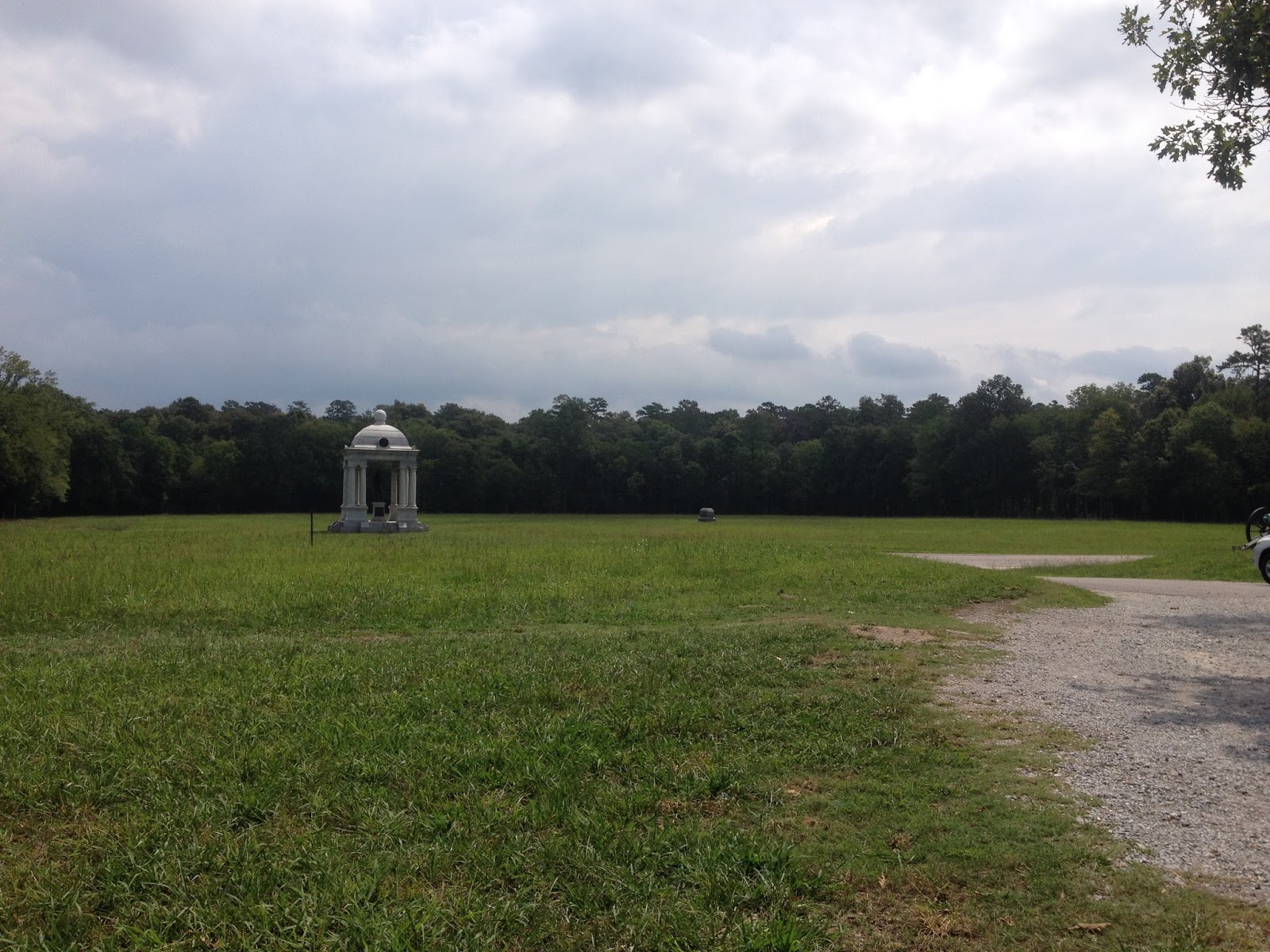
We took note of a number of fine monuments commemorating the men who fought here.


We soon came to Wilder's Tower. Union Colonel John T. Wilder lead a "lightening brigade" of cavalry equipped with a seven shot Spencer repeating rifles. This late war improvement in rifle technology allowed multiple shots to be fired while  conventional rifles were still being primed, packed and shot once. Colonel Wilder defended this hill until he realized he was isolated and fell back to provide a rear-guard for retreating Union troops.


136 steps to the top (I can vouch for that) get you to an observation tower that provides a 360 degree view of the center of the battle lines, where the southerners poured through a gap in the Union lines.


That's Donna and Sasha down there in the shade of the tree. Smart girls!


An emotional monument near Horseshoe Ridge shows a riderless horse trying to escape the battle.


Back to reality this afternoon, we were told that the problems with Nessie weren't all that serious. At least nothing that $1,000 can't fix.....

So, we're camped again tonight in the parking lot, next to I-24 south of Chattanooga. It's not too bad, though, we have water and electric hookups and the dump station is only 20 feet away. We're hoping that the necessary parts will arrive tomorrow so that repairs can be made this week. Oh, the problem? The electric motor that drives the bedroom slide in and out is connected to a gearbox that reduces the rpm's of the motor and increases the torque. Between the two gears, a tooth or two has broken off. Bummer.

Tuesday, August 23, 2016

GSMNP-Clingman's Dome

Our last day in Gatlinburg was a day of choices. We certainly had not seen all of Great Smokey Mountains National Park and the hundreds of miles of trails in it, but we needed to hit one more highpoint before we left.

We chose to drive to Clingman's Dome, the highest point in the park at 6,643' elevation. Near the top a steep but paved 0.5 mile trail leads to an observation platform, from which one can see 100 miles in any direction on a clear day. It was a nice day when we were there, but by no means clear.


After a few rest stops, we made it to the top and took a pic of Mt Le Conte. We had to celebrate!

The observation platform was built in the 1930's by CCC workers using wood forms and scaffolding. What an engineering marvel!


On the platform, we found ourselves above the clouds.


But soon more clouds began to drift in.


The Appalachian Trail follows along the Park ridgline, and passes directly under the observation deck. Donna decided to take a short hike!


The bees were buzzing among the last of the summers flowers.


We stopped to take a last look to the east. Out there somewhere is Paynesville, Cherokee and Maggie Valley.


We left Gatlinburg about 10 this morning and drove south on I-40, I-75, and I-24 to Chattanooga, Tennessee. We are settled into the customer parking area at Lee-Smith Truck Service. Lee-Smith provides truck and rv sales, service, and parts on a 65 acre site just off of I-24. We're scheduled for a slide-out motor diagnosis tomorrow. Let's hope the problem is fixable!

We received a text message a few days ago from our friends from Michigan, telling us that they are on vacation in the Virginia/Tennessee area. Well, one thing led to another, and we were able to spend a wonderful afternoon with Dale and Lisa, catching up on what's been happening since we last saw them last year. Lovely people, and we are extremely happy to call them friends. We're already kicking around ideas that will allow us to meet again!


We enjoyed dinner with Dale and Lisa at Puckett's Restaurant in downtown Chattanooga along the Tennessee River. Dinner was unique, combining traditional bar-b-que with comfort food. One of the dishes we enjoyed was called Piggy Mac, with pulled pork under a layer of very cheesy Mac-n-Cheese! Oh, yeah, now we're talking!

We're looking forward to a successful conclusion to our repair problems, but in any case, we'll enjoy our time here in the home of the Chattanooga Choo-Choo!

Sunday, August 21, 2016

GSMNP-Cades Cove & Dixie Stampede

A "cove" in Smokey Mountain vernacular is a relatively flat valley completely surrounded by mountains or ridges. Cades Cove, roughly west of Gatlinburg, is on of the most inspiring natural and cultural treasures the Southern Appalachian Mountains has to offer. We decided to visit.

The primary access to Cades Cove is the 11-mile, one-way Cades Cove Loop off of Little River Road and Laurel Creek Road. Our first glimpse of the Cove was spectacular!


Cades Cove is home to over 80 original structures. The John Oliver cabin in the oldest log home in the Cove, built in the 1820's. Typically, parents, infants and daughters slept on the first floor and sons slept in the loft. Simple tools were all that was required to build such a cabin: felling axes to cut down the trees and score the logs along their length, then a broad axe to hew the logs into a shape with two flat sides. The notched corners need no nails or pegs; gravity holds them together. A little mud to fill the chinks between the logs and hold the chimney together, and you have a home for an entire family.


The Olivers had a tremendous view of the valley from their porch!


With only five narrow, muddy, and steep roads into and out of the valley, residents learned to be self sufficient. Corn was a staple crop so several grist mills were set up. This one, the John P. Cable grist mill is now just a few yards away from the Cades Cove Visitor Center, which is a small structure designed to blend into the environment. Incidentally, the residents of Cades Cove probably got very tired of eating cornbread three times a day, so legal distilleries sprang up to make us of the grain. George Powell was one such who "forgot" to quit after Tennessee voted for prohibition....


The Carter Shields cabin was built by a wounded Civil War veteran about 1910. It shows that sawmills had arrived in the valley, and is typical of a house where logs were used for the walls, but sawn lumber was beginning to be used for part of the structure.


Returning to Gatlinburg, we marveled at how quiet the streets were! It's a Sunday afternoon, I guess.


We felt the need to be tourists while we're here, so we decided to get tickets for Dolly Partons Dixie Stampede Show in Pigeon Forge. Arriving this evening at about 5, we were treated to a warmup by the Mountain Ruckus Group. Click on the video below to hear a poor cell phone recording of Tennessee's most famous song.


After moving into the main building, we were seated in horseshoe fashion around a large sawdust floored arena. An estimated 1,000 people sat down to enjoy the dinner and show.


Flash photos were prohibited, but we managed to get a couple of "important" pics!


A Ringmaster on a white horse directed the show. We enjoyed a very intricate display of trick riding, barrel racing, and, in general, superb horsemanship.


A tribute to pioneers who went west,


led to a full-scale square dancing number.


Audience members were enlisted in the North vs South segment. The black chickens were "northern' chickens and the white were "southern". The kids were told to herd them to the finish line, and which ever color chicken crossed the line first.....well, you get the picture. The kids were presented with "olympic" medals one and all, and the audience (and parents) cheered them greatly.


The show ended on a patriotic note, with flag-bearing horses and riders performing intricate routines to the music of America The Beautiful sung by Dolly Parton (via recording, of course). Amazing and touching.


By the way, the dinner wasn't half bad either! We knew something was amiss when we were seated, the show started, and the vegetable soup was served in small bowls with handles. Looking around, we didn't see any spoons.....so we slurped the soup. A short time later, an entire roasted Cornish Hen was placed on the plate, followed by a serving of baked potatoes and a pork chop. Still no utensils....OK, here we go with the fingers. No wonder they call it the "most fun place to eat in Pigeon Forge!" The chicken was delicious, but we had to take the chop, potatoes, and dessert home (fruit turnover).

It's been raining heavily off and on today, but that didn't dampen our enthusiasm for the culture of Cades Cove or Dolly's show. It was a great day!

Saturday, August 20, 2016

Cherokee, NC via Newfound Gap

Our friends Richard and Jan from "the olden days", who now live in North Carolina, didn't have lunch plans today, so D and I decided to check in with them one more time while in this area.  Newfound Gap Road (otherwise known as US 441) rises from 1290' elevation in Gatlinburg to Newfound Gap at 5046' elevation. Along the way, the scenery is absolutely awesome. It's never possible to describe or capture in photos the grand scope of the hardwood forests that cover these mountains, but we stopped at every turnout to try.

The misty, cloudy day cloaked the mountain peaks in cotton, softening and silencing the landscape.


It was a cloudy, rainy day, but from time to time the clouds cleared a bit, allowing us to look down the valley of the Little Pigeon River toward Gatlinburg.


At the summit, the North Carolina/Tennessee state line bisects Great Smokie Mountains National Park, giving us a perfect photo op!


Newfound Gap is also the crossing point for the Appalachian Trail. Starting in Georgia, the 2,200 mile trail continues on to Maine, following the spine of the Appalachian mountains. Donna met and talked with a group of ladies in their 60's (plus) that were embarking on a hike to Maine! At least we can say that we hiked (200 feet) of the Appalachian Trail....


Shortly before dropping into the town of Cherokee, we stopped at Mingus Mill, one of only two water-powered mills still operating in the park. Today was an off day, but normally a miller grinds corn and wheat to make cornmeal and flour "for the tourists".


Water is diverted from a nearby creek and sent to the mill via a flume.


The water drops into a tall structure just outside the building (the dark vertical area in the photo). The weight of the column of water provides pressure to turn a cast iron drive shaft, turning the grinding wheels and powering the mechanism that cleans and grades, according to size, the flour or cornmeal.


We dropped down into the community of Cherokee, NC, following the Oconaluftee River. Cherokee is indeed a Cherokee Indian Reservation named Qualla Boundary. Evidence of human habitation goes back thousands of years. The first inhabitants of this area are believed to have come south from New England and enjoyed a sophisticated agriculture-based life. First encountering Europeans in 1540, when Hernando de Soto led an expedition through Cherokee Territory, the Cherokee were friendly, but in the late 18th century, Scotch-Irish, German, English and others arrived in significant numbers. The Cherokee retreated to the Blue Ridge Mountains and adapted to European ways, adopting a written legal code in 1808 and creating a written alphabet for the Cherokee language. A Cherokee silversmith named Sequoyah started a system of "schools" and by 1810 nearly all the Cherokee could read and write.

In 1830, President Andrew Jackson signed the Removal Act, calling for the relocation of all native peoples east of the Mississippi to Indian Territory, now Oklahoma. The Cherokee appealed to the US Supreme Court and won their case before the country's highest tribunal. President Jackson ignored the decision and ordered the forced removal of the native peoples. Some 13,000 Cherokee marched to Oklahoma along what has become known as the Trail of Tears, where about one-third died en route.

A handful of Cherokee disobeyed the government edict, however, and hid out in the hills around the site of present day Cherokee. In 1889, they regained legal title to 56,000 acres of ancestral lands. The area stagnated for years, surviving clear-cut logging operations that ruined the eastern forests, encroaching farms, and racial bias. These days, tourism and gambling provide income for the 10,500 Cherokee descendants that live on the reservation.

After a lovely lunch at Granny's Kitchen, and several grand hours of conversation with Richard and Jan, we headed back over the mountain. We were able to get another photo of the Little Pigeon River valley.


Crossing the divide, we noted the extreme southern end of the Blue Ridge Parkway, some 469 miles from where we visited at mile zero a few days ago.


A wonderful day, with good friends, and beautiful country to see. What more could we possibly want?

Friday, August 19, 2016

Pigeon Forge, Sevierville and SugarLand

After a rousing breakfast at the Mountain Lodge restaurant just a couple of blocks from our park, we headed toward the bright lights and zip lines of Pigeon Forge and Sevierville. Pigeon Forge is just a few miles away, and we were there in no time. Of course the main attraction is linked to a very famous musician, songwriter, actress and producer.


Just up the road, in Sevierville, where Dolly was born, a statue of her has the place of honor at the county courthouse!


Sevierville seems to be a normal town, perhaps with a few more restaurants than most, but pretty middle of the road.

Pigeon Forge, however, has every attraction known to man (or woman). As we drove through town on the main street (The Parkway), we laughed at all the different ways that have been invented to separate a tourist from his dollar! From an upside-down White House to a King Kong themed amusement park to every major restaurant chain ever imagined, Pigeon Forge has it all. One of our staple restaurants when on the road is Cracker Barrel, with a home-cooked theme. There are three CB's within four miles of each other in PF!

One of our favorite sights was a restaurant with a catchy name:


After the urban experience, we felt a need for a slower and more beautiful area. A drive into Great Smoky Mountains National Park gave us the peace we needed.


We pulled onto the Gatlinburg Bypass, which offered an extraordinary perspective of the town.


At the Sugarland Visitors Center, we scoped out some exhibits of local flora and fauna. Seems like we met this guy at home one time!


A short, 3/4 mile Nature Trail led from the Visitor Center through a hardwood forest....


Across the proverbial babbling brook...


To the mighty crescendo of Cascade Falls! Well, maybe it's not Niagara, but the 35 foot high fall is still very pretty. The overcast day was perfect for walking, and we enjoyed the trail immensely!


A bit later, a cloudburst drove us indoors. D prepared a wonderful meal, and, with a piece of peach meringue cake for dessert, we settled in for a quiet evening at home!