
Said to be named by early settlers because of the large number of Indian skeletons found on a nearby hill, the result of imported diseases that effectively wiped out the local First People.
The Welcome Center at the western entrance to town (there are only two) references a film production that was shot here.

Indian Head Campground is located at the eastern entrance to town, and is a satisfactory park exclusive of the dirt road leading to it and the dirt and gravel interior roads and sites. The utilities (including 50 amp power) are satisfactory, and we're in a site that allows us to use the satellite antenna. There is no cable or over-the-air television. The wifi is recognizable but unusable, however the cell signal via the Rogers network is adequate.

We arrived in Indian Head on Tuesday, so on Wednesday we decided to venture into Regina to check it out. Regina is the second largest city in Saskatchewan after Saskatoon and is the provincial capitol and the site of the training academy for the Royal Canadian Mounted Police, who maintain a Heritage Museum at the facility near downtown Regina. The museum is gilled with artifacts and exhibits showcasing the history of the RCMP from its founding in 1873 through it's "Royal" award in 1904, bestowed by King Edward VII in recognition of their excellent service and on into the present day, using sophisticated techniques in an ever-changing environment.

A detailed record has been kept of the history of the RCMP, including this photo of the first car accident suffered by the agency in 1919!

One of the most interesting exhibits described a fictional crime and enlisted the help of the visitor in solving it.
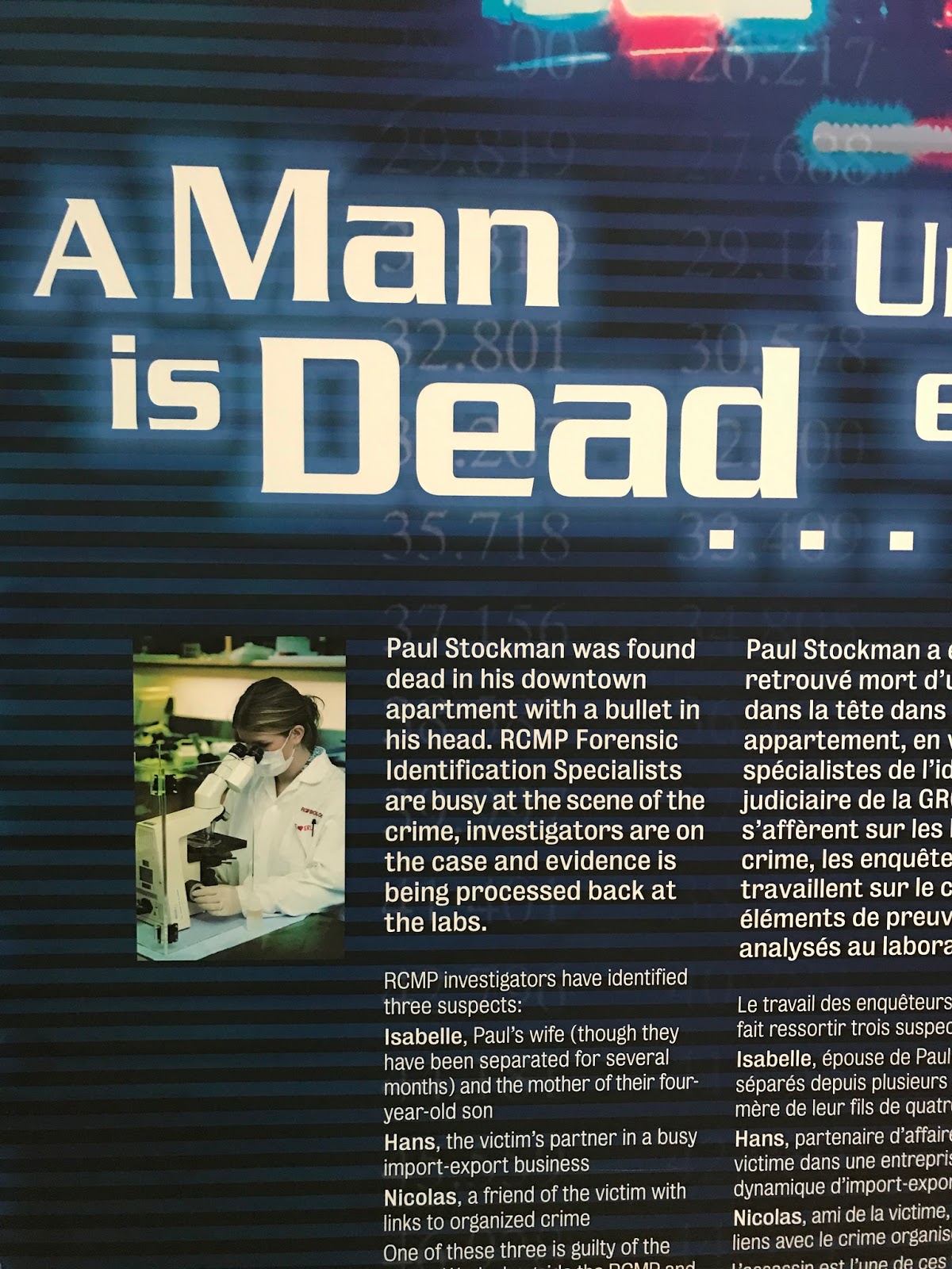
Nine clues are available, from a piston on the floor, a bag of money, and a tipped over champagne glass. The visitor is encouraged to use sophisticated equipment along with an analytical approach in solving the murder. At one point, D and I pressed our index finger to a reader and compared our fingerprints to five broad categories of prints. We both fall into the Radial Loop category!


Donna and I don't remember ever sampling Poutine(s?), so we had to experiment. This dish is served all over Canada, and this restaurant had a list on the blackboard menu that contained a dozen different varieties. Poutine is a serving of french fries, covered with brown gravy, and served hot with melted cheese curds on top. Then it gets interesting.....any number of different toppings can be added to that base. We chose the Ringer, which included Onion Rings on top. Consider...this was a full pound of potatoes plus the other goodies!
We also shared a delicious Elvis burger. A half-pounder with all the pickles and such, and a healthy smear of peanut butter and three strips of bacon on top. Enough said. Diet the rest of today (and tomorrow).
Trying to give our stomachs a rest, we headed home via a "Scenic Route". And was it ever! Leaving the TransCan, we headed northeast toward Fort Qu'Appelle, which is located just a bit south of Echo Lake.

Many hamlets are identified by a number, as in "North Qu'appelle No 187" Curious, no?
We passed Mission Lake and Katepwa Lake and began to climb out of the river valley. The hills on either side appear to have been formed by a giant gold dredge millennia ago, being to evenly folded together.

Back on the prairie, we saw wheat fields as far as we could see.


Back on the outskirts of Indian Head, we found the famous Bell Barn. This horse stable was built in 1882 of locally gathered stones. It is 69 feet in diameter and 14 feet high with 29 single stalls and two double stalls arranged so that a single man could take care of all the horses.

This is the last of some 100 structures that were part of the Qu'Appelle Valley Farming Company, founded in 1882 with a mere 53,000 acres! The operation soon became known as the Bell Farm, after it's major stockholder and general manager, Major William R. Bell. From the 33 foot high tower, Bell could survey all of the farm within a five-mile radius. Yes, Virginia, it is flat out here!
The roads hereabouts are laid out in a north-south, east-west orientation, as was customary in farming areas. However, the streets of Indian Head run at a 45 degree angle to the section lines because Major Bell insisted that a road be built directly from his farm to the grain elevator located on the railroad spur. All the other streets were laid out parallel to that main road as the town grew and prospered.
So there you have Indian Head, Saskatchewan. Should you ever be traveling on the TransCan, be sure to stop and look at the 3,000 pound plaster indian head located at the information booth, eh?
No comments:
Post a Comment