Last Monday, September 10th, was a day of "going separate ways". Larry and Debbie, and their friend Pat, along with two others of their friends, Clay and Pebble (yep) who are spending the summer in the Hiawassee area, all went golfing at a local course. I didn't go, worse luck, because I needed to make a quick stop at a local "doc-in-the-box" to have an ear looked at....I can't hear very well anyway, but one ear went dead! Diagnosis: allergies. Take two antibiotics and don't call me in the morning! The golfing group got rained out on the 7th hole, so I guess it all worked out ok. A quick dinner in downtown Hiawassee at Daniel's Steakhouse finished off the day, and a bit of playtime for Max and Sasha finished them off also!
Both dogs know exactly who their best friend is! Debbie is so good with Max and Sasha!
Debbie brought a tug toy, and both pups latched on as if they had been playing this game for years!
On Tuesday, September 11th, God Bless America, Larry and Debbie and Donna and I went on a day trip to Brasstown Bald. This mountain, Georgia's highest point at 4,784 feet, is just a dozen miles south of Hiawassee. We had to check it out.
On a clear day, it is possible to see the tall buildings of Atlanta from the summit, and on most days the states of North Carolina and South Carolina are visible as well as the remainder of the state of Georgia to the south. "Bald" is common terminology in the southern Appalachians describing mountaintops that have 360-degree unobstructed views.
The area surrounding Brasstown Bald was originally settled by the Cherokee people. Legend has it that a great flood swept over the land and all the people died except a few Cherokee families who sought refuge in a giant canoe. When the canoe ran aground at the summit of a forested mountain, there was no wild game for the people to hunt and no place for them to plant crops. The Great Spirit killed all the trees (Bald) on the top of the mountain so that the surviving people could plant crops. They continued planting and lived from their crops until the water receded. Sounds like another story passed down from the ancients....
The US Forest Service operates an observation tower atop the peak, keeping watch on the thousands of square miles of forest that lies below.
We took advantage of a clear moment to snap a photo of Debbie and Larry.
The clouds came and went, a product of the moisture in the ground heating and rising from the forest floor. In the distance, we spotted the town of Hiawassee and the edge of our campground.
A stone wall surrounds the observation deck, and as we trekked around it we spotted this unusual plant. If anyone can identify it, we would appreciate the input.
Beautiful clouds!
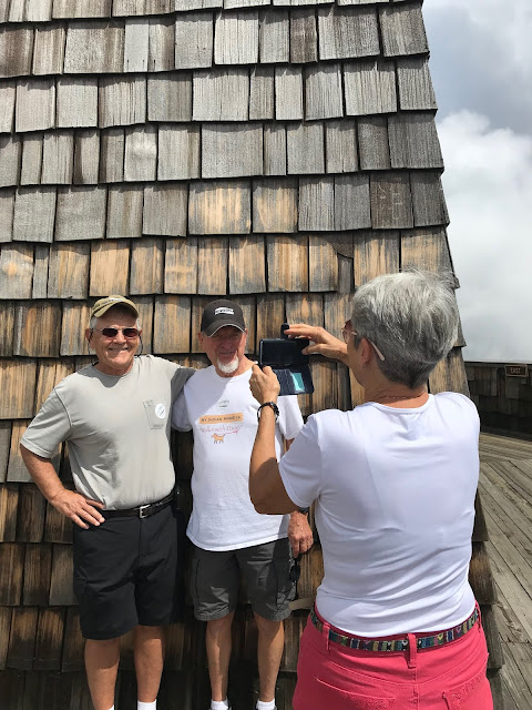
And, of course, we had to have the requisite photo of a photo...Larry and I were trying to act grownup...
With a couple of last looks back at the awesome cloud formations visible from the top of Georgia's highest peak, we jumped into the car to continue our trip.
The trip down the mountain was peaceful and calm, and just a bit damp!
Wednesday was to be our final day in Hiawassee, Georgia, so we needed to make it special. Just a mile or two from the rv park is a little specialty shop near the Hiawassee River called the Creekside General Store. A few signs greet the visitor on arrival:
At the end of the day, we were reluctant to see our visit come to an end. Debbie prepared a wonderful grilled salmon dinner and we lit a campfire for ambience!
We watched darkness slowly gather us into it's arms, and just before total darkness we were awed by a glimpse of the Moon and it's companion in the lower left.
As much as we would have prolonged it, the night was shortly over. Sasha, Donna and I returned to our motorhome to agonize over the latest hurricane Florence reports. Hiawassee is about 400 miles from the expected point of landfall in Wilmington, North Carolina, but lies pretty much in the "cone", or potential path of the hurricane after it comes ashore. We tussled with the decision to go or stay, continue or run. Our next rv park is located in Milledgeville, GA, well south of Hiawassee, and a bit south and east of Atlanta. Since it is located very near the southern edge of the cone, we decided to go ahead and brave the potential wind and rain.
Two hundred seven miles south of Hiawassee, via US 76/23/123 and 441, we pulled into site number 24 at Scenic Mountain RV Park. The site is on top of a hill, so there's little chance of flooding, but we're a bit exposed if the wind picks up. We're hoping for the best!
Milledgeville is on the Georgia Antebellum Trail, so we're looking forward to visiting some of the 150-plus year old homes that Sherman spared on his way to the sea during the Civil War. Beginning in Macon, GA, and ending in Athens, GA, home of the University of Georgia, also referred to as UGA or simply Georgia. It was founded in 1785 and at one time was one of three schools to claim the title of the oldest public university in the US. In addition to more than 140 degreed areas of study, the Red and Black of the athletic teams are know nationwide (go Bulldogs!).
Sorry, got sidetracked there for a moment. It's awesome to be in an area with so much history, and to hear and see some of the places we've only heard about!
Don't go away!


No comments:
Post a Comment