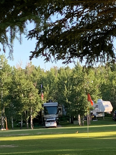
US 20 also goes into Idaho Falls, and then northeast toward West Yellowstone. On the way it passes through the hamlet of Ashton. About 8 miles east of town lies the Aspen Acres RV Park and Yellowstone Golf Course. We've booked a week here to relax, play a little golf, and get reacquainted with Roger and Mary, our long-time friends from Texas, who are spending the summer here.
Site 8 is one of the few able to accommodate a large motorhome. It's very near the golf course but is out of level. The front of the motorhome is just off the ground, and Donna needs a boost to reach the first step! After an afternoon of conversation and cold drinks (it was 82 and sunny the afternoon we arrived), we enjoyed Mary's famous meatball sandwiches for dinner!
On Monday, RnM had an appointment in the nearest large town, Rexburg, so Donna and I took a short 110 mile day trip south into the Teton Valley. We didn't want to go all the way to the Teton's, so we bailed off of ID 33 onto ID 32 and returned home, but not before we got close enough to take a few photos.
We've noticed a huge acreage of crops out here in eastern Idaho, many acres of potatoes, of course, but also wheat and hay, with some canola thrown in for good measure.
With Roger having a bit of difficulty walking due to an old injury, the four of us and three dogs decided to do a day trip on Tuesday. Our objective was the highest mountain in the Beaverhead range, Scott Peak, at 11,378 feet above sea level. So off we went: US 20 to Rexburg, ID 33 west to ID 28 through Sage Junction and Mud Lake, then north through Lone Pine toward National Park Road 190. OK, we're about a hundred and thirty miles into the trip and cannot find NP 190! North and south we went, searching for any old road that went east into the Beaverhead range and the border between Idaho and Montana. No luck.
Along the way, though, we stopped at historical markers and learned that ID 28 through the valley is called the Sacajawea Historic Byway. More than 10,000 years ago, humans occupied this valley and eventually became the forerunners of the modern northern Shoshoni Indians. A French Canadian trapper found this valley in 1818 while trapping beaver. The valley became known as Cote's Defile in his honor.
Near Lone Pine, we discovered an abandoned log cabin. It's easy to see why this valley, with it's abundant water and fertile soil would attract an early farming family.
While Roger crawled under a barbed wire fence to get a closer look, The girls stayed outside!
While we found several dirt roads leading east into the Beaverheads, we never did find NP 190, so we decided to have a picnic along Birch Creek. What a beautiful spot!
So, with some feeling of disappointment, we headed home. Taking a different route through Dubois got us to Resburg again, and then back to the rv park near Ashton. Two hundred fifty eight miles later we arrived home, within sight of the Teton Mountains.


No comments:
Post a Comment