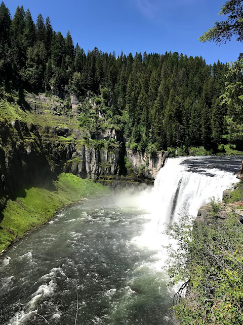
Highway 47, the Mesa Falls Scenic Byway, leaves Ashton toward the east through miles and miles of rolling farmland. eventually it rises into the National Forest near Warm River.
This community dates back to 1896 when settlers arrived from Europe establishing farms and ranches. Years later, Warm River was the stopping point for travelers on a slow journey on a narrow muddy road to West Yellowstone, Montana. The road was eventually improved and became a major thoroughfare to Yellowstone Park. In 1947, Fred Lewis and his wife Bertha incorporated the Town of Warm River and Bertha became it's first mayor. The Rendezvous Dance Hall provided hamburgers, laughter, music, and fun on a Saturday night. When US 20 bypassed Warm River, the town faded into the shadows. The Rendezvous is gone, but they say that on a quiet evening, you may hear faint sounds of music.
Just a few miles further east is the first of our objectives. Falling 65 feet, Lower Mesa Falls can be viewed from an observation platform built by the Civilian Conservation Corps in the '30's.
Over a million years ago, a super-eruption of a volcano obliterated life in this part of Idaho and spread ash over much of the current US. In this area, the ash solidified into "Tuff", and the river has been patiently carving through it since.
Just a mile east, Upper Mesa Falls is a bit more spectacular!
Upper Mesa Falls cascades 114 feet over tuff that has been dated to 1.3 million years old. The river continues to slowly carve its way through the rock.
We don't usually go in for selfies, but this was such a nice day, and the river was gorgeous! And as long as one of us can go incognito.....
A nice drive on a beautiful day!


No comments:
Post a Comment