Saturday evening we spent a wonderful couple of hours with Brian and Kristina. Brian is one our son's best friends from high school and they have kept in touch over the years. We haven't seen him for ten years or so, so it was great to catch up. Brian was involved in the 1989 invasion of Panama and the removal of dictator Manuel Noriega. From there he was deployed to Iraq and participated in Operations Desert Storm and Desert Shield. His experiences there have led him to become a counselor to returning veterans and assisting with the transition back into civilian life. He works closely with the VA and several private organizations. He fulfills a vital role and we applaud him.
Sunday, the 26th, we spent the afternoon with Dave and LaShonna and their son Luke. Dave is another contemporary of our son, and has a successful business in the fiberoptic industry. He also has kept in close contact with our son, and it's wonderful to see him and his family. Dave and Brian seemed to spend as much time with us years ago as with their own families, so this has been a nostalgic visit. These are great men who have matured into successful members of society. While we had our doubts at times, they have restored our faith in our younger generation. They've done well!
The Western Slope of Colorado, that is, the area west of the Rockies, is an interesting area, transitioning from the arid deserts of Utah to the Rocky Mountains. One extremely interesting area just a few miles from Monument RV Park is the Colorado National Monument.
The 24 mile loop road into the Monument is, at best, a 35 mph road, and oversize vehicles are prohibited. but the views are outstanding! From about half way up the western entrance to the park, the entire Grand Valley is visible. Once a farming community, Grand Junction is now a cosmopolitan, diversified city, thanks to the influx of people from out of state. A neighbor here at the park is considering moving to the area, and went looking at houses on Monday. He related a tale about seeing a 2 bedroom, 1 bath house built in the '40's that sits on 2 acres of land. $720,000! The basement must double as a gold mine.
Great pinnacles and chasms are everywhere along this road. Almost too much to understand.
The road, as I said, is twisty, but not steep, so the drive is an easy one.
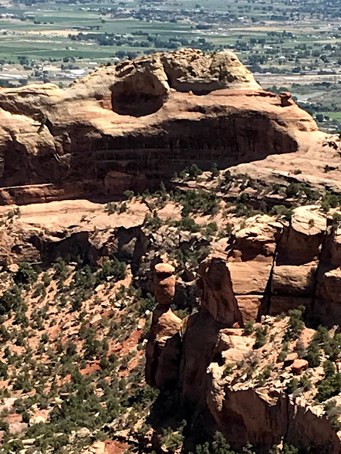
As with so many area in Utah/Colorado/Arizona, harder rock was formed on top of softer sandstone. As the softer material erodes away, a column is created, protected by a "hat".
Independence Monument stands alone and proud in the center of the National Monument. John Otto arrived here in 1907, and fought for preservation of the area for all to enjoy. In 1911, the National Monument was formed. John was the first to scale Independence Monument, but these days hundreds of climbers are challenged by it's steep walls and the last 20 feet that requires a backward climb. Every year on July 4th, an American Flag is planted on the top of the pinnacle.
Scenic overlooks at regular intervals along the road provide place to view and wonder.
Nearing the end of the loop road, and near the highest point in the park at 6,640 feet, we came across Ute Canyon. On the west side, huge walls of sandstone boggle the mind.
These formations were called the "Coke Ovens" by early explorers due to their decided resemblance to coke ovens used in the east.
Once out of the park, a scenic byway called the Tour of the Moon runs along the base of the plateau. This is private land, just about covered with ranches and housing developments. It sure would be nice to have a view like this!
The day that the motorhome was being serviced we took a ride east to the town of Palisade. Known for it's fruit stands and peach orchards, we stopped to check it out. the bluff behind the town is, for obvious reasons, known as The Palisade.
Downtown Palisade would be a great place to explore and have lunch....in a more normal time.
The local bank has a sense of humor!
So, we've just about explored the Grand Junction area, at least the parts that are available in these crazy times, so our next stop will be back in Utah.


No comments:
Post a Comment