Kansas has defined 12 scenic byways, each illustrating something unique about the state. Number 1 is called Land and Sky and travels northwest Kansas where wide open expanses of land meet endless skies. This is the one we drove today. Other byways explore fossil areas, valleys that divide western shortgrass Great Plains from the mixed-grass prairies of the eastern state, bedrock and limestone areas, pioneer and early military towns and Route 66.
Out of Goodland, we drove north on Kansas 27 toward St. Francis. Just our of town we spotted another of the sculptures that dot the area. Made from tractor parts and painted John Deere green and yellow, the "Goodland Grasshopper" sits alongside a large farming operation.
About 20 miles out of Goodland, the western sky began to look a bit ominous, but since you can see for literally miles, it was hard to tell how far away trouble was.
Periodically along the byway, kiosks provide more information about the area. When we stopped at the third kiosk we noticed a truck with an eye-catching name!
This point of interest also described the dust bowl conditions during the 1930's and told about how farming methods have changed to prevent a re-occurence.
The major change, other than being able to draw water ever deeper from the Ogalalla Aquifer, is the "no tilling" method of land preparation when new crops are to be planted. The seeding machines simply insert the seeds along the side of the stubble of last years crop, thereby using the old plant material for nutrients and not disturbing the soil unnecessarily. Plant spacing to maximize absorption area and weed control to eliminate water loss are also vital components of the system.
The byway notes several events from the past, including this site of the Indian encampment of 1864-65 where between 800 and a thousand tepees with an average of 6 to 8 residents in each, gathered to avenge the Sand Creek Massacre. Also of note at this site, the last remaining male buffalo in the area was killed by homesteaders.
Just north of the village of St Francis, we crossed into Nebraska. The scenic byway had ended at the state line, but we kept going. Highway 27 ended in the village of Haigler, Nebraska, so we turned east on US 34, crossing the dry Republican River several times. No Democrat to be seen.
An interesting historical marker caught our eye as we motored along toward Benkelman. Seems that cattle drives were big in this area.
We had crossed an area of badlands called the Arikaree Breaks just before we crossed into Nebraska, and we caught the tail end of the area just before we crossed back into Kansas.
Benkelman is one of those Midwest towns that refuses to die. The only grocery store is closed. More than half of the downtown is closed. But there are still signs of life in the residential area.
The local park is well kept and dedicated to a native son. Ward Bond was the star of the television series Wagon Train back in the day.
Heading south again, we found ourselves on Kansas 161, going toward Bird City. This road is one of those north-south roads that goes forever in the midwest. What a view!
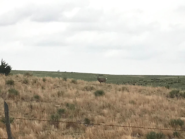
Somewhere along this road Donna spotted a curious deer, just munching and staring as we stopped. Happy Deer!
Bird City is aptly named for the hundreds of Robin Redbreast birds that hang in this area. They were shy however, and hard to photograph. We had to be satisfied with fly-bys.

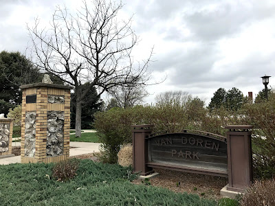
Bird City has a lovely park dedicated to Mr/Mrs/Ms Van Doren. Sidewalk segments were stamped with the names of people and families that had contributed to the construction. While Sasha and I walked the perimeter, Donna prepared a picnic lunch. lt was cloudy, windy, and cold, so we ate in the car.
And the clouds continued to build.
East out of Bird City on US 36 brought us to the metropolis of Atwood, KS, the county seat of Rawlins County, with a population of about 1,200. Originally spelled with two T's, the post office requested the name change in 1882, after 7 years as Attwood, the first name of the 14 year old son of the founder, J.M. Matheny. Again, there is much to be wondered at with a town like this. Located at a crossroads, and with grain elevators and a thriving CO-OP to service local farmers, there are about 500 residences and a handful of businesses, one of which we almost patronized!
As I write this, 10:30 Mountain Time or 12:30 Central, the clouds have finally decided to consolidate their efforts and it has been raining for several hours. The park has asked us to disconnect our water hose to prevent freezing, so I'm connecting the dots: rain and freezing temps? Snow? We'll see in the morning!
When we returned this afternoon, we were met by the owner of the park and a plumber. Uh-oh, not good. A blockage in the sewer line right under our site number 9 will require that the line be excavated and repaired tomorrow morning at 8 am. We elected to move to another site.....
Tomorrow has a couple of local interest items on the menu along with laundry and such. If we can navigate through the snow (fingers crossed) that is.


No comments:
Post a Comment