We’re in one of the most incredible areas in the United States, the windswept sandstone canyons and colored spires of Utah. We’ve visited Moab, Arches National Park, Zion and Bryce Canyon National Parks, but we’re exploring a different park this time: Capitol Reef National Park. Capitol Reef is not quite as accessible as the other parks, and that intrigued us. We left Silt at about ten, heated up the pavement on I 70 until we got to Green River, Utah, then hesitantly turned onto Utah highway 24 toward Hankville. We had done a bit of cyphering and knew that this road, while in good condition, is literally a lonely, lonely, road. Near as we could tell, it was about a hundred miles in any direction for services….not a good place to break down or run out of fuel!
A long way to anywhere, but there are some killer rocks!
The farther south we went, the more amazing the formations became.
We arrived at our rv park in Torrey, Utah, about 3 in the afternoon and tucked into site M3 of Thousand Lakes RV Park.Torrey, population about 180, was established in the 1880’s by members of the Church of Latter Day Saints. A handfull of hotels, restaurants and rv parks anchor the town that bills itself as the Gateway to Capitol Reef National Park.
The view from the park is incredible, as it is in just about every direction around here! Afternoon showers began to develope but not before we got to enjoy a nice sunset.
Our first full day started with a clear and crisp view of the redstone formations just out our window. And, of course, the neighbors rv had to get in the way!
We saddled up King James (our awesome truck) after breakfast and headed for the Capitol Reef Visitors Center.
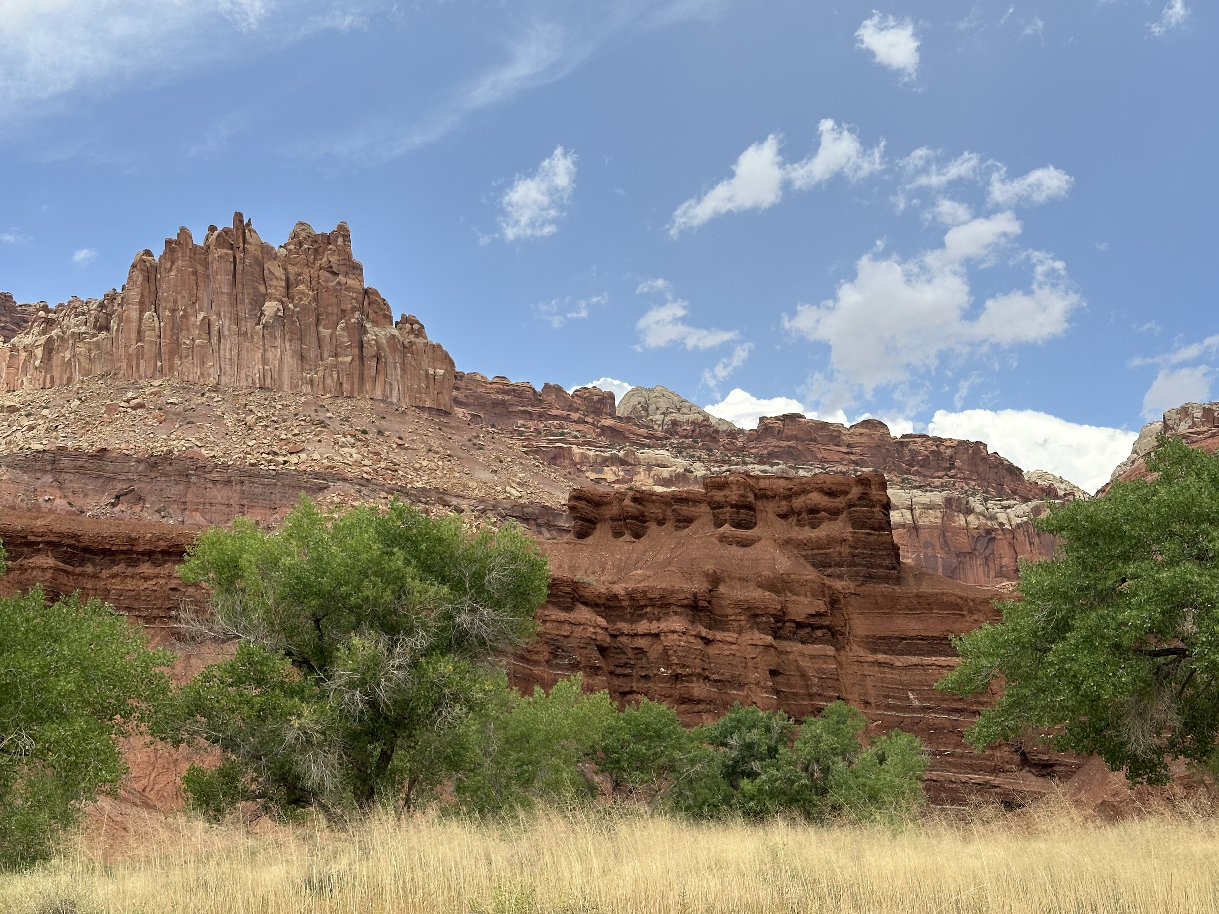
Every park has to have a chimney rock!
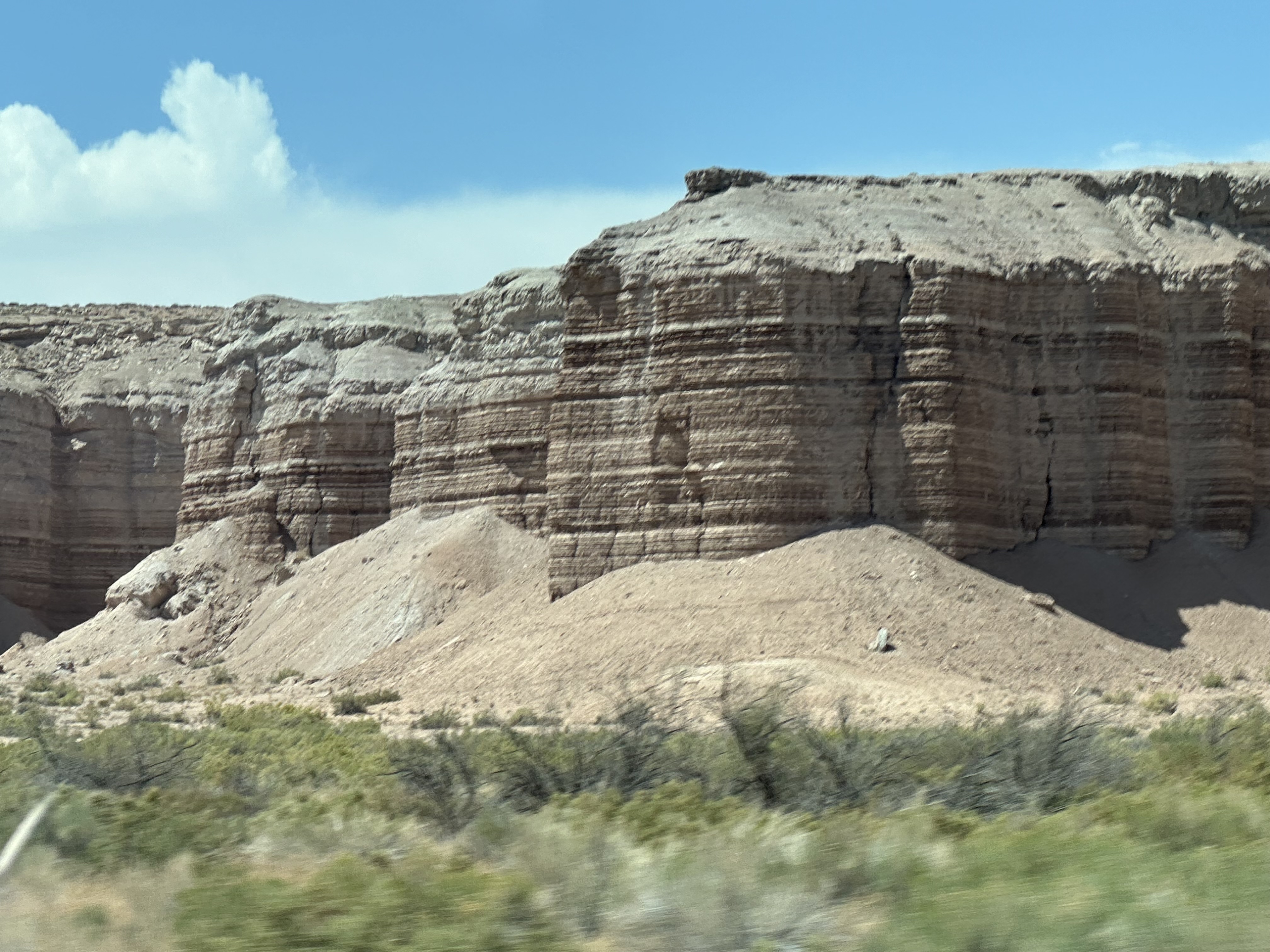
It’s difficult to make out, but the rounded formation in the center is actually 165 feet higher than the formation on the left! The “notch” in between is a fault line, one of thousands that crisscross this area like cracks in the mud of a dry lake bed.
In the distance, storm clouds appeared, but that didn’t slow us down!
No words can describe what we’ve seen. This isn’t Kansas, Toto!
Out of the Visitors Center, Scenic Drive heads south with more magnificent views.
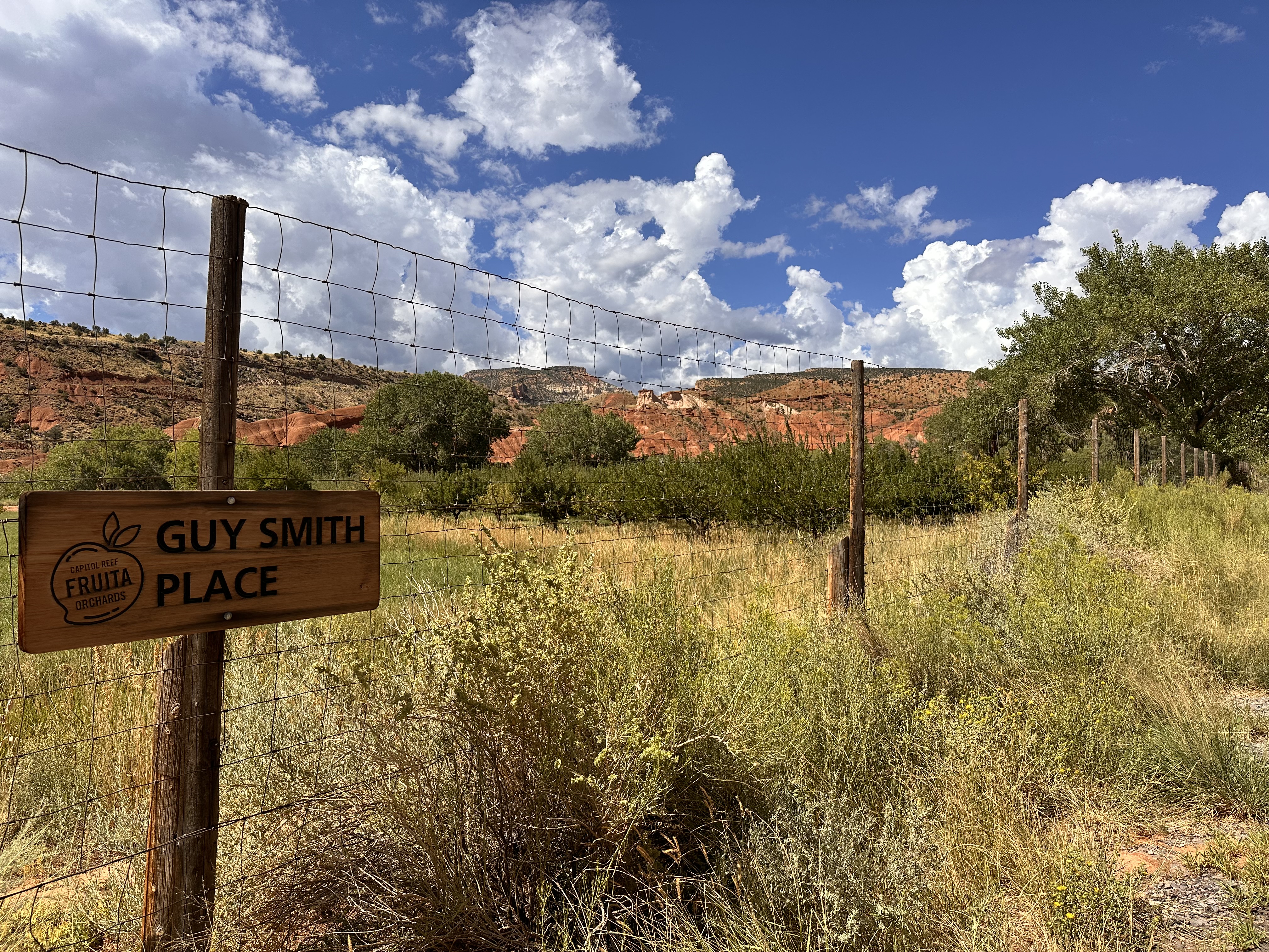
Near the VC, an apple orchard flourishes in the most unexpected place. This was the site of a small community back in the day that had very little contact with the outside world because of the difficult terrain. One of their projects was the apple orchard that still provides apples to visitors!
There is an NPS campground at the end of Scenic Drive, settled into another apple orchard. We drove slowly through and noticed this young fellow relaxing under a fruit tree!
The storm finally caught up with us, so we left the outdoors for a warm and dry place in the trailer!
Second day: we were advised at the Visitors Center of a couple of daytrips in the area, so we just had to go check them out. Our first choice was to venture south on the Notom road. There was at one time an actual town named Notom, and even today the small valley where it was located is a green oasis along the banks of Pleasant Creek. We noticed that this southbound road paralleled the Waterpocket Fold, where tectonic plates collide, resulting in the spectacular formations that we’ve been seeing. It’s called Waterpocket because water collects in depressions in the rock…pockets, and Fold because of the way tectonic plates are colliding. Hoping to get a different view of the Fold, we took off.
Passing the fruit orchards, we saw that in addition to apples, there were peaches, cherries and other tree crops.
A bit farther down the road, we stopped to look at some petroglyphs. Dating back almost a thousand years, the figures seem to represent hunting expeditions, maps of local areas, and…..aliens?
Leaving the glyphs, we continued to the Behunin cabin. Elijah Cutler Behunin and his wife Tabitha raised 13 children in this house!
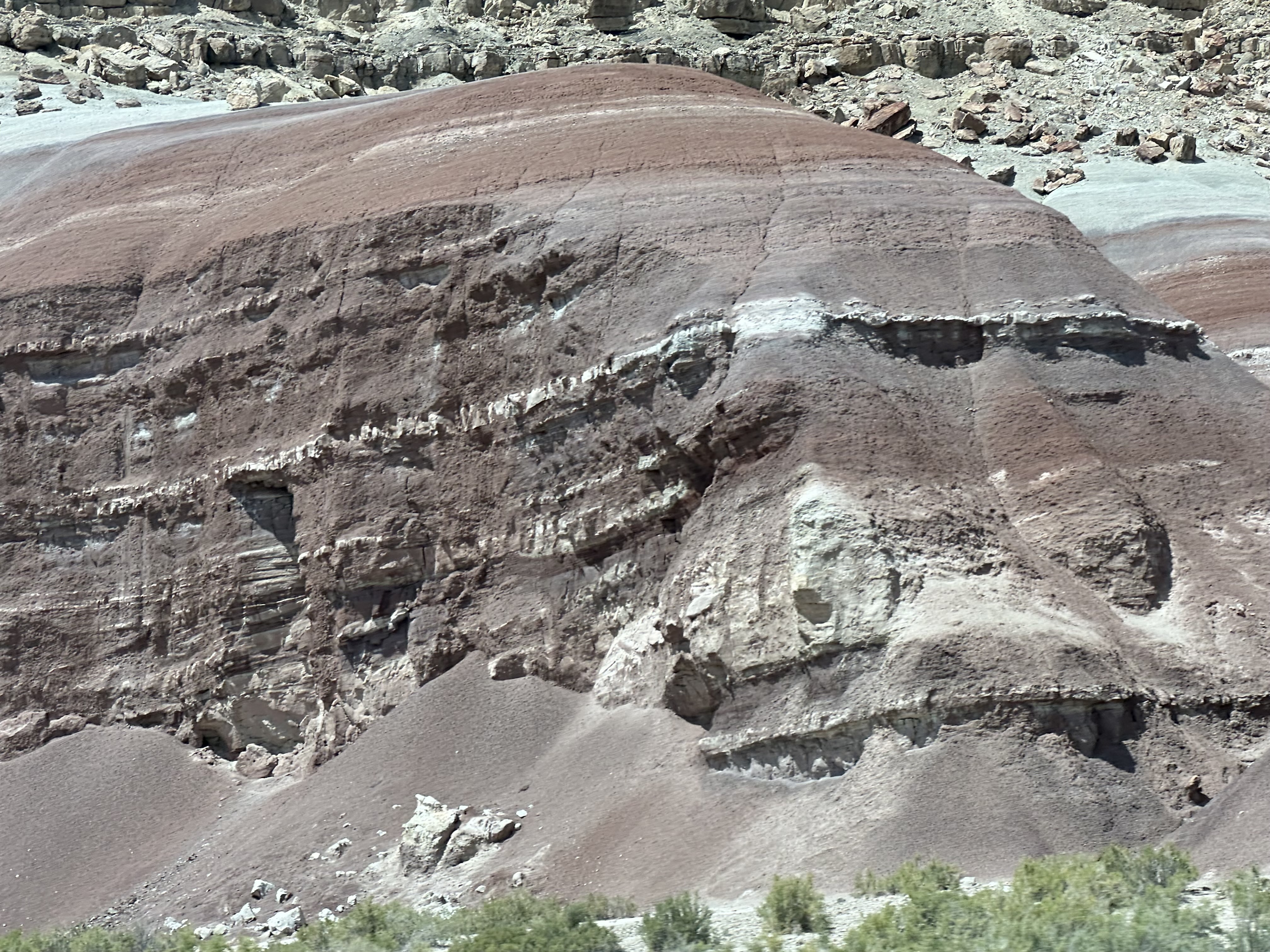
The rocks just keep on coming!
Moving south on Notom road, the terrain changed dramatically, and we found ourselves watching the storm clouds building over the Fold.
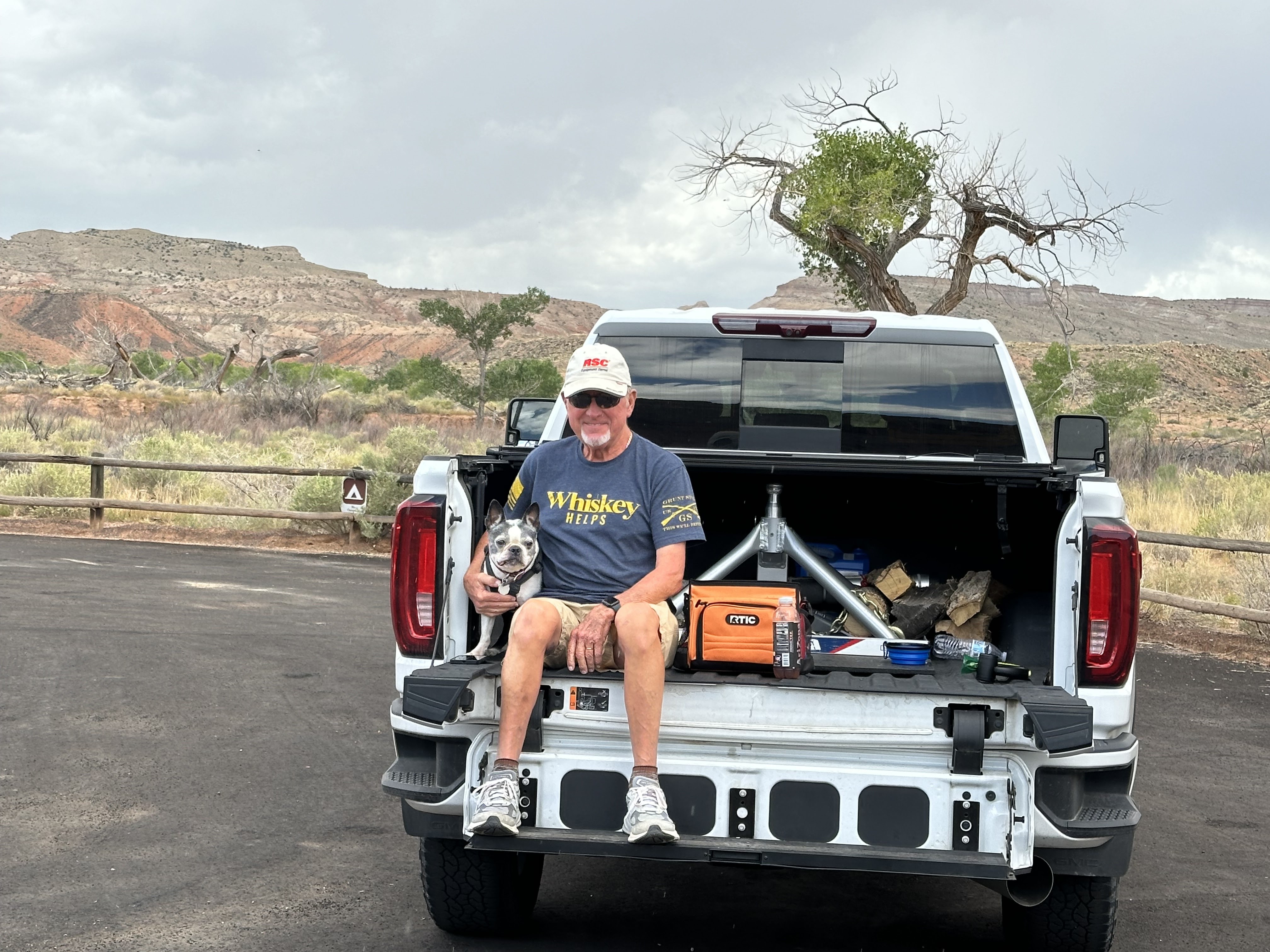
Just before returning to Torrey, we stopped for a picnic lunch and a photo op.
The storm blew through, with heavy rain and light hail, but the temp was comfortable, so we sat outside under the awning, enjoying the smell of a high desert storm.
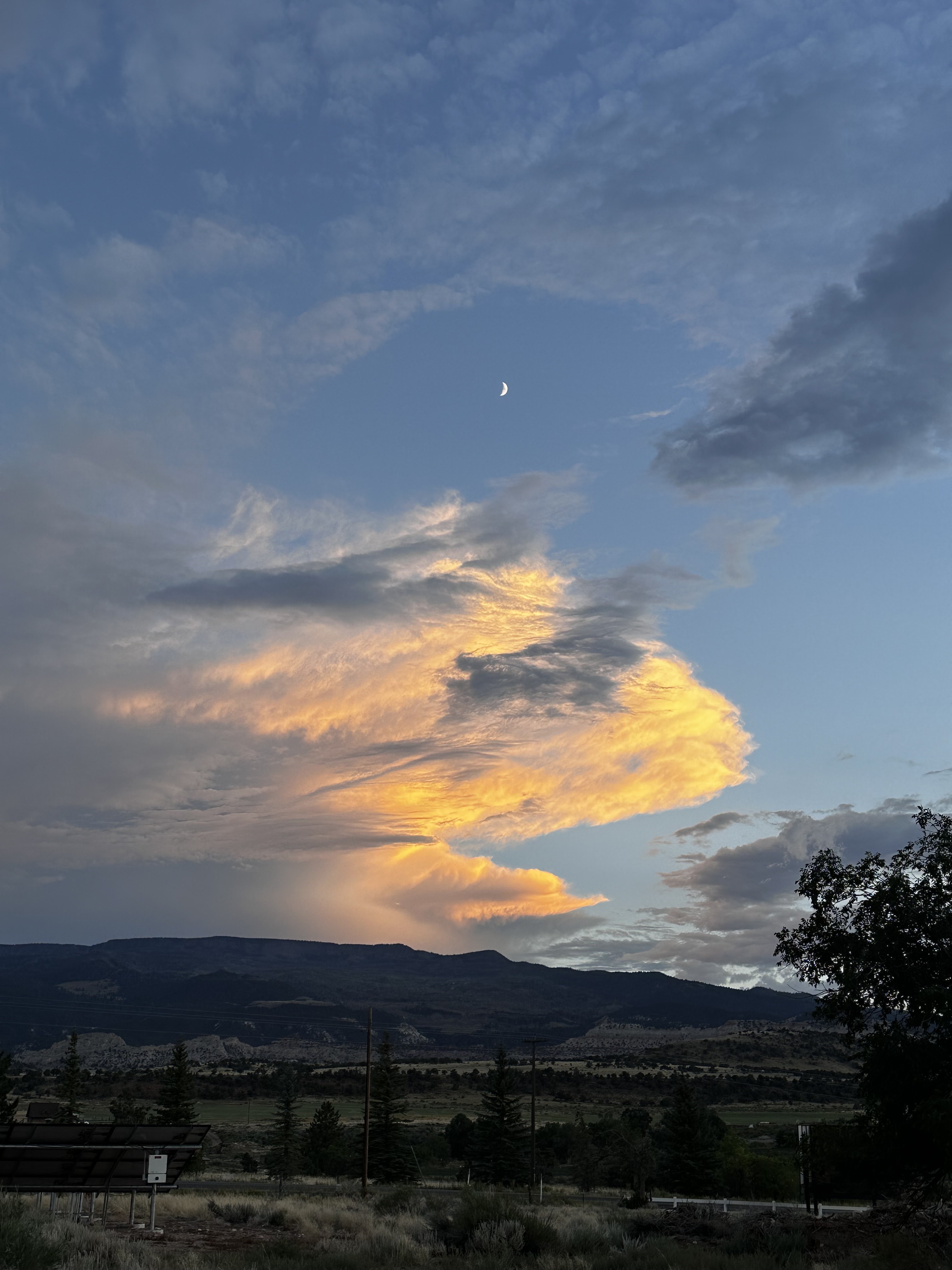
Of course, just about sunset, another thunderstorm rolled over us! This one was dramatic with pink lightning and rolling thunder. Sasha was not happy!
We have another daytrip on our list, so next day, after Notom Road, we ventured south again, only this time it was on Utah 12, which eventually ends up connecting to US89 near Bryce Canyon and just south of Panguitch, Utah, 116 miles away.
We elected not to travel that entire distance, instead stopping at Calf Creek Observation Point. Calf Creek is buried in a well worn canyon cut through sandstone.
As the road moved into the Dixie National Forest and the elevation rose, we found ourselves creeping through thick clouds, at times driving 15 miles per hour so as not to exceed our range of visibility!
The changeable weather was a concern, but we marched on.
Just south of Boulder, Utah, a wall jumped up with rock hard swirls and swooshes, a monument to the huge mud flows of millions of years ago.
 ‘
‘
The little town of Boulder was the last town in the continental United States to get mail delivered by mule! It is so isolated that it didn’t have electricity until 1947 and until 1985 was totally isolated when the dirt road to town was closed in the winter.
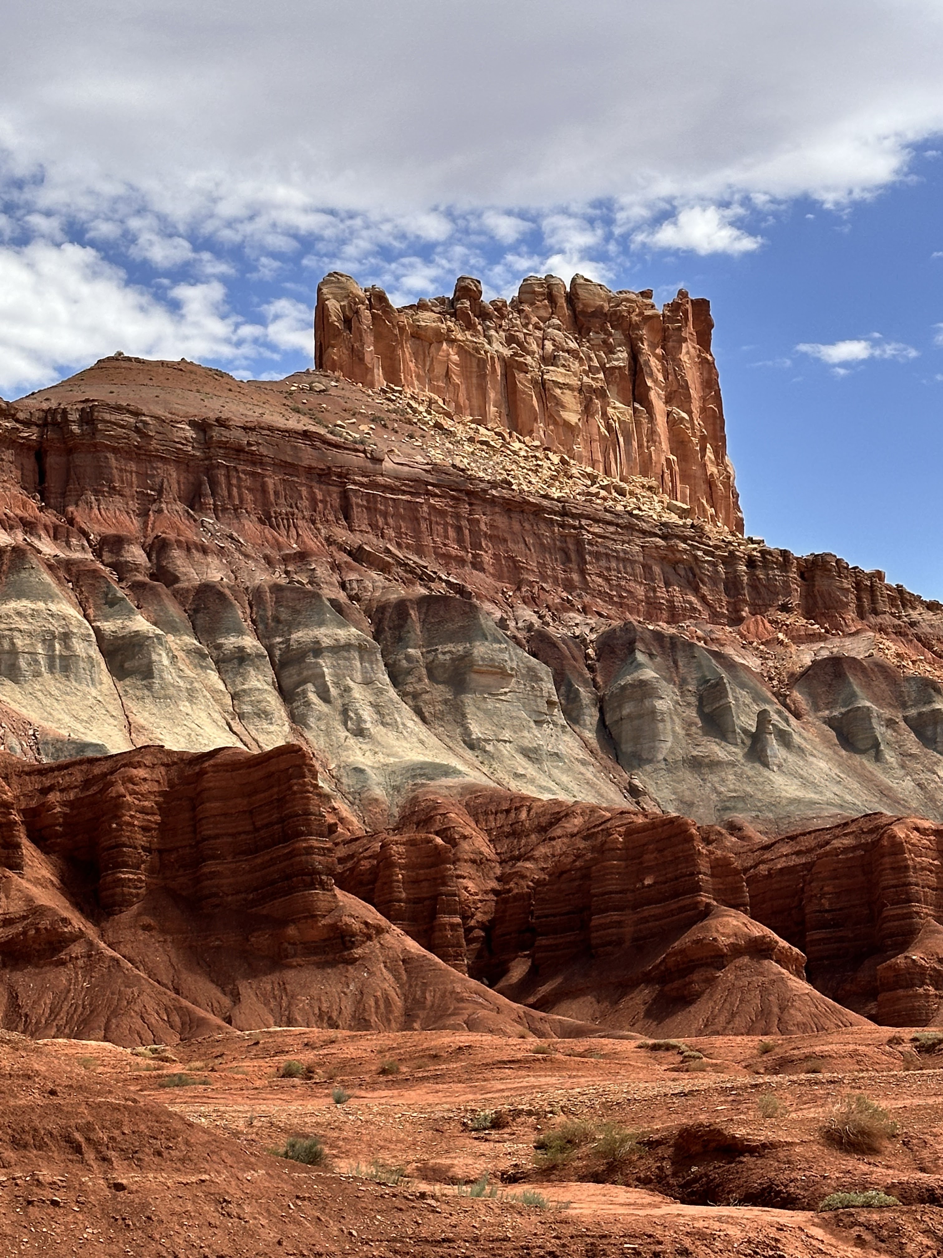
Turning back to Torrey, we caught a look at an interesting formation before we climbed into the mountains, hoping to beat the thunderstorms.
We didn’t escape the wind, rain, clouds or cold, but we did make it home safely. We have surely have had some storms while we’re in the Capitol Reef area. By the way, early travelers thought the fantastic rock formations looked much like state and federal Capitol buildings, and some with experience near oceans believed that the mountains looked like a barrier reef, because they were so difficult to cross. There you go: Capitol Reef!


 ‘
‘


No comments:
Post a Comment