Monday, August 31, 2015

Niagara Falls, Part USA

Heading north this morning, we stopped at the upper Niagara River Observation point provided by the New York Power Authority to get our first look at the Niagara River. The river is the source for a large portion of the power used in the east, and is loaded with hydro-electric plants along its length.

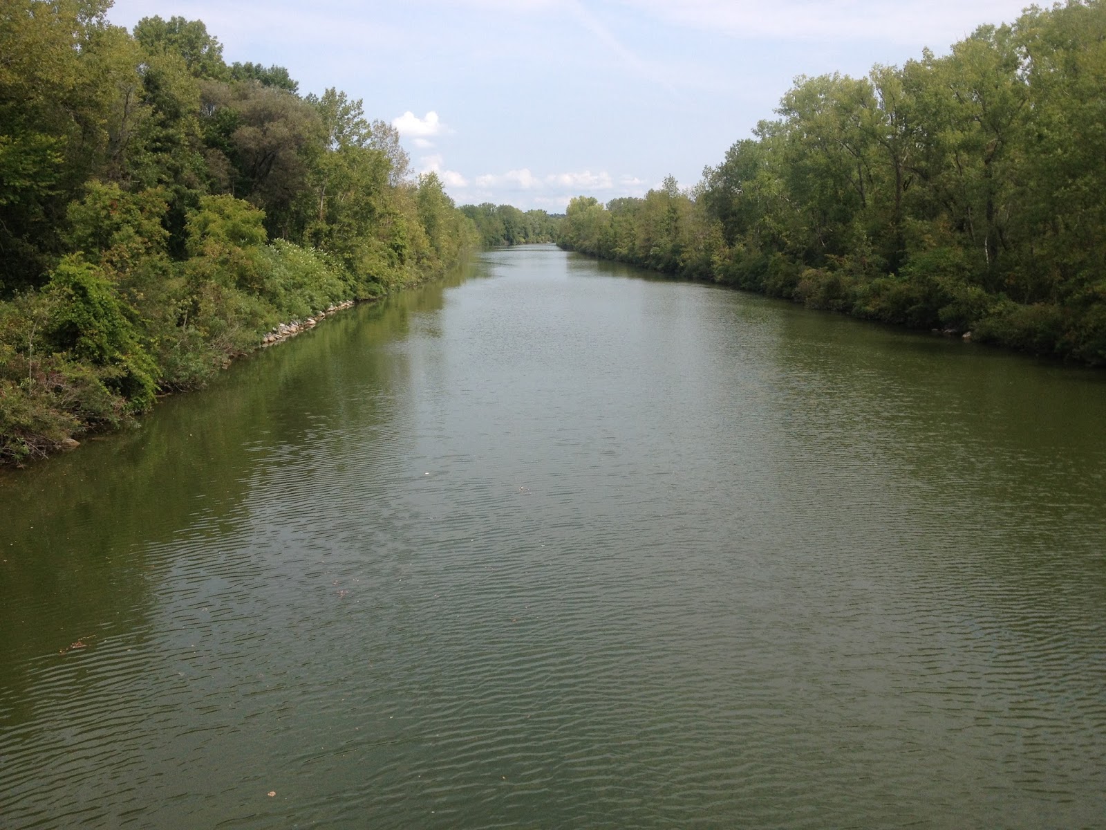
At this point the Niagara River is a wide, seemingly slow river, appearing to be much like the Mississippi or Missouri Rivers, but off in the distance we could see a hint of the reason we're in this part of town.


A few miles north on the Robert Moses Parkway and we arrived at the Niagara Falls State Park. The state of New York doesn't charge a fee for entrance to the park, believing it to be a national treasure as well as the second most visited site in the state after New York City, but parking is a bit pricey. We were lucky to find a spot on a side street and shot across the park to the American Falls.


It's impossible to conceive of the amount of water flowing over the falls, but a sign estimated that 75,000 gallons a second flow over the American Falls. Horseshoe Falls, on the Canadian side, are visible in the distance below several fancy hotels and observation towers.


The noise of all that water hitting the rocks below is deafening. Imagine a half dozen trains roaring by at high speed and you'll have some idea.


Just upstream from the Falls, an area of whitewater is known as Hell's Half Acre. Appropriately so, I think!


Seeing all this water, and noticing the tour boats cruising the river below the Falls, gave us an idea.


But first, a look at the two sets of waterfalls that we hoped to see from a different angle….


First step: buy tickets (surprisingly reasonable).


Second step: get fashionable blue poncho and ask people nearby to take "before" picture.


People nearby: He's from Cuba and she's from Venezuela. Currently living in New Jersey and struggling with English. Today is her 33rd birthday….Happy Birthday!


Step 3: Don blue poncho and try to look cool!


Here we go! Past the American Falls with a bit of mist….


American Falls with the Observation Tower behind and Rainbow Bridge farther back. Rainbow is the primary route into Canada from Niagara Falls and the Maid of the Mist boats are boarded at the base of the tower.


On to Horseshoe Falls. We begin to understand why we were given the ponchos.


The view leaving Horseshoe give you an understanding of the majesty of the Falls!


The American Falls. The narrow falls on the right is aptly named Bridal Veil Falls.


Horseshoe Falls.


Awesome!


Goat Island separates the American Falls and Horseshoe Falls and is accessible by pedestrian walkway. We strolled over and took a photo of the Falls from the south.


This is the branch of the Niagara River that feeds Bridal Veil Falls.


Those yellow slickers down there are people navigating the trail to the Cave of the Winds. And that's Bridal Veil Falls dumping a million gallons of water just a few feet from them!

Donna declined the invitation….


And this is what is pouring over the edge…


From the pedestrian walkway between Goat Island and Niagara Falls, NY, it's easy to see how the large, slow, wide Niagara River is pinched down just before it enters Hell's Half Acre and then over the edge.

This has been an incredible day of sightseeing! Off to Canada tomorrow if the Good Lord is willin' !

Sunday, August 30, 2015

Moving West

We enjoyed a dog show Saturday morning sponsored by the Ontario Shores Kennel Club. They are affiliated with the UKC, a parallel organization to AKC. I made the mistake of asking a participant if UKC meant "Unknown Kennel Club". Wrong. It means Unified Kennel Club, thank you very much.


And this young lady and her pup won Best of Show!
Congratulations!


After the Dog Show, we took our bikes north to the Erie Canal and rode another section of the Canalway Trail.


Sunday morning we left Cheerful Valley Campground, with it's huge lawns, Flint Creek for tubing and fishing, Dog Shows, and Saturday activities, and headed West on I 90, the Thomas Dewey Thruway. Yep, it's another toll road, but the choices were limited. The road was, for the most part, in good repair, and the traffic was light.

Our destination was Niagara Falls, New York, about 109 miles west and we arrived at about 3 in the afternoon. Our park of choice is Niagara Falls Campground and Lodging. They offer two rooms for rent and have 64 rv/tent sites, most of which have full 50 amp hookups. We are in site 37, a nice long and satellite friendly site that is, at most, 12 feet wide. Oops. The staff/owner is very nice and the location is good, so we'll make do with the narrow site for awhile. We noticed that the taste of the water in New York state was somewhat less than we generally hope for. There seems to be a lot of Sulphur and minerals in it, and so it tastes awful to us. The Cheerful Valley water supply is a well, so no treatment was evident. Our first clue was when the cream in the morning coffee curdled! The water here in Niagara Falls seems to be better, albeit very hard.

We're looking forward to being tourists for the next few days, and will report back about what we've seen!

Friday, August 28, 2015

More Fingers

Heading south from Cheerful Valley RV Park got us to Waterloo, New York, this morning. We were trying to get to the east side of Seneca Lake. We sorta got lost, and ended up driving south on US96 instead of US96A. The error had a good side, though, as we found the Muranda Cheese Company.


All of their cheeses are made in house from Holstein cows milked and tended daily onsite. All the cheeses are made from unpasturized milk, giving the cheese a bit harder texture than expected. The office has a great tasting bar set up, so we stopped in for a bit of information on cheese. Our tasting lesson led us to buy a small block of Red Buddy, a semi-hard cheese so named because it goes well with red wine. We may not make that pairing, but the snacking possibilities are endless! We also bought some of their signature smoked Gouda, Bel Ceillo, and Blue. Donna tells me two are for snacking, and two are for cooking….I'm glad she knows which is which!

We finally found US96A, which is closer to Seneca Lake, and therefor prettier, so we headed south again. Just south of Lodi, we stopped to take a photo of Seneca Lake.


Known primarily for its farmland with corn and soybeans, this area east of Seneca Lake is fast becoming a premier grape growing area. These pictures, taken from the balcony of the Lamoureux Landing Winery, show just how beautiful the countryside is.


We were starting to run out of time, having gotten a late start this morning, so we decided to turn east toward Cayuga Lake. The map showed that County Road 143 was the one we wanted….
Glad to have a Jeep!


Finally finding the lake, we turned north toward Seneca Falls, where a state park provided access to the water.


Cayuga and Seneca are the largest of the Finger Lakes, being 400 and 632 feet deep respectively. They are roughly 37 miles long, and cover an area about 100 miles across in a region where farm stands still work on the honor system and the sleepy Main streets of 19th century towns like Geneva, Skanateles, and Hammondsport invite a stroll and some antique hunting.

We'll be leaving the Finger Lakes region for awhile, but hope to return to the southern part of the lakes in a few weeks. Note to self: the weather is changing as we speak. The nights are cool and damp, and the trees are beginning to look a bit stressed. Winter is on the way, so find the Big Boy Pants and the sweatshirts soon!


Thursday, August 27, 2015

Lake Canandaigua and Seneca Lake

We wanted to explore the Finger Lakes area of New York state further, so we left the motorhome this morning and drove west to start our circle loop through the western Finger Lakes. These lakes are slender, north/south stretches of water, created by ancient glaciers. The name derives from their resemblance to fingers, and they do in fact resemble the scratches made by fingers on the land. There are eleven lakes, however, so unless God had eleven fingers…..

Our first stop was in the village of Clifton Springs, which has a minimal Law Enforcement Department.


But the town boasts a number of houses that make our mouths drop open. What a house! We've seen so many wonderful old houses in the east this year that we're almost on overload.


Two large brick buildings caught our eye as we cruised through Clifton Springs. This turreted structure,


and, across the street, another brick block of a building.


So, here's the story: Dr. Henry Foster arrived in Clifton Springs in 1850 with the intent to establish a "sanitarium" which used the local spring water in spa treatments. At the time, mineral water baths were all the rage, with well-to-do clients spending huge amounts of money for the social and health benefits of the water. Clifton Springs is blessed with a stream that contains a fairly large amount of Sulphur, so it was a logical choice for the spa.

Dr. Foster had a slightly different take on the water treatment thing, believing that the well-being of the body depends not only on exterior application of beneficial treatments, but also should include proper nutrition, physical exercise, and most important of all, spiritual peace. The first building in the pics above is the original hospital built by Dr. Foster. The interior was done in marble for ease of cleaning, and in the heart of the building, a chapel was built that includes a Tiffany Glass reproduction of Da Vinci's Last Supper from the Sistine Chapel. As the clientele grew, the second building was built across the street to house nursing services, maternity rooms, and what we would now call "out patient" services. Occupational Therapy services were also housed here, a concept that first developed here in Dr. Foster's Hospital. This building is now a low-income apartment building.

Dr. Foster's house is adjacent to the Hospital, which is no longer in use as a hospital, having been converted to an assisted living facility. In the 1970's, a new hospital was built immediately behind the original hospital, and the brick structure was slated for demolition. After several days of wrecking ball action, the building remained intact, so plan B was implemented: Save it and repurpose it! The Chapel remains intact and is available for use, but construction activity today put it off limits for us.

Dr. Foster's house:


Trivia: In 1882, George Washington Lisk arrives in Clifton Springs at the age of 21 to work in his uncles' hardware store. In his spare time, he made custom tinware items 1 piece at a time in a shop behind the hardware store. By 1886, G.W. Lisk had established an enterprise to produce chamber and commode pails, and in 1888 Lisk Mfg. Co. is organized in Clifton Springs with patents for anti-rust pail bottoms. Through the years, until the 1940's the business continued to enjoy modest success, with a low point during the depression when it only made $934 for the year. After WW II, new technology convinced the third generation of the Lisk family to expand into specialty manufacturing, and today G.W. Lisk Company, Inc. is the largest manufacturer of high tech solenoids for space, aviation, Navy, ground, and automotive use. So there you have it….chamber pots to aerospace in 130 years!

Next in our day trip was the village of Canandaigua. Famous for the Sonnenberg Gardens and Mansion State Historic Park, Canandaigua is located at the north end of Canandaigua Lake. We were able to get a long distance photo of the mansion, but didn't tour the gardens because they are being prepared for winter by covering with large greenhouse structures.


South on NY 21 brought us to South Briston and Woodville. We were looking for a particular viewpoint for the lake, but were unable to find it, so we stopped for lunch instead at the Sawmill Restaurant. Located on the shores of the lake, the restaurant provides a great patio area overlooking the water.


After a couple of Cuban Sandwiches (sliced roast pork, sliced turkey, cheese, tomatoes and dill pickles), and some directions, we took off for the viewpoint.


From our vantage point high above the lake, we were able to see the entire length of Lake Canandaigua. What a sight!


Leaving the town of Naples, New York, at the southern end of Canandaigua Lake, we headed northeast across rolling farmland. Miles and miles of corn and soybeans dotted with quaint Amish houses and huge factory farms. Reminds me of Iowa!


After passing by the north end of Lake Keuka, we drove through the towns of Penn Yan and Dresden, and found NY 14 North along Seneca Lake. In Geneva, at the north end of the lake, a park provided a super view of the lake.


Downtown Geneva is a collection of turn of the city buildings. Fascinating!