Tuesday, June 30, 2020

Caldwell, Idaho to Twin Falls, Idaho 160 miles

Monday, the 29th, found us on Interstate 84, heading east in a driving rain storm. So much for spending all day Sunday washing the motorhome and car! There was so much grit and grime on the car after our arrival in Twin Falls that I couldn't roll down the windows for fear of scratching. Fortunately, we found highly rated Tony's 2T car wash and auto repair. For $9 they did a prewash routine, ran us through a drive through wash machine, and did a hand dry. Nice job!

We are staying two nights in Twin Falls, at the 93 RV Park, so named because it's about 8 miles south of town on US Highway 93. We passed by here last year on the way to California and thought we should stop sometime and find the Twin Falls. Site 41 is a bit out of level, but perfectly adequate for a short stay.


We arrived early in the afternoon, so decided to go visit the Falls about 4 pm. The skies were still very stormy, and it was sprinkling rain, but the Falls were spectacular!

Named Shoshone Falls and lying in a state park northeast of town, the falls were a major impediment to river travel back in the day. Today the area nickname is "The Niagara of the West".


Downstream from the falls, the Snake River moves placidly through a steep canyon.


Thousands of swallows make their nests in the craggy sides of the canyon, and flew about as if they were on a mission. Or, they were just happy to be alive! Several are just visible in the foreground:


So, Tuesday morning we ran into town to do a bit of shopping. Donna is preparing dinner for friends from Texas that are spending the evening at the same park. Just a bit of socializing!

Storm clouds have kept us inside most of the day.


Tomorrow it's off again!

Sunday, June 28, 2020

Last Day in Boise, Idaho

The weather changed drastically today. From the 80's and 90's of the last few days, we woke to temps in the 60's and grey skies. It was raining to the south, courtesy of a system rotating over Oregon. The prediction is: Rain.

Our plan for today was to drive some 70-odd miles south to visit the Queen of Idaho's ghost towns, Silver City. This once prosperous mining town still has a functioning hotel and restaurant/bar, so thousands of off-road enthusiasts, motorcyclists, and tourists of all sort flock there on a nice summer day for lunch. Donna packed us a lunch in anticipation, but then the rain arrived. Not to be dissuaded, we set off anyway, toward Jordan Valley, the jumping off place for miles of dirt road leading to the town. Jordan Valley was named for Michael M. Jordan, a prospector from the 19th century. The population of this farming community is roughly 150 hardy souls.

Jordan Valley is in Oregon, just across the Idaho line, and after driving some 64 miles to get there, we discovered that an inch of rain had made the 13 mile dirt road into Silver City impassible for our little suv. Well, it was a nice trip anyway. Should have bought the Can Am....

Another weather cell was approaching, so we left town in a hurry...


While north, toward our "home", things were a little bit better.


Just staying ahead of the weather cell, we slipped into Caldwell. A quick walk with Sasha, and a return to the motorhome just in time.


Somewhat annoying, this day, but seeing some new country was interesting. We'll be packing up tomorrow morning, heading east to see more new stuff!

Saturday, June 27, 2020

Burns, OR to Caldwell, ID 162 Miles

We left Burns after only one night, reluctantly, but we had to continue our interesting easterly voyage on the Central Oregon Highway. US Highway 20 continues through Buchanan, Juntura, and Vale before eventually connecting to Interstate 84 near Ontario, Oregon. From there the journey was a short jaunt southeast to Caldwell, ID, and the Ambassador RV Resort.


The park is a great place to spend a few days sightseeing the Boise, Nampa, and Meridian areas. The roads are paved, each site has a bit of grass, and there is a nice concrete patio to sit on and enjoy the 85 - 90 degrees temps!


There is a long dog trail around the perimeter of the park, and as we strolled along the construction taking place on the west side of the park we couldn't help but see a beautiful Idaho sunset, even if it was taking place at 9:30 at night!


Our next day, Friday, we went into downtown Boise. Along the banks of the Boise River there is an extensive park complex, and just a few blocks north lies the State Capitol building. As you know by now, our wish is to visit all the state capitols possible. Under the circumstances of Social Distancing, we elected to shorten our visit to this capitol. From the outside, the circa 1905 building clearly shows how office wings were added to the original structure in 1921.


We entered through the guest entrance and made our way to the rotunda, where a huge United States flag is suspended in the center.


The rotunda is actually two domes in one. The inner is made of wood, and the outer is constructed of steel and concrete. Sixty foot high steel columns support the domes. Those columns are hidden behind faux marble columns built of wood and covered in Scagliola - a mixture of gypsum, glue, marble dust, and granite dyed to look like marble. The technique originated in Italy in the 1500's as an alternative to heavy marble.


We exited the building when tour groups began to arrive, and contented ourselves with a walk around the capitol complex, enjoying the native landscaping as we went.


The Oregon Trail passed through here, so in 1906, local schoolchildren erected this monument to honor those pioneers.


Boise and it's suburbs are known for farmers markets, particularly on Saturdays in the summer, so we devoted Saturday to visiting a couple and picking up some tasty treats. I won't bore you with photos....I don't want to make you hungry...just imagine Rum Cake, Rainier Cherries and Cake Pops...

Stops at Costco, grocery stores, and gas stations completed our day. One more day in this area before we leave for parts east. We'll struggle to find something to do..

Wednesday, June 24, 2020

Crescent, OR to Burns, OR 176 Miles

Our second day in the Crater Lake area took us north of the little burg of Crescent, Oregon to the Newberry National Volcanic Monument.


This area contains many examples of the cataclysmic volcanic activity that occurred here. Our specific objective was labeled The Big Obsidian Flow. At 1300 years old, the flow is the youngest in Oregon, and originated in what is todays Paulina Peak. After driving north on US highway 97, through La Pine, and turning east, we came to the monument entrance, and then the trailhead leading to the lava flow, where we found that the trail was not dog friendly due to having been constructed from sharp, glass-like pieces of obsidian shards. In fact, signs warned against hiking without heavy hiking boots. Since the temp was in the mid nineties and we had our faithful canine companion with us, we had to pass. Doggoneit!

So, after a picnic lunch along the Deschutes River, we cruised back into La Pine and stopped at the drive up window of Central Perk for a Mango smoothie to sip on during the trip back to Crescent.

Today, Wednesday, June 24th, we left for points east. Following US 97 north toward Bend, Oregon, we were instructed by our GPS (Samantha) to turn off onto Knox Road, then onto Rickard Road so as to bypass downtown Bend and access US 20 east.

After 14 miles, this was what had become of the road:


Eventually we reached US 20, The Central Oregon Highway.


There was little to do along this stretch of road. One hundred fourty miles of high desert. Needing a bit of lunch, we resorted to entering one of the two rest stops along this road via the exit just for a little excitement! And, of course, we exited via the entrance. WooHoo!

The town of Burns, Oregon, eventually appeared, along with the Burns RV Park. This is one of the absolute nicest rv parks we’ve ever stayed in! Wide spaces, well groomed grass, and a huge grass area for Sasha to play ball. Outstanding! I just wish it wasn’t in the middle of nowhere!


We pulled in at about 2 pm, in plenty of time to do some laundry and play with the dog. While the weather was cloudy, it was warm. A perfect end to the day!


Monday, June 22, 2020

Home to Crater Lake, OR 301 Miles. Back on the Road!

After some serious soul searching, we decided that we could do a modified "shelter in place" trip this summer, so with regrets to our family and friends, we left Central California on Saturday, June 20, 2020, the day before Father's Day.

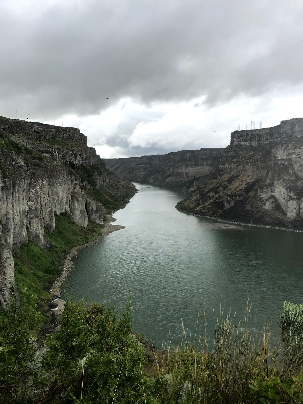
Our trip this summer will be a short one, just a loop through the western US. Our first stop was at the Yreka RV Park in Yreka, California. Site C2 suited us fine for one night, even though it was a bit out of level. Nessies leveling system took it in stride and we settled in after a 300 mile drive north on I-5, the major highway north and south from the Canadian border to Mexico, and right through the heart of California. The highway is in good shape, and easy to navigate (just hook a bungee cord to the steering wheel and go take a nap). Not a lot to see, but as we crossed Lake Shasta, we couldn't help taking a photo of boaters on one of the huge arms of the lake on a fine, warm, summer day.


Site C2:


In order to get to US 97, we had to backtrack a bit on Sunday, but the sight of Mount Shasta made it all worth while!


Taking the 99/97 cutoff out of Granada, we found ourselves getting a close look at Mount Shasta.


A quick 174 miles later, we arrived at Big Pines RV Park in Crescent, Oregon, and were escorted to site 29, one of the easiest to get into rv sites we've ever been assigned; we drove a hundred yards down a road from the office and straight into the site!


We celebrated Fathers Day via phone, text, and FaceTime, and I enjoyed some extraordinary chocolate chip shortbread cookies from my daughter? It was a nice afternoon!

On Monday, we packed a lunch and headed south toward Crater Lake, Oregon. On the way, we stopped at the Collier Memorial State Park Logging Museum. The self guided tour takes a visitor from days of horse drawn high wheel carts and Misery Whip two man saws all the way to the production days of the mid-twentieth century. 


As time and technology progressed, steam power was used wherever possible. This contraption was used to load logs onto rail cars, and was made by the Clyde Iron Works in Duluth, MN.


A number of old trucks, tractors and wagons were on display, from this solid wood wheel (yes, those are cut from trees!),


To this GMC 950, proudly labeled a "Diesel"


And this old Mack.


Continuing our day trip, we headed toward Crater Lake. Our first view was of the former Mount Mazama from 30-odd miles away. The collapsed cone is clearly visible as a bowl shape with a distant snow covered peak beyond. At this point we were at about the same elevation as the bottom of Crater Lake.


The water in the lake comes from snow. There is no other inflow, and there is no outflow. After the collapse of the cone, magma continued to rise, effectively sealing the bottom of the crater. Wizard Island, on the left in this photo, is a small cone that rose after the collapse from the floor of the crater.


The color of the water remains a deep blue. No boating or fishing is allowed.


Had to get at least one shot of Mama and the Lake!


As we began to wander away from Crater Lake, we noticed mountain ranges in the west that put us in mind of the Blue Ridge Mountains!


A momento:


So we sadly left this amazing natural wonder! It has been near fifty years since we last wondered at this lake, and it continues to amaze us!

So, after a one hundred and seventy six mile loop, we returned home to a warm evening and a cool drink! Hot sausages from the grill and corn on the cob put us into bed for a great nights sleep!