Wednesday, June 30, 2021

Food Trucks, Coffee Kiosks, and Homeless Camps

Salem is not the same city that we remember from our last visit here, when we would ride our bicycles downtown, and rarely worry about locking them up. 

We stopped for gas at the station near a major grocery chain this morning. Lots of people and cars, and, in Oregon, lots of attendants that are required to pump your fuel for you. The regulations regarding that were temporarily suspended due to the heat a few days ago and the evening news had a story about locals not being able to figure out how to pump gas, resulting in huge lines at gas stations. As we fueled the car, a recorded message played over and over on the PA system, warning us not to leave valuables unattended, leave the car, and to watch for suspicious activity. Mobile solar surveillance stations were placed around the parking lot. What...??!!!

We decided to go out for breakfast at Patty's Off Center in downtown. We soon noticed that there literally is a food truck on every bare lot! Take your choice: mexican, vegan, or "Oregon Burrito". We also noticed a huge number of coffee kiosks, trailers, or, call them what your will, small semi-portable buildings serving coffee drinks. 

Our goal was a great little breakfast shop off of Center Street (get it?). Tucked into a small strip mall, Patty's is a local go-to we hear, so we decided to try it out. It's an eclectic shop, with a huge rooster on the roof to identify it, and dozens of poultry related signs hanging inside.


Breakfast was very good. Donna ordered extra crispy hash, and it came just as she had hoped!


My order of Uncle Mike's Redneck Benedict was a taste treat! An herb biscuit (sage and marjoram), two sausage patties, two eggs, smothered in sausage gravy and garnished with scallions....my cardiologists' number is......


As we drove around town, we couldn't help but notice that under every highway overpass, in every public park, and on the narrow grass strip in the parking lot at Pet Smart, a tent city has sprung up. Now, I know I'm old fashioned, but there's something inherently wrong with a situation where the "unhoused" squat on public or semi-public land, pay no fees, pickup no trash, and have enough money to smoke marijuana and eat McDonalds sandwiches. Trust me....eyes on. I can't help but wonder where this problem originated, and why is it such a huge issue in metropolitan areas? 

Ok, enough with that. I can't fix the problem, so I'll ignore it like so many others do.

On a lighter note, the weather has turned cloudy, with cool temps in the 70's and 80's! Wonderful!


Monday, June 28, 2021

Frying Pan, Part Trois

 It was a short travel day today, only 90 miles to Salem, Oregon, but it required more than 4 hours to travel. Just five miles west of Cascade Locks, we saw scattered debris of a small rv along the road. We had heard that Interstate 84 was closed for several hours Sunday afternoon, so this must have been the site of the accident. Unfortunately, we weren’t quick enough with the camera to get a pic. 

As we approached Interstate 205, east of Portland, we got caught in a huge traffic jam.


The photo doesn’t look like much because we, along with half the rest of Oregon, were concentrating on the center lane.  The highway split into north and south branches, and no one knew which lane to take. As it turned out, we could have saved a bunch of time hopping into the open left lane. Oh, well.

Turning south on I 205 gave us a glimpse of stopped northbound traffic.

A quick stop for fuel, and we slid into Hee Hee Ilahee RV Resort, site 46. We’ve stayed here several times in the past when the park was new. Now the trees are near mature, the concrete sites are beginning to deteriorate, and the price has doubled. It’s still nice, but is showing a need for some maintenance.


When we arrived, the temperature was 117 degrees, F. Another new record. Thats three record setting days in a row! Fortunately for everyone in the northwest, a cold front blew in in the early evening and as I write this at 9:00 pm, the temp is 79 degrees! Wow!

 Lets hope for a cool one tomorrow!


Sunday, June 27, 2021

Frying Pan, Part Deux

 After a record temperature setting day yesterday, the band played the same song again today, only with more vigor! We took off at about 10 this morning for a day trip to the Washington side of the Columbia River Gorge, and by 2:15, the temp was toasty.

The evening news out of Portland, Oregon, tells of even hotter temps tomorrow. Yesterday set all-time heat records. Today was even hotter, and the forecast is for even warmer temps tomorrow! I'm glad we'll be going to Salem, Oregon, because it's only going to be 113 tomorrow!

We left Cascade Locks and traveled over the Bridge of the Gods to the north side of the Columbia River. So named because legend has it that a stone bridge crossed the river millennia ago, but collapsed, forming rapids in the river. Evidently indigenous peoples named that stone arch Bridge of the Gods, so....


The bridge is problematic for larger vehicles, both for weight and size. We paid the $2 toll and slid across in the car. From the viewpoint on the Washington side, we got a great view of Cascade Locks and the Columbia River.


As we drove east on Highway 14, the terrain changed dramatically. Soon we were in layers of molten rock that poured from cracks in the earth about 15 million years ago, coating 65,000 square miles two miles thick! As the Ice Age ended, huge amounts of water poured through the Gorge, scouring the rock and leaving giant gravel bars.


We turned north on US 97 toward the town of Goldendale, passing huge wind farms.


Goldendale lies in the Klickitat Valley, which advertises itself as the home of famous Goldendale Hay, with 35,000 acres of Alfalfa and 25,000 acres of wheat. A scenic turnout pointed out the extraordinary dormant volcanoes in this part of the world.


Mt. Ranier is readily seen in the distance.


But Mt Hood is a bit harder to see, just below the corner of the sign.


From Goldendale, we took WA 142 back to the west, passing abandoned farms along the way.


We stopped in the town of Klickitat for a picnic lunch. We sat in the car with the engine running and the ac going and in the shade of a tree in a city park!


Highway 142 follows the Klickitat River, which appears to be one of the muddiest rivers in the west!


Despite the thick water, dozens of people were cooling off with a raft, tube, paddle board, blow up mattress kinda trip!


We became a little concerned when we saw an empty kayak drifting down river....


But we quickly saw the passenger. He/She is the green hat bobbing in the center of the photo with the paddle in hand!


Returning to US 14, we were amazed at the confluence of the Klickitat and the Columbia! The muddy stuff is on the near side, but the Columbia soon assimilates the dirt, and it disappears.


The evening news has said that at about 9,000 feet on Mt Hood, the temperature was 96 degrees today. It's HOT!


Saturday, June 26, 2021

From The Frying Pan.....

Most, if not all, of the West and Southwest is ratcheting up for a heat wave. Temps in record territory are going to be common. In an effort to escape the heat in Walla Walla, Washington, which is in the southeast corner of the state, inland, and surrounded by wheat fields, we drifted west into the Columbia River Gorge. When we left WW at about 10 am, it was 85+ and rising rapidly. 200 miles west, when we arrived at the Cascade Locks/Portland East KOA, the temp in the shade was 107. It was 2:30 in the afternoon, and still getting hotter.

US Highway 12 west out of Walla Walla sent us to US730 south along the Columbia River.


The river is so overwhelmingly huge that it looks like a small ocean.


As we left the Palouse hills of Walla Walla, it became obvious that the Columbia had been doing it's erosion job for thousands of years. The formations were awesome.

Interstate 84 was picked up south of Umatilla, and became our latest favorite road after the nightmare the other day driving into Walla Walla! Near Arlington, Oregon, we started down a long grade toward the Columbia. 


The views in the Columbia River Gorge Recreation Area are beautiful.


The rv park is located in the hamlet of Cascade Locks, Oregon, on the south side of the river. Named for a series of locks built in 1896 to aid in navigation. The locks were submerged in 1938 by the construction of Bonneville Lock and Dam, and the creation of Lake Bonneville. Highlights of recent activity in Cascade Locks include: an attempt by the Confederated Tribes of Warm Springs to build a casino in town (on hold), an arrangement whereby the city would sell water for Nestle for bottling (rejected by voters), and a proposal to add pedestrian lanes to the Bridge of the Gods nearby for hikers on the Pacific Crest Trail. This is a.....nice.....community. The remains of the locks and surrounding area has been converted to the Cascade Locks Marine Park, with fishing piers and picnic areas.


Near the marina, a bronze commemorates Sacagawea and Lewis and Clark's Newfoundland dog, Seaman.


Lewis and Clark passed through the Gorge in 1805, with the much needed help of Sacagawea and her French Canadian husband Charbonneau, with whom she had a child, Jean-Baptiste, who is riding on the back of the young woman.


Driving west we arrived at the Columbia River Gorge Waterfalls Road, which is historic US 30, the original road through the Gorge. The first waterfall we came to was Horsetail Falls.


Many people were enjoying the cool water at the base of the falls.


Wahkeena Falls is a delicate brook burbling down the mountain. Quiet and peaceful.


We wanted to stop at the most spectacular of the Columbia River Falls, Multnomah Falls, but the parking lot was jammed, the number of visitors was immense, and it was 108 degrees. Nope, not this time. The ribbon falls is spectacular, however, falling 620 feet in two tiers. It's said that over 2 million people a year visit the falls, and I believe most of them were here this afternoon!

Back at camp, Site 86 held our attention for about 45 minutes, long enough to down a couple of glasses of iced tea, then we retreated indoors. Even though the park is shaded by mature Douglas Fir trees, it was still hot! This park was a last minute decision when we heard about the heat wave. The original plan was to dry camp along the bank of the Columbia at BLM's John Day Dam. Very little in the way of shade trees and no electricity quickly put an end to that plan! A couple of frantic phone calls found this site at the last minute. The sign at the entrance said "Full", but there are a handful of sites still available at sunset, so I suspect some people changed plans.


Because of the trees and the narrow roads in the KOA, we had to do some fancy footwork getting into the site. Three left turns around rv's placed too close to the road, pickups and campers poking out into the street, and small children riding training wheel bicycles in unexpected directions caused Donna to describe the event as "the closest we've ever been to hitting something". Now to worry about how to get outta here!


Friday, June 25, 2021

Walla Walla. Want to Buy A Case?

 We wanted our day in Walla Walla to be extra special, so we got in the car mid-morning and set off to see what we could see. Our first stop was the site of the town of Frenchtown.


Frenchtown was a mixed-marriage, multi-lingual community of French Canadian trappers, traders, and indigenous women who settled here in the 1820's. Frenchtown was never an official town, but rather a collection of log cabins scattered along the Walla Walla river, interspersed with Cayuse Indian camps. There were at one time some 50 cabins in the community. All that is left is a memorial marking the site and listing the known names of residents who were buried in the nearby cemetery.

Although many French Canadien trappers had moved into the area, they didn't initially bring with them the concept of land ownership, but simply adopted the Indigenous method of recognizing common land use as required by the community. As the Anglo population increased, the concept of "long lot" ownership was put into place, where each farmer claimed a long, thin strip of land abutting a river, thereby maximizing the number of farms with access to the river, which was the principal "road".

This idea of land ownership conflicted with the Indians way of life and led to innumerable conflicts. In 1836, Marcus and Narcissa Whitman arrived to bring Christian beliefs to the tribes. Failing at this, Marcus shifted to ministering to new immigrants, leading to an influx of diseases, mainly measles, that killed a vast majority of the local Cayuse tribes. Indian culture indicated that if a sick person in the care of another person died, the caretaker would be killed in retribution. With this in mind, and armed with a knowledge of loss of land, a group of suspicious Cayuse killed Marcus and Narcissa Whitman and eleven others on November 29, 1847.


In 1855, the longest Indian battle in the history of Washington Territory was fought just west of the town of Walla Walla from the 7th to the 10th of December. During the four-day standoff, Chief Peo Peo Mox Mox of the Walla Walla tribe agreed to become a hostage to prevent an immediate attack on his village. His trust was betrayed by the US Army, and Peo Peo Mox Mox and eleven other hostages were killed, mutilated and dismembered. Eventually, the indians retreated, the conflict eased, and treaties were signed (and then broken).

The overlook near the Battle of Walla Walla is a place of contemplation and regret, marked by well tended flowers.


The Walla Walla river traces a route of the Oregon Trail.


Back in town, a leisurely drive through older residential areas let us look at many older, well kept homes. This one on the corner of Rose and Tukanon Streets is an unusual example.


Co-incidently, the house is only a few blocks east of downtown, and the Walla Walla Bread Company, where we ate lunch!


Lunch was so-so. It seems that downtown WW has high aspiration as a destination town. Local wineries number over a hundred (although, as people familiar with California's Napa Valley, we were at a bit of a loss as to how you can make and bottle wine without having a lot of vineyards in the area...). Downtown WW is jammed cheek by jowl with tasting rooms. Not many restaurants or shops, but dozens of wine tasting places. If you want to purchase, advertising tells us you can get a great deal on case lots! Kinda strange. Reminds us of the old days of Barkers on the sidewalk hustling a show "inside"!

Walking back to our car, we noticed an odd building across the street. As I took this photo, a gentleman approached and began to tell me about his childhood in Walla Walla, and how this was the town theater! He reminisced over many a Saturday movie in plush velvet seats and throwing popcorn from the balcony!
It now houses offices and a couple of small downstairs shops.


So, there you have it. Walla Walla Washington in 36 hours. This town of 35,000 is four and a half hours from Seattle, and about 6 miles north of the Oregon border and thrives on tourism and agriculture. Wheat grown in The Palouse is still a major player in the area. Even though there are dozens of things we haven't seen in town, we're leaving tomorrow. See Ya!


Thursday, June 24, 2021

Spokane and Walla Walla, Washington

The wifi at the Spokane Valley KOA was unusable. The best connection point was in the game room of the office building. Not very convenient! Our ATT cell signal was only one bar, so that was out. My last post was done late in the evening when usage was low, but yesterday just didn't happen as far as internet connection.

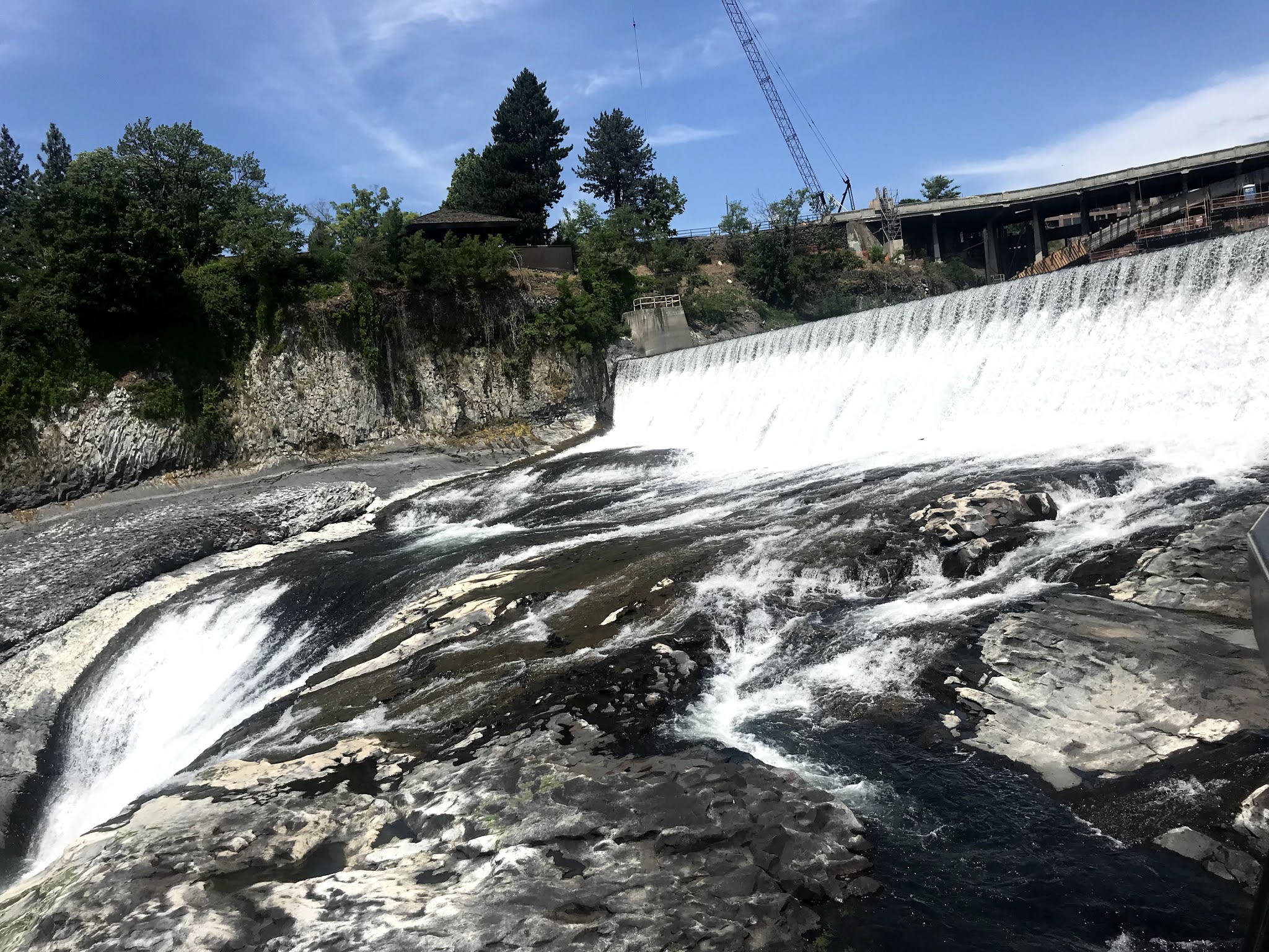
We did, however, have a chance to explore downtown Spokane. In 1974, Spokane was the venue for a Worlds Fair event. An island in the Spokane River was created, added to, and built on. Today, the US pavilion remains as an event center, but the rest of the island has been converted to parks, trails, water features, and statuary, and is known as Riverfront Park.


This is also the site of the Upper and Lower Falls of the Spokane River. The upper falls is the most spectacular, with roaring whitewater rapids!


 The power company make good use of all the water to produce electric power.
 

The lower falls is calmer, but still incredible. A short diversion dam provides intake water for another hydroelectric plant.


A kind gentleman stopped to take a family photo. Thanks, Lowell!


A block south of Riverfront Park, we found welcome relief from the heat at Atticus. The midday temp was in the mid nineties, and walking around in the heat with all that water developed a glow! In Atticus we found iced tea with spearmint and a splash of mango! Gimme a large, please!


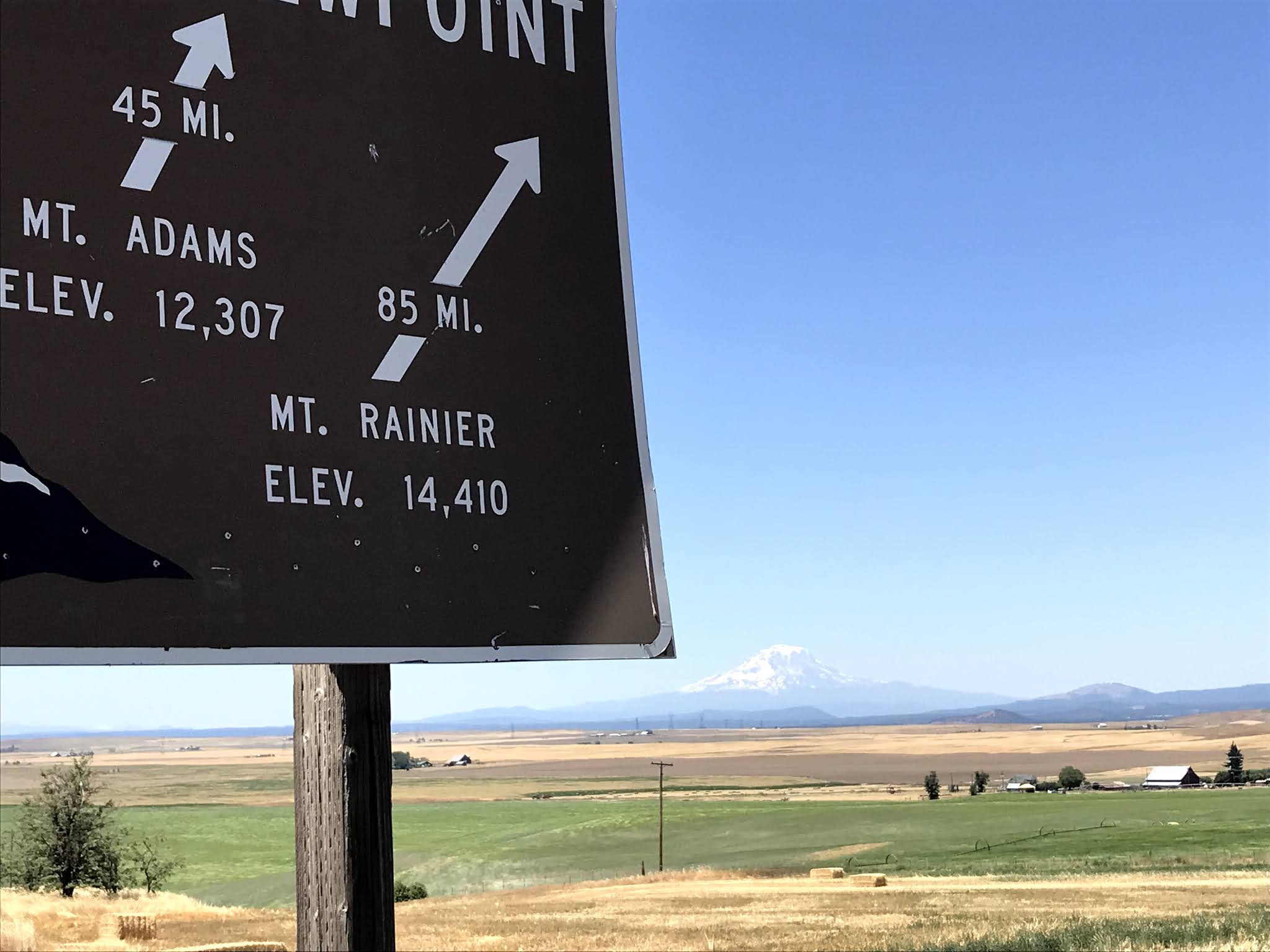
We also saw a sign that is both frightening and encouraging.


A quick stop at Fred Meyers grocery store and it was back to the cool interior of the motorhome. Sasha was glad to see us!

Today, Thursday, we left Spokane about 10 am, heading west on Interstate 90 toward Ritzville, where we turned south. That's where we made a significant error. Two routes can be taken: south on US395, a great, mostly divided highway that zips into Kennewick, where it was a hop and a jump to our destination. Or, south on WA261. This was a pretty good road until we got to a point just south of Washtucna, where it turned to...something other than good. The next 60+ miles were slow, 45 mph, steep, twisty miles. There were, however, some interesting sights along the way.

Leaving the pine trees around Spokane, we found ourselves in grazing country.


And roads that seemed to go on forever.


Then, a change began to occur. Fields of wheat stretched for miles.


We began to see the beginning of The Palouse. Huh?


The Palouse is one of the seven wonders of Washington State. The others are: Mt. Rainier, Mt. St Helens, The Columbia River Gorge, The Hoh Rain Forest and Long Beach on the Olympic Peninsula, and The Channeled Scablands, which are large swaths of barren bedrock and rocky land formations. Called Scablands by early settlers because they were not suitable for farming, they are called Channeled because they are crisscrossed by narrow channels cut into the bedrock, called Coulees. But I digress.

The last of the Seven Wonders is The Palouse. Formed from wind blown dust and silt blown over millennia. The dust was created by glaciers slowly grinding rock, to be left as the glaciers receded. Wind, rain, and time have carved the dust into rolling hills cut through with rivers. From the Steptoe mountains, a peek at the Palouse Scenic Byway:


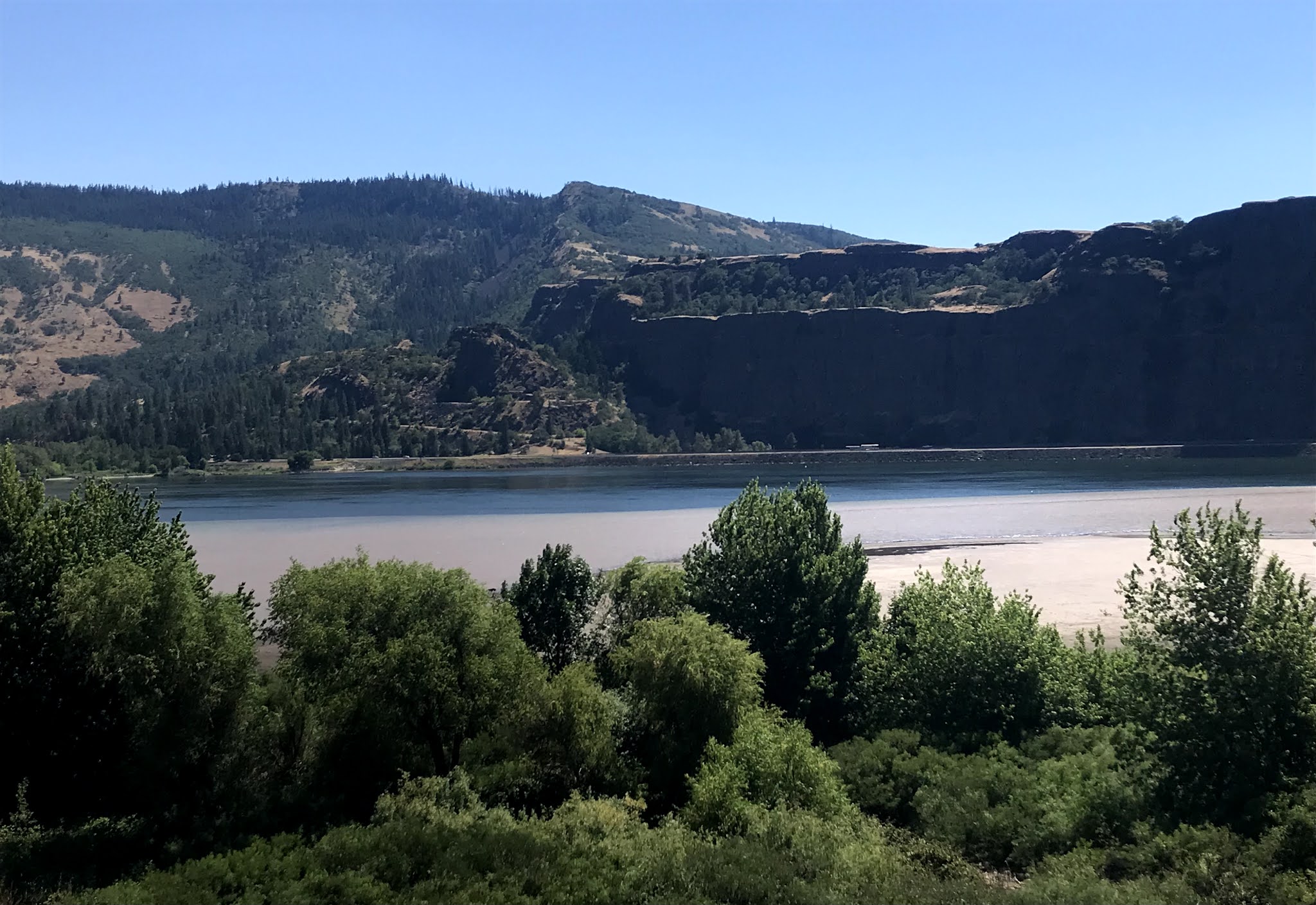
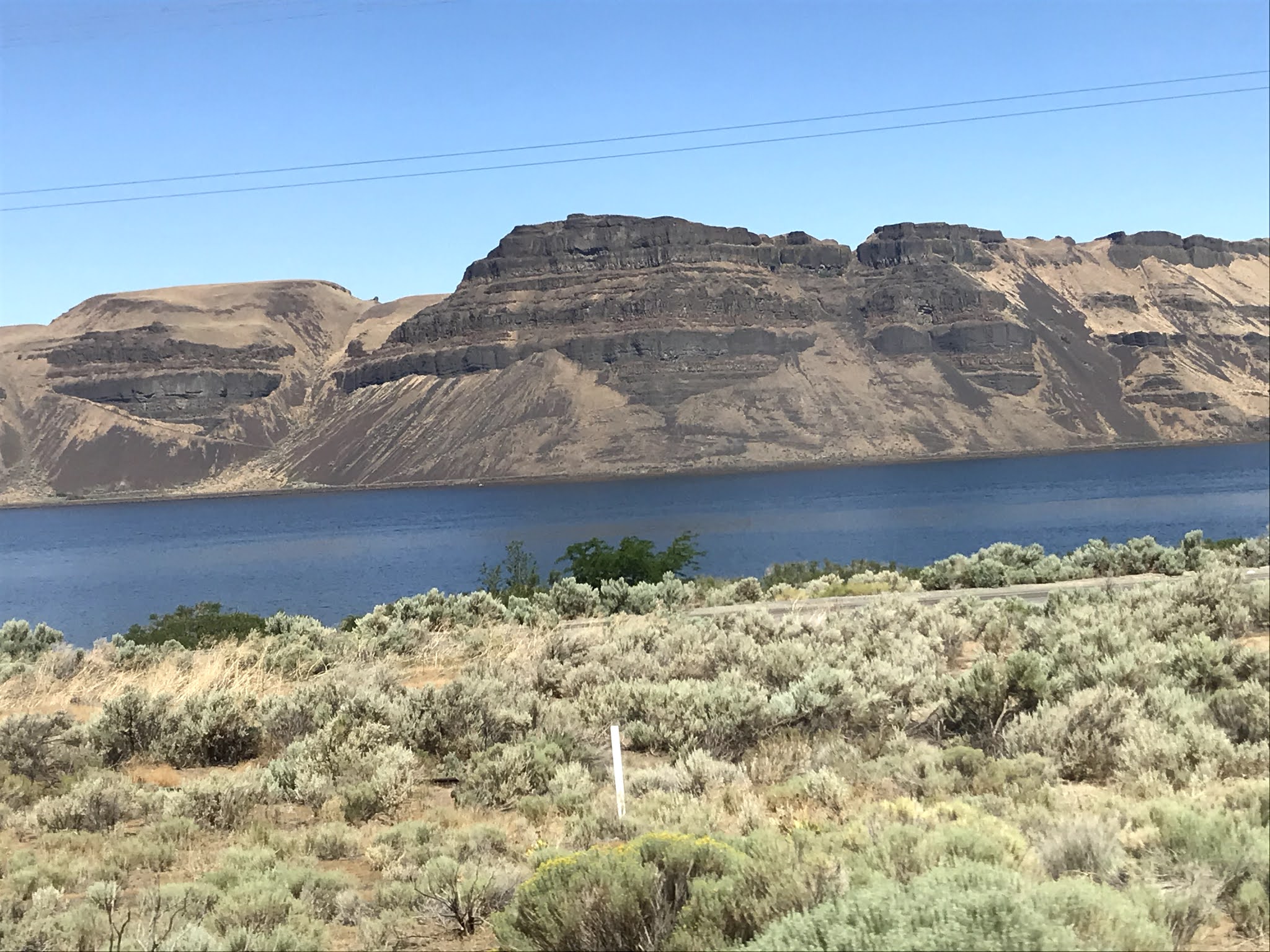
The Snake River appeared near Perry, with it's signature railroad bridge.


Crossing the river was a challenge! The elderly....nay....old bridge has a sign on the approach warning of "Narrow Bridge". And it was.


But we made it, after holding up oncoming traffic for a bit.


And soon got into the depths of The Palouse. Millions of acres of wheat cover these rolling hills, causing us to wonder how the crops are planted and later harvested?


Those black spots are not UFO's, but bugs on the windshield!


So, after 172 miles of slow going, we pulled into Walla Walla, Washington, and the Blue Valley RV Park, Site number 26. Not a bad park, Easy in and easy out, with paved sites and patios. It's located in a sketchy part of town, but the surrounding walls provide a sense of security.The trees are still young, but somehow we were assigned the only site in the park where the satellite tv reception was blocked by a tree! I guess we'll have to actually talk to each other for a couple of days!


We heard about a Thursday night Farmer's Market a few miles down the road, so we had to check it out. Fifty dollars later, we had home-make tamales, peach and marionberry pie, Walla Walla sweet onions, cherrys and cheese! I would post pics of the pie, but.....(it was delicious1)