Monday, July 29, 2019

Treasure Island

On Sunday, we traveled from our Walmart resort to the Treasure Island Resort, Casino, and RV Park just north of Red Wing, Minnesota. Our GPS monster gave us a choice of using I94 west and then dropping south to Red Wing, or using a series of backroads that generally follow the Chippewa River.  Since either option was only a short two hour drive, we chose the backroads and byways option.

We crossed the Wisconsin Channel of the Chippewa River about noon, just after a tremendous rain and thunder storm. It was one of those storms where you couldn't see to drive for a few minutes, and then everything dried up and the clouds went away! We were very happy to be done with that!


Eventually we crossed the Mississippi River at Red Wing and turned north toward the casino and rv park. This isn't a resort by any means, unless you take full advantage of the casino's entertainment and gambling opportunities. We're here for another reason.


We're here to visit family and friends for a week and to celebrate the birthdays of Donna's brother and sister-in-law.

RV parks in this area are few and far between. In years past, we've stayed in a nice park in Woodbury, MN, but that land has been converted to a senior housing complex. Last year we stayed in a KOA campground in Maple Grove, MN, but since our plans changed relatively recently, that option was already booked up, so here we are, about 50 miles south of their home in Stillwater, MN. It's a bit of a drive to see them, but we're happy to be able to do it. We have a couple of day trips scheduled, and, of course, a big birthday celebration, so it'll be fun!

Till next time!

Saturday, July 27, 2019

Eau Claire, Wisconsin

We're not Yoopers anymore. Now we're Yusta Yoopers. We left Houghton, Mi, this morning, traveling south and west on Michigan Highway 26. It was a bit of a trick getting out of the Houghton City RV Park we were in, but with a little luck and eyes squeezed shut in anticipation of some loud banging noise, we made it.

MI 26 leads to US 45, and we traveled through dozens of small towns, including the hamlet of Watersmeet on Indian reservation land. US 45 peels off to the east in Eagle River, while WI 17 continues south through Rhinelander and Gleason to approach the town of Merrill from the east. We had planned to stay the night in Merrill, but with the westward time change, we found that we would have the entire afternoon to kill. Not for us, so off we went west. In Wausau, we turned due west on WI 29, a four lane highway that should be part of the interstate system.

We began to research rv parks as we traveled west, but came up completely empty! A handful of city'county parks were booked for the weekend, so those were out. Near Chippewa Falls we merged onto US 53 south, beginning to get a bit concerned about having a place to sleep tonight! Donna located a Walmart in the southern part of Equ Claire that allows overnight rv parking, so for the first time this summer, we are parked in a busy but well lit Walmart parking lot.


The temperature at 10:15 is 71, down from 92 earlier in our day. We're hoping a cool breeze will come in soon, since we aren't going to be able to run our generator and ac all night.

There is one other rv parked here tonight, so we're considering ourselves safe in numbers. Traffic is heavy and there are people loitering here and there, but we don't seem to be an object of interest, so we'll hope for the best! Tomorrow it's on to I 94, on the way to Minnesota.

Thursday, July 25, 2019

Copper Harbor, Michigan

We started our day, the 25th of July already, with a strong cup of coffee and a desire to visit what is just about the most northern mainland tip of Michigan and learn about the copper mining that shaped so much of the Upper Peninsula (Yooper). As we got on US 41 in Houghton, and crossed the drawbridge into Hancock, we began to see signs telling us about copper mines that were in operation in the late 1800's until almost WW2, so our first stop of the day was at the Quincy Mine, on the bluff overlooking the canal that separates Houghton and Hancock.

The Quincy actually began operating on a small scale in 1846, and continued until 1945. Known as "Old Reliable" because it paid dividends to its investors every year between 1868 to 1920, the mine was the country's leading copper producer until 1867. The Quincy Mining Company was an innovator in the industry, investing in housing for its workers. Simple tents in the early days to complete three story houses shortly before the mine shut down. East coast executives wanted to build homes with electricity and running water but onsite managers didn't think it was necessary for workers to have such high-class dwellings. Realizing that better working conditions would attract and keep workers, company housing eventually proved effective in helping the Quicy Mining Company retain its status as one of the premier mining companies of the region.

The No. 2 Shaft Rock House is open to the public (lower levels only). The gears, cables, ladders and trolleys remain in place to give us a glimpse into the past of copper mining.


The No. 2 shaft was the world's longest mine shaft, at 9,260 feet along the "dip" of the deposit on a 55 degree angle. The world's largest steam-driven mine hoist was built in 1918 and housed in the No. 2 Hoist House to raise and lower ore and workers into the shaft. It lifted 10 tons of ore at 36.4 miles per hour! The box on the left was sealed, as a bucket, and was used to extract water from the mine. The trolley on the right seated 30 miners, three abreast, for transport in the mine.


The incredible size of this operation is mind boggling.


The shafts and stopes of the Quincy Mine have slowly filled with groundwater since the closing of the mine. The water has currently filled the mine up to the seventh level, where it is drained by a large adit, or mine entrance shaft. Amazing.


The town of Calumet was the Queen of the mining camps. The Calumet and Hecla Mining Company was headquartered in Calumet, and Calumet was essentially a company town. The C&H provided schools, hospitals, and housing for its workers as well as above average wages. A broom factory was set up for blinded employees, and dormitories housed elderly, single former employees. The Calumet and Hecla's success resulted in increased benefits that trickled down to workers, making the company the preferred employer in the area. Bowling alleys, libraries, and schools won praise for the company, but favoritism in assigning housing contributed to the strike of 1913. The Western Federation of Miners called for a general strike in July, 1913, demanding and 8-hour day, a minimum wage of $3 per day, and that the company recognize it as the employees representative. Under National Guard protection, the mines reopened and many miners went back to work. The company instituted an 8-hour day, but refused the $3 minimum wage and refused to recognize the union. Tensions remained high.

On Christmas Eve, 1913, the Western Federation of Miners organized a party for strikers and their families at the Italian Benevolent Society Hall in Calumet. The hall was packed with over 400 people when someone shouted "fire". There was no fire, but 73 people, 62 of them children, were crushed to death trying to escape. This effectively ended the attempt to unionize the mine until 1943, when the company signed an agreement with a CIO affiliated union.

We visited the Coppertown USA mining museum in Calumet for a look into that past.


Housed in what was the carpenter shop, the museum houses tools and exhibits that detail the brute force necessary to wrest copper from the ground. The C&H was among the first to use pneumatic drills to loosen ore, saving time and labor.


If you read the small sign in front of this iron kettle, you'll see a reference to a "whim".


This is thought to be the origin of the phrase "on a whim"!

Huge old-growth timbers were used to shore up the tunnels and drifts. Sometimes they failed. Note the broken tree trunk and compare to the workers in size.


Calumet, formerly know as Red Jacket, retains much of its historical flavor. Many buildings are from the 1800's and reflect the background of the Finns, Welch, Swedes, Norwegians, and Eastern Europeans who immigrated to the US and became citizens. This structure, still under reconstruction, must have been built by someone from Europe.


Religion was a huge component of these immigrants lives, and they supported their churches wholeheartedly. The Catholic church is the tallest and most impressive of any structure in Calumet.


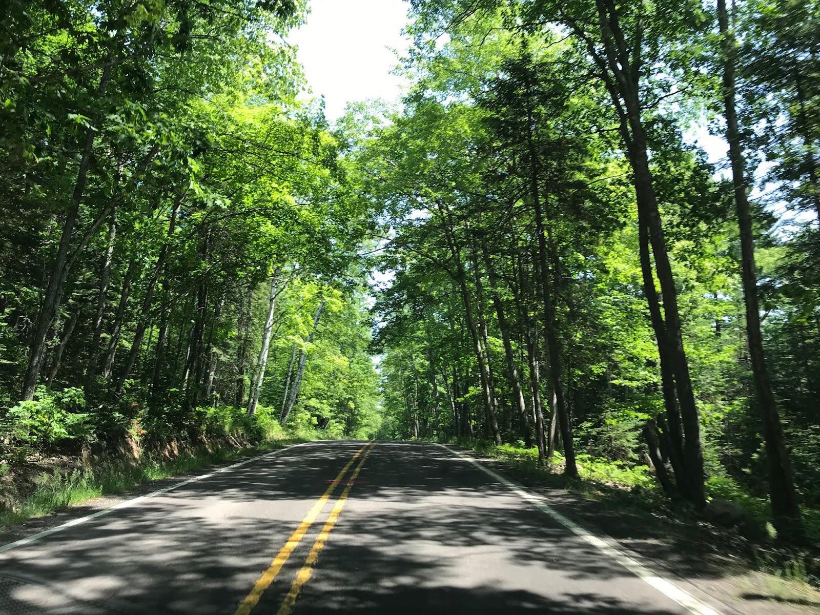
Continuing our drive north on US 41, we drove through miles of lonely trees, overhanging the highway as if to draw a "hello, I'm here" from passing cars.


Copper Harbor has a neat name, but not much else. The highlight for us was to watch ducks cruise across the main shipping channel....


Not wanting to retrace our route north to Copper Harbor, we took a side road (Michigan 26) and skirted along Lake Superior. In Eagle Harbor we saw the first of the fall colors.


In Eagle Harbor, a wide, sandy beach attracts sunbathers.


And the Eagle Harbor lighthouse is one of hundreds around Lake Superior.


After 110 miles, we think we have had just a taste of the Keweenaw Peninsula and its copper mining history. Very nice. We have been pleasantly surprised at the information we've been given....we had no idea that this area was so interesting!

Wednesday, July 24, 2019

Gateway to Keweenaw

134 miles north and west of Munising, Mi, along US 41 where we spent the last three nights, lies the town of Houghton, Michigan. Not to be confused with Houghton Lake, where we spent two nice weeks, this town not only draws visitors to the historic copper mines of the Keweenaw Peninsula, but also bills itself as the birthplace of professional hockey. While the first is fact, the latter may be open to some debate, but we know that there's a lot of ice in this part of the country in the winter, so who knows?.....

We're tucked into space 13 of the City of Houghton RV Park along the Houghton-Isle Royale Canal. There is a little known national park on the island of Isle Royale in Lake Superior, and the headquarters of the park is here in Houghton. A ship shuttles visitors to the island for camping and hiking twice a week for a cost of $140 round trip per person. They say it's an animal lovers paradise with moose, ptarmigan, and all manner of fish and fowl to see.


The temperature was in the low 80's when we arrived about 2 in the afternoon, with a slight breeze. Each campsite has a covered patio/deck overlooking the water, so it was a great place to relax after a days drive!


Across the canal we can see the remains of a copper smelter. This area was a booming copper mining and smelting area at one time, using an abundance of copper that was first used by Native Americans for arrowheads and tools. It was so common that it could be picked up from the surface of the ground and easily shaped into implements!


Downtown Houghton is now primarily tourist supported, with restaurants and brew pubs competing with trinket shops for the visitors dollar.


While we're here primarily to visit Copper Harbor and catch a little history of the copper industry that was so prominent in the area, we also plan to enjoy a bit of relaxing time before we begin to make our way west.

Tuesday, July 23, 2019

Munising to Grand Marais and Back

A late start this morning put us on County Road H58 east out of Munising, headed into the depths of Pictured Rocks National Seashore. Yesterday we took a look at the park from the lake side, so today we decided to explore it from the "topside", going through some extraordinarily beautiful forest.


Yesterday, we saw Miners Castle from the water side. Today we got a glimpse of the formation from above.

Yesterday:


And today:


From the observation platform, it's a looonnnng way down to the water!


The top of the rock formation does, indeed, look a lot like a castle turret.


A pair of Peregrine Falcons were perched on the very top of the rock as we arrived, but one flew off into the distance, leaving his (her) mate to stand watch. A bit of research reveals that these Falcons primarily feast on seagulls.


A few miles along the highway brought us to Log Slide observation site. Back in the day, when millions of white pine and white fir were taken from these forests, the preferred methods involved work in the winter because snow and ice made it easier to transport the timber. An ice path led to this steep slope, which itself was watered to create a thick ice slide, and the trees were pitched over the edge, where they landed on lake ice. Picked up from there by mules and sleds, the timber was transported to Munising or Grand Marais.


Imagine the timber sliding down this steep slope, and bouncing about at the bottom! Dangerous work, for sure! Signs at the top of the slope recommend caution descending this slope. It's not advised for people with cardiac or respiratory issues since the time descending is about 90 seconds, but the time climbing back up is about 90 minutes!


Sixty some miles after we left Munising this morning, we arrived in Grand Marais, Michigan, expecting a thriving fishing community with some tourist activities. Well.....
The population of Grand Marais is now about 350 souls, down from 480 in 2010. There are three breweries, two restaurants, and a food truck parked in the public park at the head of the bay. We chose the West Bay Diner for a light late lunch, and were not disappointed with the Reuben sandwiches. We ordered a New York Reuben (sauerkraut) and a Manhattan Reuben (cole slaw) and they were both wonderful, if not healthy! Our server is the owner of two Boston Terriers, so we had a great time loving on Sasha, who was able to go with us today since the weather was cool and windy. This is a cute little restaurant, with the entrance in the back through the kitchen, and the menu written on a blackboard. There is a deli counter as well along with only one cook, so don't go to the West Bay Diner if you're in a hurry!


Tomorrow is a travel day, further north into the UP. We'll be Yoopers yet!

Monday, July 22, 2019

Pictured Rocks National Lakeshore

Lake Superior, named by French Voyageurs, is the largest of the Great Lakes of North America. It's also the world's largest freshwater lake by surface area and the third largest by volume. It has the highest elevation of all five great lakes at an average of 600 feet above sea level. The water contained in Lake Superior would fill a swimming pool five feet deep....if the swimming pool were the size of the United States! At 733 feet below sea level, Lake Superiors depth is the second lowest spot in the continental interior of the US after Iliamna Lake in Alaska.

OK, it's awesome.

We joined the 2 o'clock sailing of one of Pictured Rocks Cruises ships to take a bit of a ride on the lake and visit one of its most famous landmarks, Pictured Rocks.


As we headed northeast out of Munising Harbor, we began to get a sense of the vast area of Lake Superior.


Just around the headland, we got our first view of the sandstone cliffs that comprise Pictured Rocks.


At Miners Castle we saw a cave that has been hollowed out by thousands of years of wave action.


The sandstone has been stained over the years through the action of chemicals in the stone. Iron creates the reddish brown hue and magnesium creates the black.


It is said that a variety of shapes, both animal and human can be seen in the rocks.


Rainbow Cave is an unusual formation.


Indian Head Rock is pretty awesome, isn't it?


Battleship Rock presents a commanding presence on the shoreline.


And just around Battleship Rock we found Battleship Row.


We saw so many incredible sights on this trip that I got lost in the beauty and didn't get the name of this formation. I believe it's called The Flower Vase. A lone tree grows from the top of the rock, with just it's roots clinging to the stone.


Amazingly, only one root provides nutrients to the tree! Years ago, the rock between the tree and the shoreline fell away, leaving only one root spanning the gap to sustain the tree!


As we passed by the Flower Vase, a Bald Eagle left the top of the tree and soared off into the distance. An incredible sight to be sure! The eagle is just a dot in the photo just above the trees near the center.


The turn-around point for our trip was Splash Falls. Check out the color of the water!


During the winter, when Lake Superior freezes, and the waterfall turns to an icefall, ice climbers will come out to scale the icy waterfall.


We sat on the right (starboard) side of the ship on the way out, so we got a wonderful view of the vastness of Lake Superior on the return trip.


So we had to amuse ourselves somehow.....


 The American Flag flew proudly on the stern of the ship on this windy day.


Passing Grand Island on the way back to Munising we passed a lighthouse that was built in 1867 to guide ship through the narrow channel between sand bars. Only in use for a few years, one of the keepers lived here with his wife and twelve children!


Back ashore, we drove a short distance to park headquarters at Munising Falls. These falls once supplied water for a steam powered blast furnace that converted iron ore, limestone, and charcoal into pig iron used in railway ties or as an additive for other metals. As raw materials ran out, the furnace closed in 1877, leaving only a few tailings piles and scrap iron. Reclaimed by nature, the falls now flows freely into Lake Superior.


I guess we finally discovered the annoyance of selfies.....Donna has had a long, long day...


Back at camp, a snack of fried pork skins kept us going until dinner....one in the mouth, one in the hand, and several in the bag.....


It's a good life!