Saturday, August 1, 2020

Natural Bridges NM and Newspaper Rock

Leaving Blanding about 10 on US 191 south brought us to the entrance to Natural Bridges National Monument, but not before we began to get a glimpse of what awaits us in the park!


Great canyons have been carved out of the mesa.


On a short trail to Sipapu Bridge, we came across a beautifully organized cactus garden! Almost as if it had been designed to please the eye.


Sipapu Bridge is the first one to be seen on the NBNM driving loop. Sipapu means "place of emergence", the entryway by which the Hopi believe their ancestors came into their world. The three bridges seen on this loop were originally named President, Senator, and Congressman in order of height. Later explorers renamed them Augusta, Caroline, and Edwin. In 1909 the park was enlarged to protect nearby Puebloan structures, and renamed in keeping with Hopi traditions.

This is Sipapu Bridge, the oldest of the bridges in the canyon. Deceptive optics in this photo make it seem a lot thicker, but closer examination shows reality. It is 220 feet in height, spans 244 feet and is 53 feet thick.


Unbelievable swirls of color, rock, and shrubs assault the senses. Everywhere you look there is another grand sight!
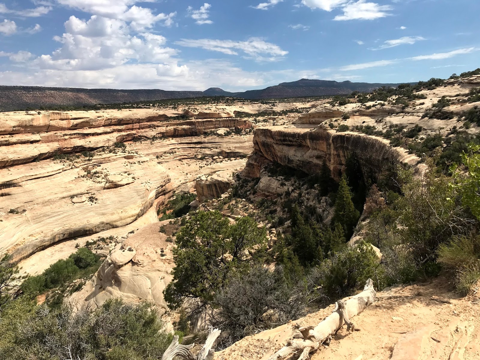


Kachina Bridge is the second bridge on the tour. In 1883 prospector Cass Hite wandered into White Canyon in search of gold along the Colorado River. In 1908 President Theodore Roosevelt proclaimed Natural Bridges to be Utah's first National Park System area.

Kachina is the youngest of the three bridges, looming big and bulky while White Canyon floodwaters still work to increase its span. Its height is 210 feet, span is 204 feet and it is 93 feet thick.


The interesting "slick rock" formations were formed of sand. It's believed that swirling sand dunes were covered and compressed over time, creating the "pudding" look!


In places, the sandstone has "shelved", that is, separated into it's various layers.


Lastly, we came to Owachomo Bridge. The difference between bridges and arches is subtle, but bridges are formed by the erosive action of moving water, while arches are formed by frost and seeping moisture after natural bridges have been formed by stream erosion. Owachomo means "rock mound," a feature atop the bridges's east abutment. Owachomo is now in its old age, having a thickness of only 9 feet. A height of 106 feet, and a span of 180 feet indicate that much of the bridge material has fallen to the ground below. The bridge may now have a fatal crack, or may last for many years.


In the distance, Bears Ears loom over the landscape. Navajo stories tell of Changing-Bear-Maiden, who was very beautiful and desired by many men. She married the trickster Coyote, in spite of warnings that the union would bring evil. Changing-Bear-Maiden began to change and by winter's end her transformation into a mischievous bear was complete. Realizing that the only way to save her was to change her into another form, her brothers killed Changing-Bear-Maiden, cutting off her ears and throwing them away. They became the buttes seen today!


The road into and out of Natural Bridges National Monument sneaks through an amazing slot cut into the spine of ancient mountains.


A storm began to develop, so we hurried on to our next stop.


We had only driven 90 miles when we returned to Blanding, so we headed north toward the town of Monticello, and beyond. A monolithic sentinel marks the side road that leads to our destination.


Twelve miles west of US Highway 191, we found Newspaper Rock. A petroglyph panel that records approximately 2,000 years of human activity. Pre-historic peoples etched on the rock until AD 1300, then in historic times, Navajo and Ute people have made their contributions. In Navajo, the rock is called "Tse Hane" (Rock that tells a story), but unfortunately, we do not know if the figures represent storytelling, doodling, hunting magic, clan symbols, graffiti or something else.


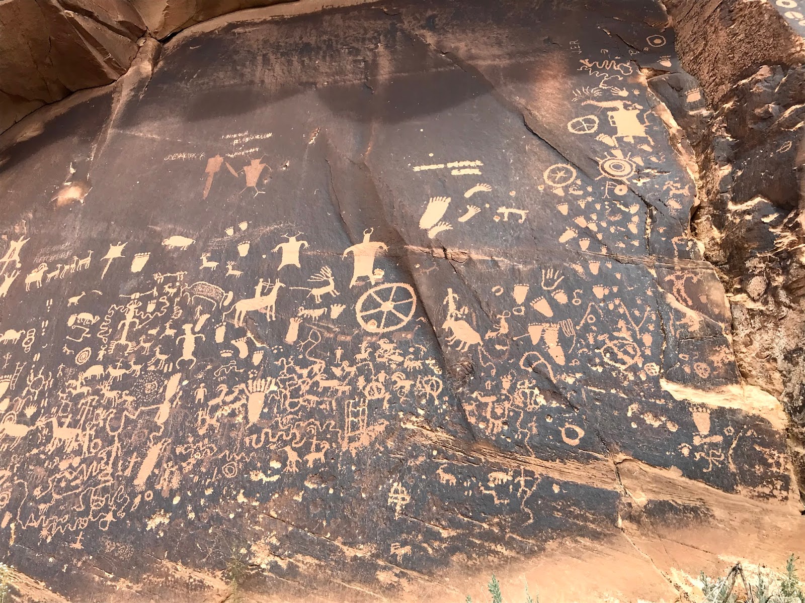


The road into Newspaper Rock has some very interesting rock formations both alongside and over the road.


We had escaped the rain, so headed back to Blanding, having put 183 miles on the car today! But it was fun and we saw some remarkable sights.


Our stay in Blanding has been rewarded with a tremendous sunset!


And so it ends. Tomorrow it's another day and another place!

Friday, July 31, 2020

Hovenweep, Utah and Back

Hovenweep National Monument is located just a few miles from Four Corners, where Utah, Colorado, New Mexico and....(quick....what's the other one?) meet. It's 44 miles from Blanding through some of the most tortuous terrain on the planet. Some gravel road, some Reservation land, and no traffic finally gets you to the Monument.


Studies across the Four Corners region have produced information about cultures inhabiting this area over 13,000 years ago. Known as Paleo-Indians, these nomadic hunters roamed the plateaus and canyons hunting wild animals. At about 11,000 years ago, drier climate conditions displaced these people as animals moved to more hospitable areas. Then ancestral Pueblo people moved in and began to seek temporary shelter under canyon overhangs and in shallow alcoves. Using low dams to conserve water near springs led to more crops, and away from hunting. Somewhere about 1100, sophisticated villages developed, with architectural and engineering projects. by the late 1200's drought and overuse of resources forced abandonment of the region. The people moved south to the Rio Grande Valley, in New Mexico, and the Hopi mesas of Arizona.

The structural remains we saw today, therefor, are over 700 years old!


This structure is known as the Stronghold House due to it's fortress-like shape.

A bit further on a well marked trail we came across the Twin Towers.


This is known as the Eroded Boulder House because of the way it's tucked into the rock alcove.


The canyon contains scores of abandoned houses and/or remnants thereof.


It's impossible to imagine dozens of children scampering about the canyon today, but it was a more favorable place to live back in the day due to hard and constant work.


The trail around the canyon is about a mile and a half. Since the temp was approaching 95 deg F., we only walked about half way. We had left Sasha in the car, locked, with the engine running and the ac humming, so we felt comfortable doing the hike, but we began to feel the heat and wimped out.

Back in the car, we flipped a coin to determine the route home. Tails won, so we headed further east through open range toward Cortez, Colorado, 42 miles away over reservation roads.

We have a penchant for giving our vehicles names. Today we were talking very nicely to Lucy....please don't run out of gas!


The mountains were somehow beautiful and foreboding at the same time.


Out here the goats run loose. Where are they gonna go?


Approaching Cortez, the landscape changed dramatically. Evidence of early settlement gave way to expansive farms set in awesome valleys.


We ate a picnic lunch on the grass under a tree in front of the now closed Cortez Memorial Pool Complex. A dog walk and cheese and crackers washed down with Arnold Palmer iced tea and we had to flip that coin again. We kinda had a hankering for an iced coffee drink, so a Duck Duck Go search sent us to Midland Bean in Dove Creek on highway 491 north toward Monticello, Utah. Unfortunately, when we arrived at the Midland Bean, we didn't get anything to drink.


The area grows along of bean type crops, so.....I suggested we go inside to check it out but Sasha put an end to that.

So on our evening walk we enjoyed a perfect sunset to end a perfect day. One hundred seventy one miles through some of the most diverse countryside imaginable. Awesome place, this southeast Utah!


Fruita, Colorado to Blanding, Utah 177 miles

But first a postscript to the last post:

Our last night in Fruita was shared with Brian, his wife, and son. Brians' Mom and Dad from NorCal also showed up, being on a bit of a road trip. Brians Mom and Dad (in-Law) dropped in from their home in Glenwood Springs, Colorado, so we had a somewhat distanced party! Brian burnt a dozen chicken breasts and smoked some ribs to go with the salad, bread, and zucchini casserole. What a feast!

Of course, the conversation got nostalgic, and Brian and I shared some good memories.


The city of Fruita has just completed a huge park complex on land adjacent to the Colorado River, so after dinner we all took a walk. The sun was just setting, so the river view was wonderful and we were able to get a photo of Brian and his family. 13 year-old Elliot was not pleased!


And so the favor was returned.


Thursday morning we said (temporarily) goodbye to Colorado and hello to Utah.


We had been on Interstate 70 west for awhile, but turned off at Crescent Junction onto US 191 south toward Moab, Utah. The scenery hereabouts is wonderful!


We stopped at a Rest Stop near Hole in the Wall and I took a quick photo to remember the area.


And then walked around the motorhome!


Just south of Hole in the Wall (a tourist trap created years ago by an enterprising family by blasting tons of beautiful Utah sandstone into smithereens) we stopped for a photo of Wilson Arch. A couple of ambitious sorts had hiked to the base of the arch.


Seventy odd miles further south on 191 we pulled into the little burg of Blanding, known as the "Basecamp for Adventure", and Blue Mountain RV Park and Trading Post. Site 13. OK. Windy. Everything works and there aren't any trains! Perfect!


A good nights sleep and then.....