Tuesday, May 11, 2021

Gotta Drive #772

Yesterdays day trip put an additional 221 miles on the car. Not enough. We left the motorhome this late morning intending to stay in Goodland and check out a couple of local interests. Our first stop was the High Plains Museum on Cherry Avenue. 


The museum showcases 100 years of high plains history and contains over 8,000 artifacts. One of the most interesting items is the first patented helicopter invented. The story goes like this: In 1909, six years after the flights of the Wright Flyer, William Purvis, a mechanic for the Rock Island Railroad in Goodland, watched some children playing with a whirligig and got an idea to build a machine that could fly low and slow to deliver freight and mail. The device utilized two counter-rotating paddles to counteract the rotational forces that occur with spinning blades and was mounted to a three wheel bicycle. Local lore has it that the Rock Island machine shop unknowingly contributed parts....

Two seven horsepower engines were obtained with donations from Goodland townspeople and a demonstration was planned in the town square. Depending on the folklore that you listen to, either of three things happened: The craft tore itself apart after lifting a few inches, or, the craft flew with Mr. Purvis aboard, but could not be controlled and soon crashed, or, Mr. Purvis was able to lift off, but flew directly into the town water tower, sending debris and water over the gathered crowd. Take your pick. Interestingly enough, just after the flight failure, the US Patent Office issued a patent for the rotary winged aircraft. 

The museum has a recreation of the craft, based on the patent drawings, and we wanted to see it. No Go. The museum is closed on Tuesdays!

Strike 1

Our next stop was the NOAA office just north of town. The National Oceanic and Atmospheric Agency maintains a facility in Goodland that monitors weather throughout the midwest, using radar and sophisticated imaging systems.


Ok, the facility normally gives tours, but doesn't at the moment due to the 'Vid.

Strike 2.

A stop at Good Grounds for a cup of coffee (ok, a mocha and a salted caramel latte) to soothe our bruised feelings led to a thought of finishing the Sky to Land byway tour that we started yesterday. The 211 miles we drove yesterday evidently wasn't enough, so off we went south of Goodland toward Sharon Springs.

The terrain smoothed out and we remarked that we could probably see Missouri if we knew where to look!


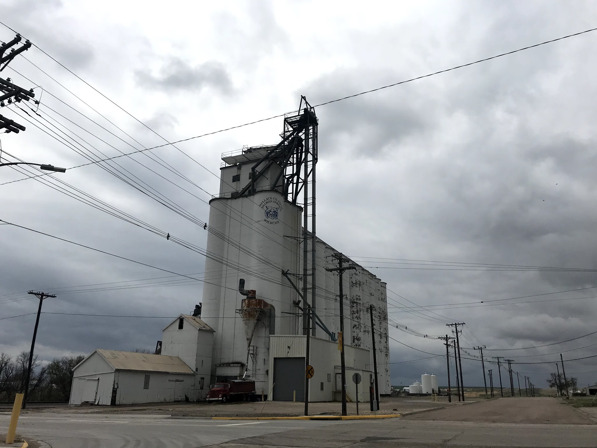
Arriving in Sharon Springs, we saw why the town is so successful. It has two grain and fertilizer facilities!


Heading east on what is called the Western Vistas byway, we happened upon this lonely tree.


Going through the hamlet of Winona, Kansas, On US 40, we noticed this abandoned school? Church? It is a symbol of the decline of the main streets of so many of these midwestern towns.


In Monument, Kansas, just before we turned north on Kansas 20, we noticed an historical point of interest that details the Butterfield Overland Despatch Stagecoach Line that connected Kansas City and Denver through this area. Check it out.


Near the town of Colby, where we expected to intersect I 70, we caught a glimpse of the wind turbine enterprise in Kansas. It's said that a carpenter was asked how he carried a sheet of plywood in the average 15 mph wind. His reply was "what wind?"


Which gives rise to the famous anecdote that the only thing to stop the wind between the Arctic and the Gulf of Mexico is a barbed wire fence in Kansas.


I 70 is undergoing improvements (?), which are evident in the new striping on the road between Colby and Goodland.


So, after another 146 miles, we returned to the motorhome to do a few chores and some more laundry before leaving tomorrow morning. It's been a good stop.


Monday, May 10, 2021

It Was A Nebraska Kind of Day

 Kansas has defined 12 scenic byways, each illustrating something unique about the state. Number 1 is called Land and Sky and travels northwest Kansas where wide open expanses of land meet endless skies. This is the one we drove today. Other byways explore fossil areas, valleys that divide western shortgrass Great Plains from the mixed-grass prairies of the eastern state, bedrock and limestone areas, pioneer and early military towns and Route 66. 

Out of Goodland, we drove north on Kansas 27 toward St. Francis. Just our of town we spotted another of the sculptures that dot the area. Made from tractor parts and painted John Deere green and yellow, the "Goodland Grasshopper" sits alongside a large farming operation.

About 20 miles out of Goodland, the western sky began to look a bit ominous, but since you can see for literally miles, it was hard to tell how far away trouble was.


Periodically along the byway, kiosks provide more information about the area. When we stopped at the third kiosk we noticed a truck with an eye-catching name!


This point of interest also described the dust bowl conditions during the 1930's and told about how farming methods have changed to prevent a re-occurence.


The major change, other than being able to draw water ever deeper from the Ogalalla Aquifer, is the "no tilling" method of land preparation when new crops are to be planted. The seeding machines simply insert the seeds along the side of the stubble of last years crop, thereby using the old plant material for nutrients and not disturbing the soil unnecessarily. Plant spacing to maximize absorption area and weed control to eliminate water loss are also vital components of the system.

The byway notes several events from the past, including this site of the Indian encampment of 1864-65 where between 800 and a thousand tepees with an average of 6 to 8 residents in each, gathered to avenge the Sand Creek Massacre. Also of note at this site, the last remaining male buffalo in the area was killed by homesteaders.


Just north of the village of St Francis, we crossed into Nebraska. The scenic byway had ended at the state line, but we kept going. Highway 27 ended in the village of Haigler, Nebraska, so we turned east on US 34, crossing the dry Republican River several times. No Democrat to be seen. 

An interesting historical marker caught our eye as we motored along toward Benkelman. Seems that cattle drives were big in this area.


We had crossed an area of badlands called the Arikaree Breaks just before we crossed into Nebraska, and we caught the tail end of the area just before we crossed back into Kansas.


Benkelman is one of those Midwest towns that refuses to die. The only grocery store is closed. More than half of the downtown is closed. But there are still signs of life in the residential area.


The local park is well kept and dedicated to a native son. Ward Bond was the star of the television series Wagon Train back in the day.


Heading south again, we found ourselves on Kansas 161, going toward Bird City. This road is one of those north-south roads that goes forever in the midwest. What a view!

Somewhere along this road Donna spotted a curious deer, just munching and staring as we stopped. Happy Deer!


Bird City is aptly named for the hundreds of Robin Redbreast birds that hang in this area. They were shy however, and hard to photograph. We had to be satisfied with fly-bys.


Bird City has a lovely park dedicated to Mr/Mrs/Ms Van Doren. Sidewalk segments were stamped with the names of people and families that had contributed to the construction. While Sasha and I walked the perimeter, Donna prepared a picnic lunch. lt was cloudy, windy, and cold, so we ate in the car.


And the clouds continued to build.


East out of Bird City on US 36 brought us to the metropolis of Atwood, KS, the county seat of Rawlins County, with a population of about 1,200. Originally spelled with two T's, the post office requested the name change in 1882, after 7 years as Attwood, the first name of the 14 year old son of the founder, J.M. Matheny. Again, there is much to be wondered at with a town like this. Located at a crossroads, and with grain elevators and a thriving CO-OP to service local farmers, there are about 500 residences and a handful of businesses, one of which we almost patronized!


As I write this, 10:30 Mountain Time or 12:30 Central, the clouds have finally decided to consolidate their efforts and it has been raining for several hours. The park has asked us to disconnect our water hose to prevent freezing, so I'm connecting the dots: rain and freezing temps? Snow? We'll see in the morning!

When we returned this afternoon, we were met by the owner of the park and a plumber. Uh-oh, not good. A blockage in the sewer line right under our site number 9 will require that the line be excavated and repaired tomorrow morning at 8 am. We elected to move to another site.....

Tomorrow has a couple of local interest items on the menu along with laundry and such. If we can navigate through the snow (fingers crossed) that is. 


Sunday, May 9, 2021

The Real Middle America

 Goodland, Kansas, a farming community of 4,500 souls, is not your average small town. One of the earliest pieces of history relating to Goodland concerns the Kidder Massacre. In July, 1867, a detachment of the 2nd Cavalry Regiment was carrying dispatches for (at the time) Lieutenant Colonel George Custer and were massacred by Cheyenne or Sioux indians near Beaver Creek, very near the future town of Goodland, which was incorporated in 1887. Located 17 miles east of the Colorado/Kansas state line and the town of Kandorado, it lies squarely in the high desert category with an elevation of 3,700 feet and an average rainfall of less than 20 inches. 

So why are we here? Well, for starters, it's 236 miles away from the snow that Central City was getting when we left there this morning! 

For another, it has an unique distinction: it lies exactly on the line separating Mountain Time and Central Time! More interesting, the KOA that we're staying at sits on the time zone line such that our motorhome is in Mountain time, but if you walk less that 100 yards to the east side of the park, you're in Central time! We've given up trying to watch tv because the cable system is in Central time and the satellite dish is in Mountain time and we get confused!

Leaving the Denver area this morning, it was (again) a surprise to drive across eastern Colorado and see the miles upon miles of flat to rolling countryside.


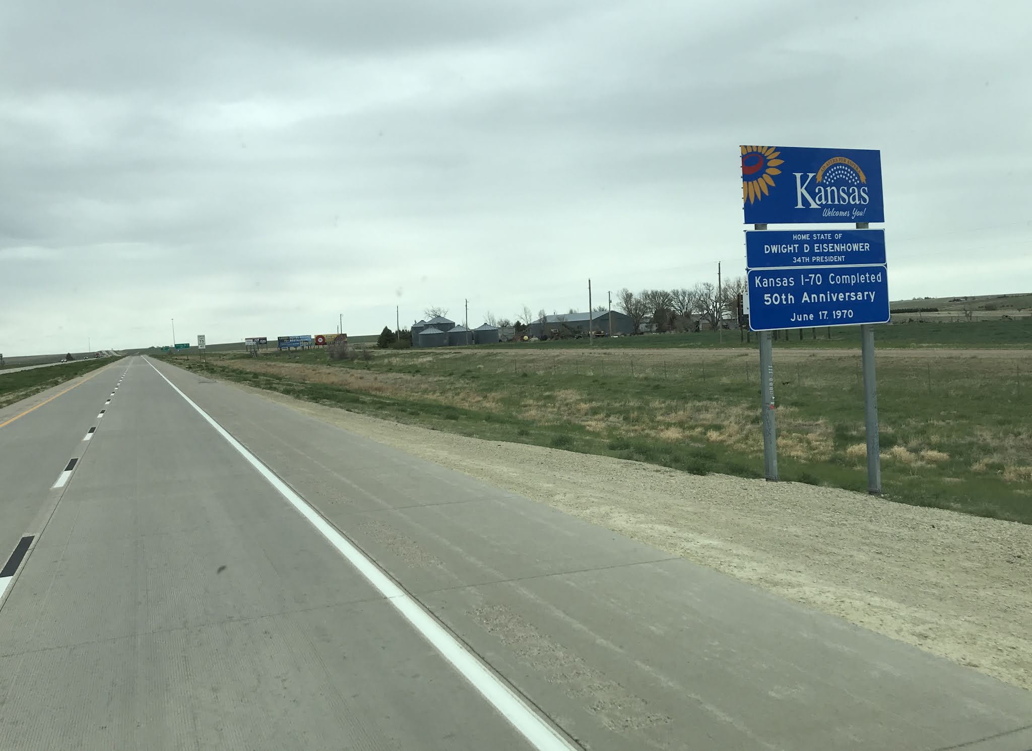
Eventually, we came across the state line.


And soon found ourselves in Goodland. A quick drive around town led us to the old Telephone Building, built in 1931 in the Art Deco style. At the time, Goodlands manual exchange had more than 1,000 telephones and the system was overloaded. United Telephone built the building and installed the fourth dial exchange in the state. United Telephone merged with Southwestern Bell in 1937 and all the mechanical equipment was removed in 1957, and the building is no longer open to the public.


Goodland is also home to the world's largest Easel.


Kansas is the Sunflower State, and Goodland is the center of the local sunflower industry, so it makes sense that when the city fathers were searching for something to bring people in off the interstate, they would settle on something flowery.

The easel is 80 feet tall, and the representation of one of Van Gogh's "Sunflower" paintings is 32x24 feet, and weighs 45,000 pounds! The artist has plans to erect seven large paintings around the world, but is working on number three at the moment.

We're finding that Goodland is a quirky place with several odd or interesting things to see, so we're glad that we'll be here a few days.

Stay tuned!

Saturday, May 8, 2021

Chased

 Saturday morning began with bright sunshine and a brisk breeze, springtime in the Rockies weather. We ditched the jackets and drove into South Downtown Denver (SoDo) and did a little shopping for the upcoming week. Then back into Lower Downtown Denver (LoDo). That's just southeast of Five Points and north of Lincoln Park. Got it? This time our destination was Union Station. Not THE Union Station, but the glorious former main railway station and central transportation hub in Denver.


The station first opened in 1881, burnt down in 1894, and fully reopened in 1914. Located at 17th and Wynkoop streets the building includes the historic terminal building, a train shed, an underground bus facility and light rail station. It also serves as an Amtrak stop for the California Zephyr. In 2012 the station underwent a major renovation and now includes the 112 room Crawford Hotel, shops and restaurants.

We took a look at downtown from the front of Union Station, then redeemed our car from the nearby parking garage. $9 an hour....

The temperature was absolutely great in Denver today. High 70's to mid 80's during the middle of the day. Short shorts were the dress code for the day, and the city, it's parks, and the highways were packed with people lovin' the sunshine!

On I70 West, heading back to Central City, we passed the famous house used by Woody Allen in his movie "Sleeper", sitting high on a cliff near Genosee.


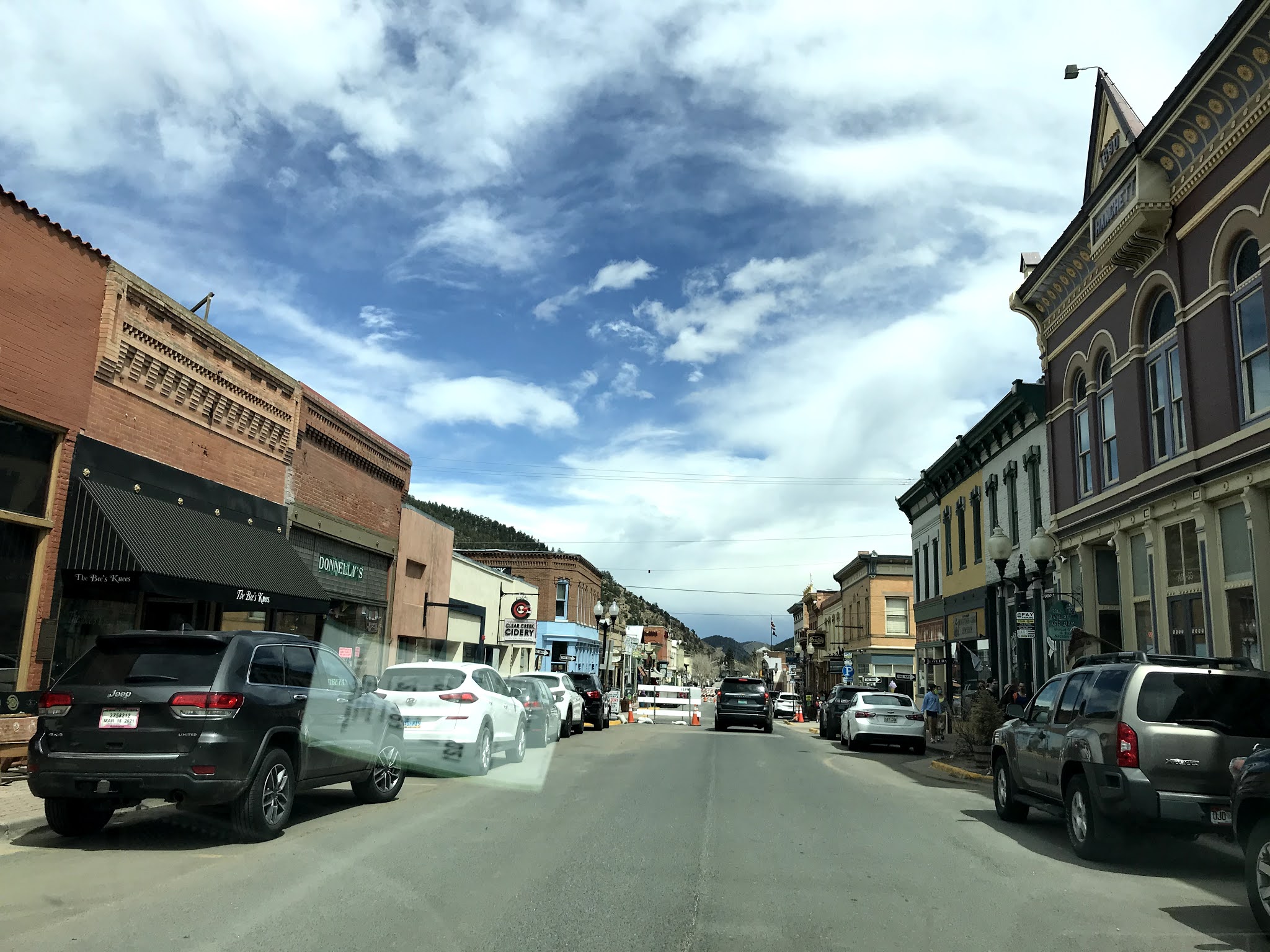
A short distance from Central City, we drove through Idaho Springs. This burg claims to be a destination for skiers and history buffs. It seemed to us to be just another tourist town so we just drove through. The white rectangle in the pic is a reflection of the parking stub from downtown. I wanted to save it.


Back in Central City, we decided to dig a little deeper (it's a gold mining joke) into the history of the area. As a result of the discoveries of mineral wealth by John Gregory and William Russell, thousands of miners flocked to the area, to eventually take $85 million in gold out of the ground. Many of their mines still stand abandoned and tailings piles dot the hillsides.


Not all of the miners were successful in their quest. Many dug a different sort of mine.


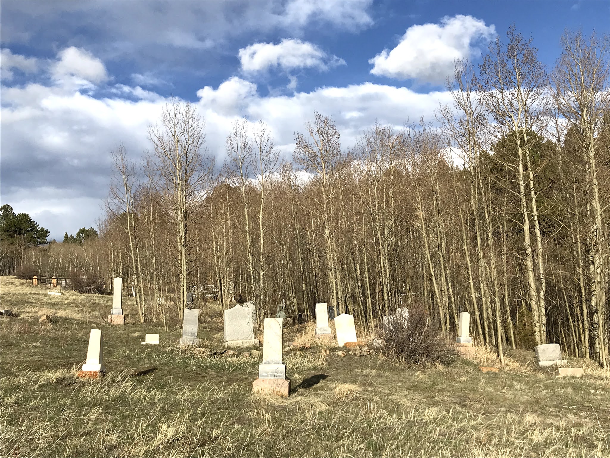
Now fallen into disrepair, the historical cemeteries northwest of town cover the side of a low hill. The markers bear witness to deaths early on in the towns history through the 1950's, when Central City was just another mining town struggling to survive. 


As storm clouds gathered in the west,


we looked out of the windshield of the motorhome at the lovely valley that Central City lies in.


Those storm clouds? They gathered a bit more....


and it began to rain. The wind came up and the temperature dropped. From the 50's midday, to the 30's in the evening. Then it snowed a little bit. A check of the weather apps we use and a listen to the Weather Channel showed us snow tomorrow, snow Monday, snow Tuesday, and temps in the thirties. That's the high daytime temp!

Ok, we can take a hint. Since we have to drop down a 7% hill to get to I70, and then another 3,000 feet or so to get to Denver, we have elected to leave on Sunday morning (Happy Mother's Day, Donna) and head into Kansas, where the only worry is tornados....

See ya later, Central City!