Monday, August 3, 2020

Mexican Hat, Gooseneck, and Valley of the Gods

Monument Valley is a bucket list item if there ever was one! You may want to visit in the Spring or Fall because of the heat in the summer and the cold of the winter. Today's high was 100 F, but a bit warmer on our day trip. More on that later.

We left Oljato this morning with a cooler of sandwiches and drinks. As we left the rv park, we took a couple of photos of rock formations just across the highway.


Our first stop was just a few miles away at Medicine Hat, Utah. The "town" of Mexican Hat consists of two restaurants, a defunct rv park, a closed motel, and a one lane bridge over the San Juan river. Due to construction, the lane is just 10 feet wide and the approach from the north is a sharp right angle turn. We were on this section of 163 yesterday and negotiated the construction with inches to spare. Today, crossing in the car, we wondered how we did it! Nevertheless, just north of the town/burg/wide spot is the formation known as Mexican Hat.


That rock should have fallen thousands of years ago!

Next, we visited Goosenecks State Park. As the land was pushed up over eons, the San Juan river cut deeper and deeper, taking the path of least resistance. Today it's only a hint of its former glory, but still follows its own path.


Several million years ago, the river was flowing on a relatively flat plain, much as todays Mississippi River. The Colorado Plateau rose up beneath it, and the river became one of the worlds finest examples of "entrenched meanders." It is roughly 1,000 feet down to the river today.


Shaking our heads in amazement, we continued on to Valley of the Gods. This area is not a state or national park or monument, but surely could be. It is all Navajo Nation land, and the Nation is kind enough to semi-maintain a dirt/gravel road through an astounding area of monumental formations. They normally run tours through this area, but the entire Navajo Nation is closed to outside activities. The "road" is suitable for SUV's, and, if driven carefully, most sedans, but only in dry weather. Numerous washouts speak to the strength of flash floods. However, the seventeen mile loop can be traversed at speeds of between one and ten miles per hour. It takes awhile, but the slow pace allows appreciation of the scenery.


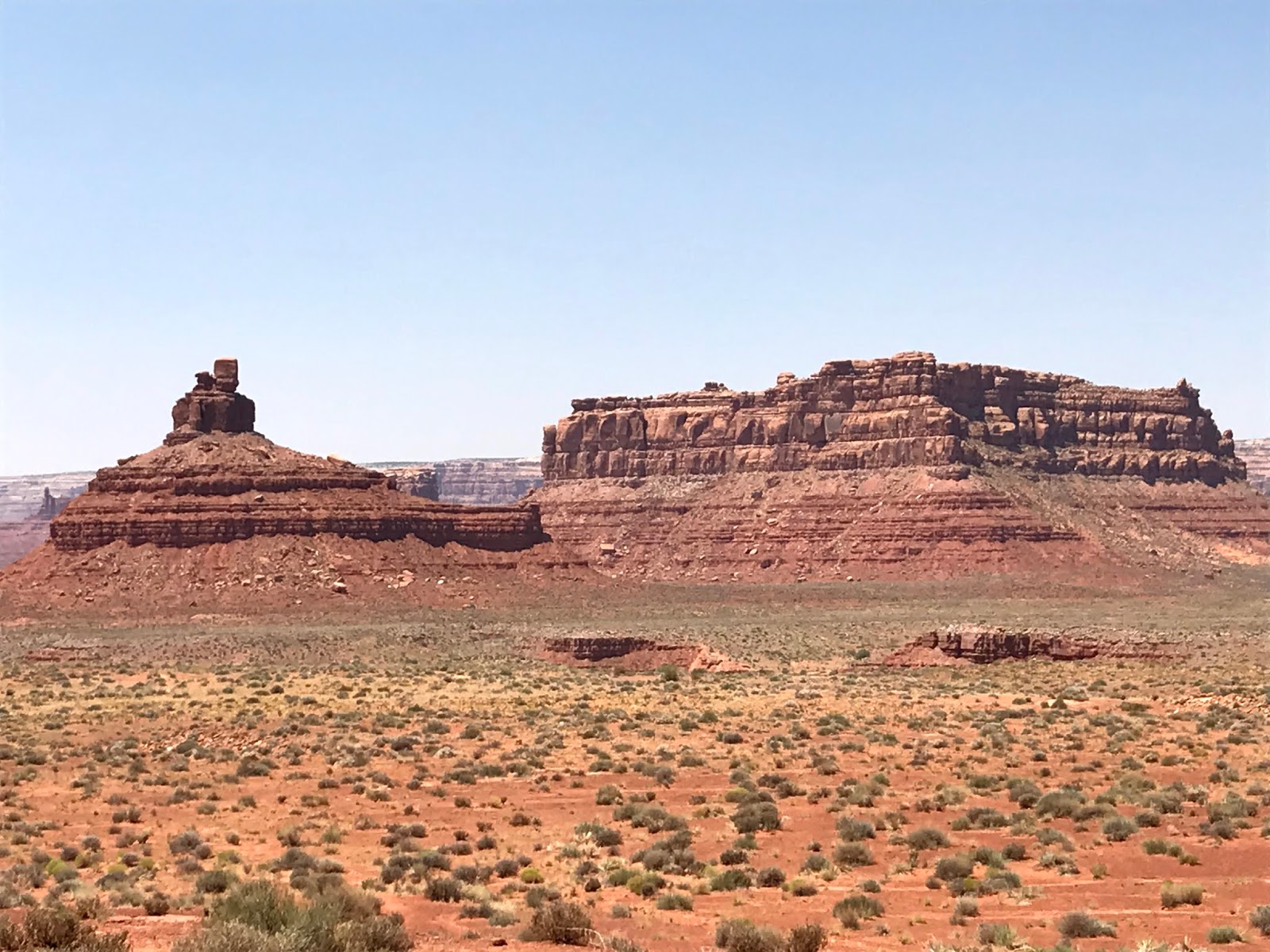


All of these formations have been given names, but they are only disclosed on a Navajo tour, so we made up some of our own. This needs to be "Aladdin's Lamp"


At this point, the car thermometer registered 127 deg F! It was 1:30 pm.


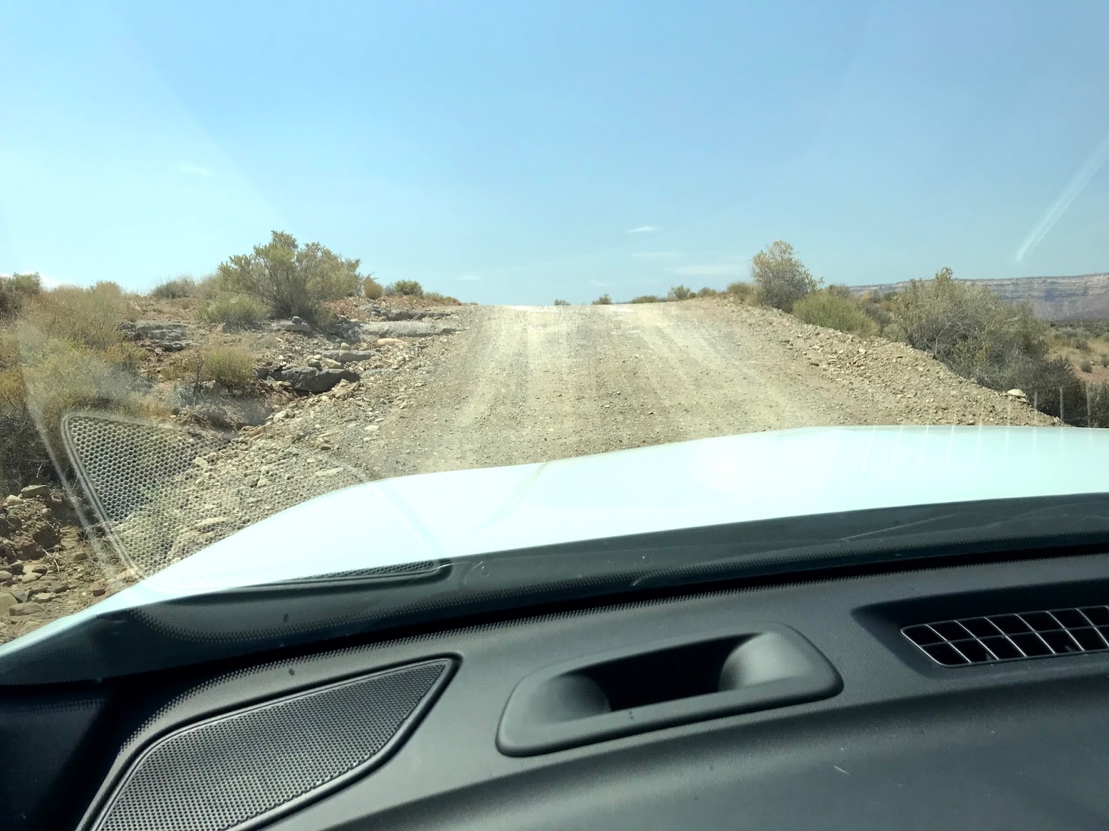
The dirt road has a lot of lumps and bumps where it's impossible to see the direction of the road until the car tops the rise. Exciting!


We returned to an almost empty rv park, but to an amazing view!


What a great place!


Sunday, August 2, 2020

Blanding, Utah to Monument Valley 68 miles

Hot. Hot. Hot.

We pulled into Monument Valley KOA at about 2 this afternoon and the temp was 96 F. As I write this at 7:30 local, it is 102 F. Sasha's walks are confined to a trip the length of the motorhome, underneath where it's shady! When the sun goes down, perhaps we'll venture out.

Leaving Blanding was difficult because we had learned of some additional places to see in the area...Canyonlands National Park being the most important, I suppose. Oh, well, next time perhaps. US Highway 191 drops south toward the Arizona border, and goes through some exciting country. 9% grades, both up and down, added a bit of excitement.


Near Mexican Hat, Utah, we stopped for a break. It was, after all, a long, long days drive! 


We were traveling too slowly for most travelers, so we pulled over to let a group of vehicles pass. Coincidently, this is the exact location where Forrest Gump ended his cross country run!


We pulled into Monument Valley KOA and were directed to site 9. This park is relatively new, so it's a bit rough, but the scenery is awesome.


We took a short drive in the area, checking out the visual opportunities. This area is entirely within the boundaries of the Navajo Nation, and most roads lead to private residences. The Navajos have set up tours and scenic drives through the most interesting rock formations, but due to the COVID situation, the Nation is completely on lockdown and no admittance is permitted. However, we found a few paved roads that led to interesting formations.


This is one of the most iconic photos of Monument Valley.


The right-most chunk of rock seems to be slowly breaking away!


Near the now closed Navajo Nation Visitors Center, several monuments are visible. I took these photos turning in a circle. Everywhere you look it's awesome!


We weren't allowed to proceed beyond a monument of a different sort, a tribute to the Navajos that pioneered this area and made it productive.


Leaving the entrance to the Navajo Nation, we caught a glimpse of another fantastic formation.


We're planning a day trip tomorrow, and hope to see more of this fantastical area!

Saturday, August 1, 2020

Natural Bridges NM and Newspaper Rock

Leaving Blanding about 10 on US 191 south brought us to the entrance to Natural Bridges National Monument, but not before we began to get a glimpse of what awaits us in the park!


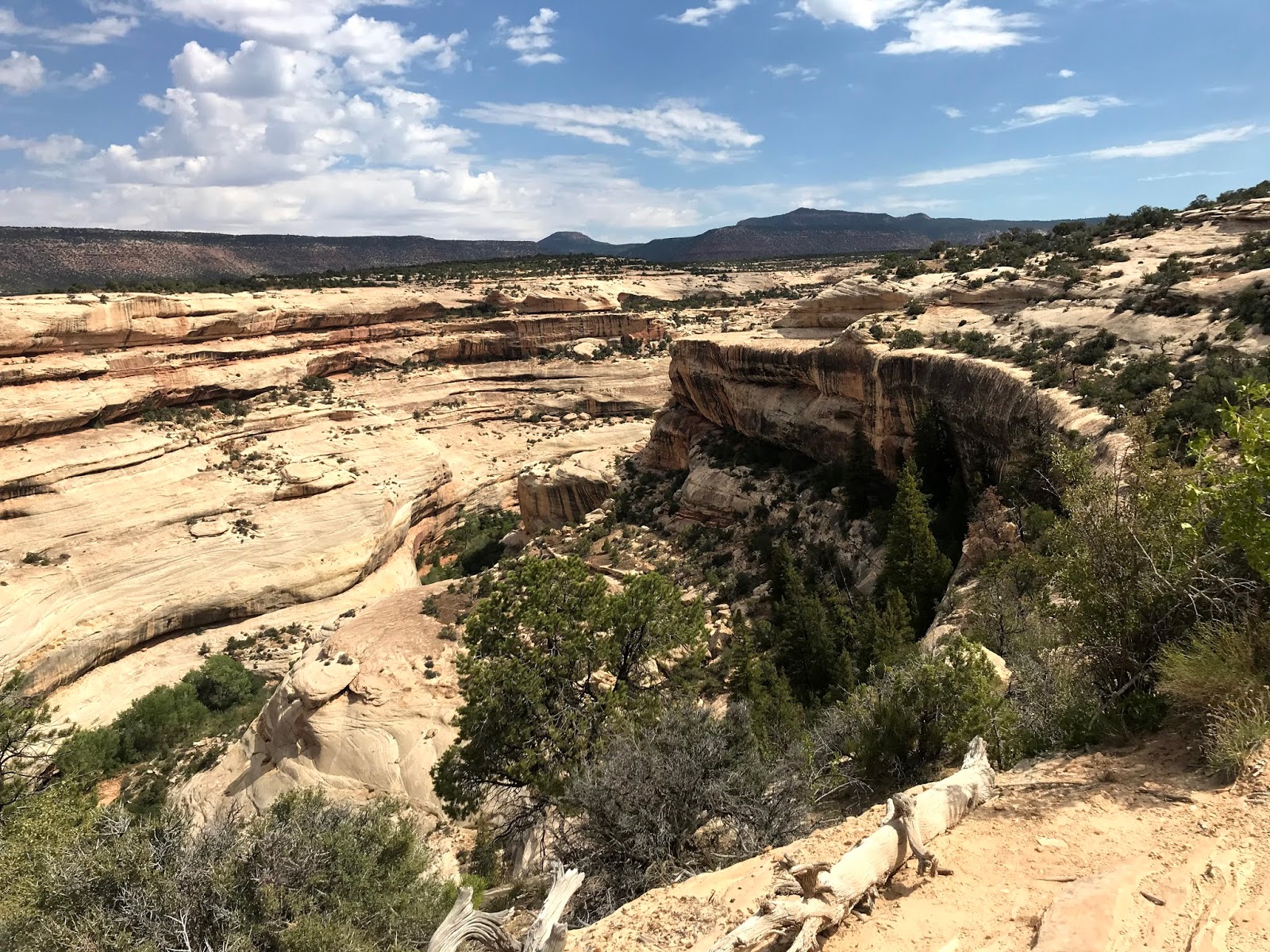
Great canyons have been carved out of the mesa.


On a short trail to Sipapu Bridge, we came across a beautifully organized cactus garden! Almost as if it had been designed to please the eye.


Sipapu Bridge is the first one to be seen on the NBNM driving loop. Sipapu means "place of emergence", the entryway by which the Hopi believe their ancestors came into their world. The three bridges seen on this loop were originally named President, Senator, and Congressman in order of height. Later explorers renamed them Augusta, Caroline, and Edwin. In 1909 the park was enlarged to protect nearby Puebloan structures, and renamed in keeping with Hopi traditions.

This is Sipapu Bridge, the oldest of the bridges in the canyon. Deceptive optics in this photo make it seem a lot thicker, but closer examination shows reality. It is 220 feet in height, spans 244 feet and is 53 feet thick.


Unbelievable swirls of color, rock, and shrubs assault the senses. Everywhere you look there is another grand sight!


Kachina Bridge is the second bridge on the tour. In 1883 prospector Cass Hite wandered into White Canyon in search of gold along the Colorado River. In 1908 President Theodore Roosevelt proclaimed Natural Bridges to be Utah's first National Park System area.

Kachina is the youngest of the three bridges, looming big and bulky while White Canyon floodwaters still work to increase its span. Its height is 210 feet, span is 204 feet and it is 93 feet thick.


The interesting "slick rock" formations were formed of sand. It's believed that swirling sand dunes were covered and compressed over time, creating the "pudding" look!


In places, the sandstone has "shelved", that is, separated into it's various layers.


Lastly, we came to Owachomo Bridge. The difference between bridges and arches is subtle, but bridges are formed by the erosive action of moving water, while arches are formed by frost and seeping moisture after natural bridges have been formed by stream erosion. Owachomo means "rock mound," a feature atop the bridges's east abutment. Owachomo is now in its old age, having a thickness of only 9 feet. A height of 106 feet, and a span of 180 feet indicate that much of the bridge material has fallen to the ground below. The bridge may now have a fatal crack, or may last for many years.


In the distance, Bears Ears loom over the landscape. Navajo stories tell of Changing-Bear-Maiden, who was very beautiful and desired by many men. She married the trickster Coyote, in spite of warnings that the union would bring evil. Changing-Bear-Maiden began to change and by winter's end her transformation into a mischievous bear was complete. Realizing that the only way to save her was to change her into another form, her brothers killed Changing-Bear-Maiden, cutting off her ears and throwing them away. They became the buttes seen today!


The road into and out of Natural Bridges National Monument sneaks through an amazing slot cut into the spine of ancient mountains.


A storm began to develop, so we hurried on to our next stop.


We had only driven 90 miles when we returned to Blanding, so we headed north toward the town of Monticello, and beyond. A monolithic sentinel marks the side road that leads to our destination.


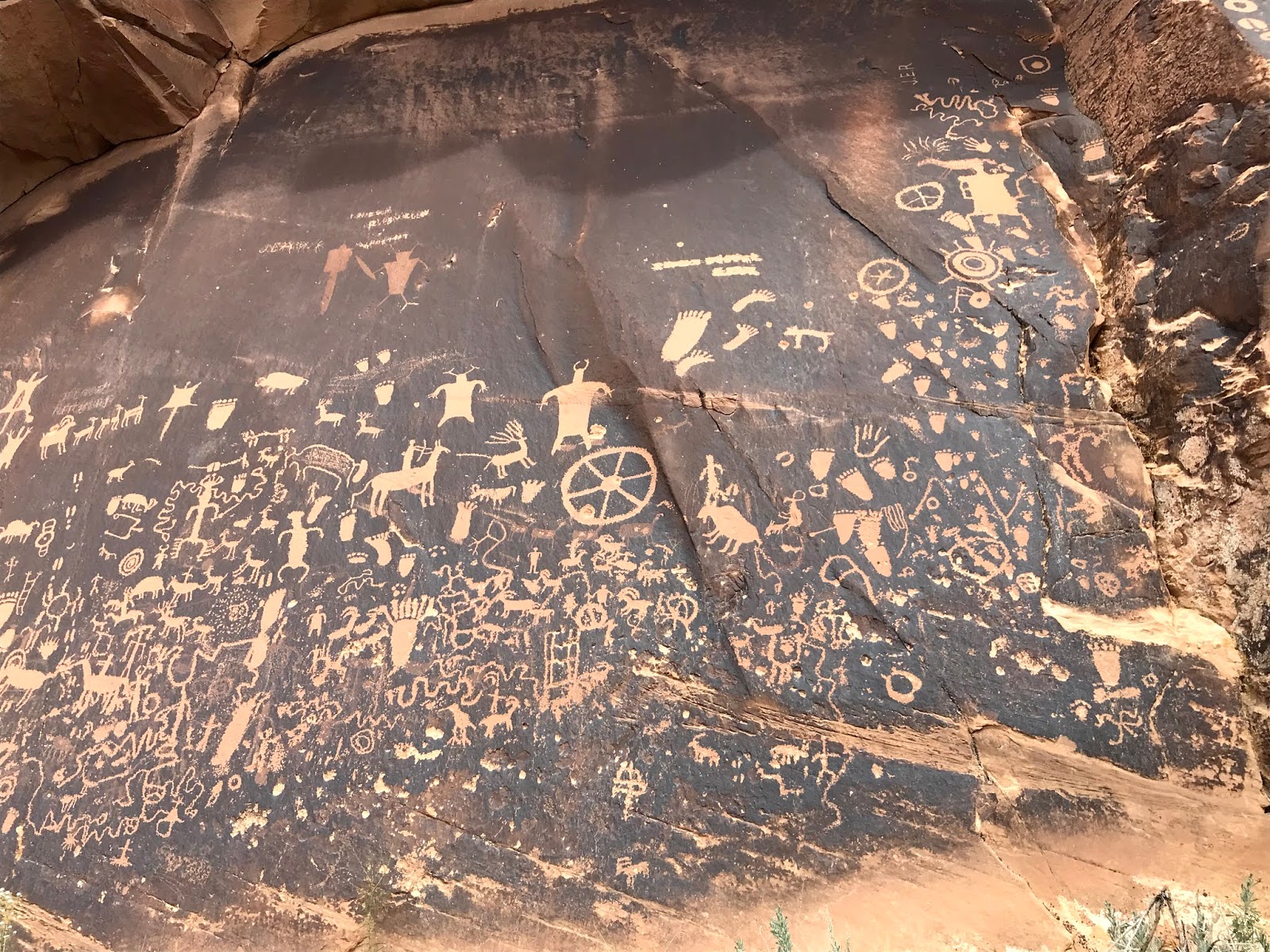
Twelve miles west of US Highway 191, we found Newspaper Rock. A petroglyph panel that records approximately 2,000 years of human activity. Pre-historic peoples etched on the rock until AD 1300, then in historic times, Navajo and Ute people have made their contributions. In Navajo, the rock is called "Tse Hane" (Rock that tells a story), but unfortunately, we do not know if the figures represent storytelling, doodling, hunting magic, clan symbols, graffiti or something else.


The road into Newspaper Rock has some very interesting rock formations both alongside and over the road.


We had escaped the rain, so headed back to Blanding, having put 183 miles on the car today! But it was fun and we saw some remarkable sights.


Our stay in Blanding has been rewarded with a tremendous sunset!


And so it ends. Tomorrow it's another day and another place!